

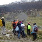
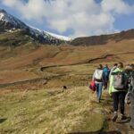
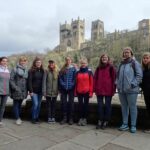
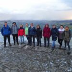
From 2nd – 9th March 2020, students of our department took part in an excursion to Northern England. Among the areas visited under the lead of Dr. Jack Williams were the Peak and Lake Districts, the North York Moors National Parks and Durham County.
Preliminary seminars provided the students with background knowledge on the topics covered by the excursion:
- Peatlands: their importance, damage due to industrialization, fire risk reduction, mitigating sediment loss through restoration and stabilization
- Abandoned mines: implications for lake quality with reference to pollution from heavy metals and sedimentation, sediment storage and delivery relative to other catchment sediment sources, schemes to reduce pollution and reintroduce native fish species into the catchment
- Coastal erosion: drivers and rates of coastal erosion (natural or anthropogenic), monitoring of rockfalls
- Societal impacts of declining industry: understanding the implications of coal mine closure for villages in North East England
The theoretical knowledge was extended by means of site visits, practical exercises and lectures along with guided walking tours during the excursion. Furthermore, students were able to gain detailed local insights by visits from employees of the National Parks and Dr. John Morris of Warwick University, who lectured on their respective fields of work and research.
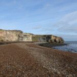
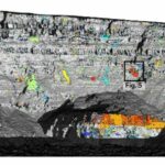
Additionally, students acquired expertise in near-continuous monitoring of geomorphic change from Dr. Jack Williams. During his PhD at Durham University he had investigated erosion at East Cliff Whitby on the North Yorkshire Coastline, which was visited by the excursion. Students obtained insights into controls of rock falls and how near-continuous terrestrial LiDAR monitoring is used to develop methods to investigate magnitude-frequency relationships of rockfall events.
Williams, J.G., Rosser, N.J., Hardy, R.J., Brain, M.J. and Afana, A.A. (2018): Optimising 4-D surface change detection: an approach for capturing rockfall magnitude–frequency. Earth Surface Dynamics, 6(1), pp. 101-119. DOI: https://doi.org/10.5194/esurf-6-101-2018
By the end of the field trip, students had improved their knowledge about sediment transfer processes that move material from hillslopes and upland areas into the fluvial network, the legacy of Northern England’s industry (in particular mining) and the role of national parks in mitigating damage to the landscape. Moreover, the course enhanced the student’s methodological skills by practical exercises.
Interested in recent and upcoming field trips offered by the 3DGeo research group? Find them all on our project website.
Also check out our current research projects for potential topics for your thesis!