

In 2015, MapSwipe began as a solution to a complex question: how do we better identify where communities and populations are, allowing mapping to be more efficient and effective?
Using a simple mobile app, volunteers are able to swipe through a series of satellite images, tapping in areas where they find features. MapSwipe can be used anywhere, at any time, which provides an easy access point for individuals to contribute to the Missing Maps project without being restricted to their laptop.
Follow up developments included the MapSwipe2HOT Tasking Manager workflow as well as MapSwipe Analytics.
That was MapSwipe then – this is MapSwipe now.
Two new project types have been introduced on MapSwipe, transforming the way that volunteers can contribute to humanitarian response globally with just a few simple taps on their phone.
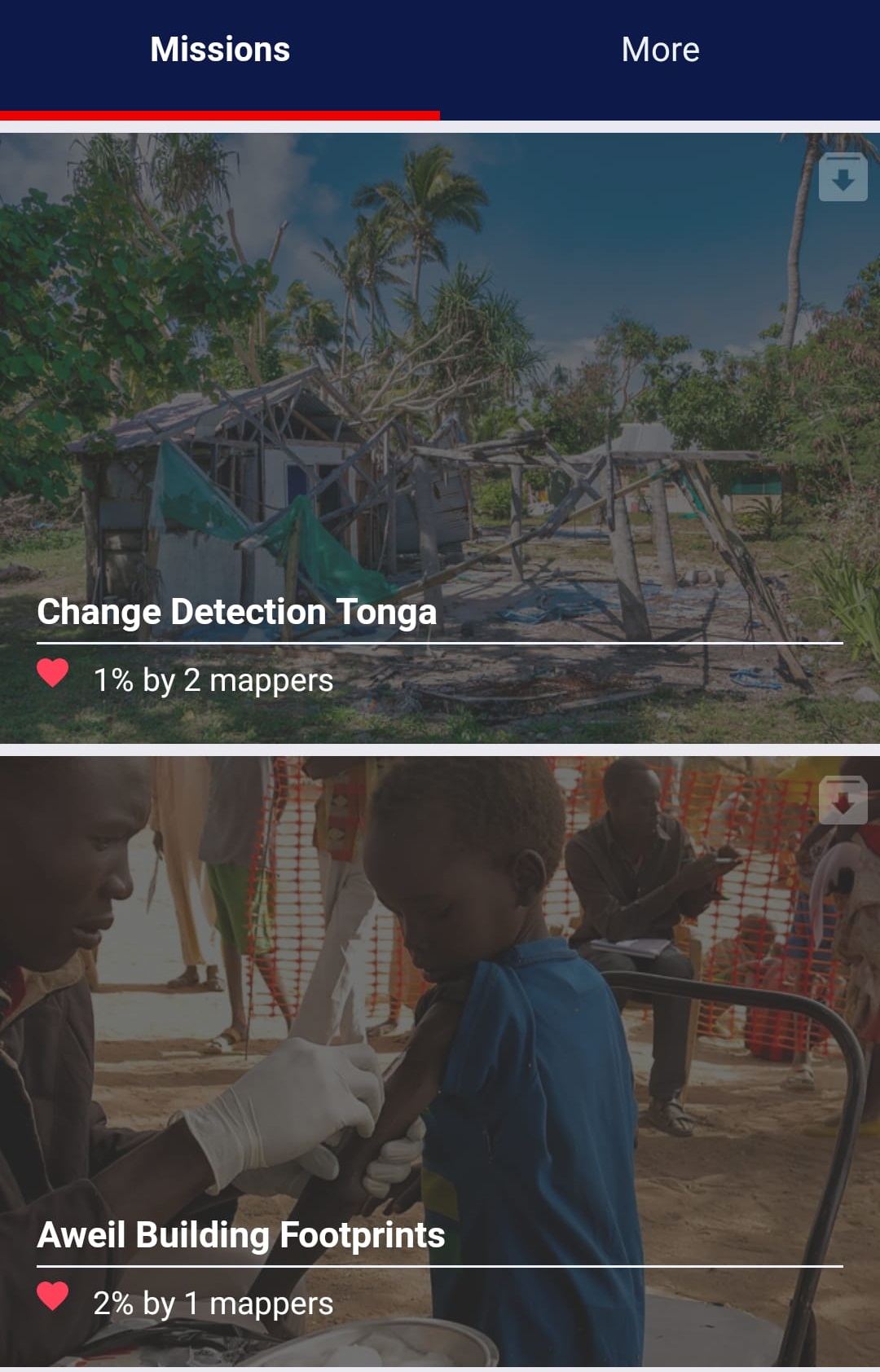
- Building Footprint project: As machine-learning and AI continue to forge a new path for mapping, this project allows volunteers to indicate where building traces are inaccurate or of low-quality, signaling where improvements need to be made
- Change Detection project: Map data should constantly evolve to reflect the changes happening within a community. Volunteers use satellite imagery to indicate when change is detected in an image, signaling the need to revisit mapped areas and update data where needed
Our team of volunteers contributing to MapSwipe have been working to redesign the user experience, ensuring that the mobile app functions on any mobile device in any geography. The new in-app tutorials coach MapSwipe volunteers on how to successfully and accurately contribute to projects.
To date, over 29,000 volunteers have covered an area totaling more than 600,000 sq. km. (that’s larger than the entire country of France!) using MapSwipe.
And we are just getting started.
If you want to learn more about MapSwipe, are interested in submitting a project, or want to get involved on the team that develops and maintains the app, visit www.mapswipe.org for more information and to download the app.
Thank you to the following individuals and organizations who have dedicated a number of hours and resources to make MapSwipe possible: Laurent Savaete, Benni Herfort (Heidelberg Institute for Geoinformation Technology), Johnny Henshall (British Red Cross), Andrew Braye (British Red Cross), Eric Boucher (Ovio), and Jorieke Vyncke (Médecins Sans Frontières). A special thanks to the British Red Cross for hosting the application.
Check also http://mapswipe.heigit.org/ for MapSwipe Analytics tools developed by HeiGIT. Future versions of MapSwipe shall combine further methods from machine learning based on our research.
Related literature:
Herfort, B.; Li, H.; Fendrich, S.; Lautenbach, S.; Zipf, A. Mapping Human Settlements with Higher Accuracy and Less Volunteer Efforts by Combining Crowdsourcing and Deep Learning. Remote Sens. 2019, 11, 1799.
Herfort, B., Eckle, M., de Albuquerque, J. P., (2016): Being specific about geographic information crowdsourcing: a typology and analysis of the Missing Maps project in South Kivu. 13th International Conference on Information Systems for Crisis Response and Management. ISCRAM 2016. Rio de Janeiro, Brazi
Herfort, B., Zipf, A. (2018): Enhancing Crowdsourced Classification on Human Settlements Utilizing Logistic Regression Aggregation and Intrinsic Context Factors. VGI-ALIVE Workshop. at AGILE 2018. Lund, Sweden.
Herfort, B., Reinmuth, M., Porto de Albuquerque, J., Zipf, A. (2017): Towards evaluating the mobile crowdsourcing of geographic information about human settlements. 20th AGILE conference 2017, Wageningen, Netherlands.
Scholz, S., Knight, P., Eckle, M., Marx, S., Zipf, A. (2018): Volunteered Geographic Information for Disaster Risk Reduction: The Missing Maps Approach and Its Potential within the Red Cross and Red Crescent Movement. Remote Sens., 10(8), 1239, doi: 10.3390/rs10081239.