

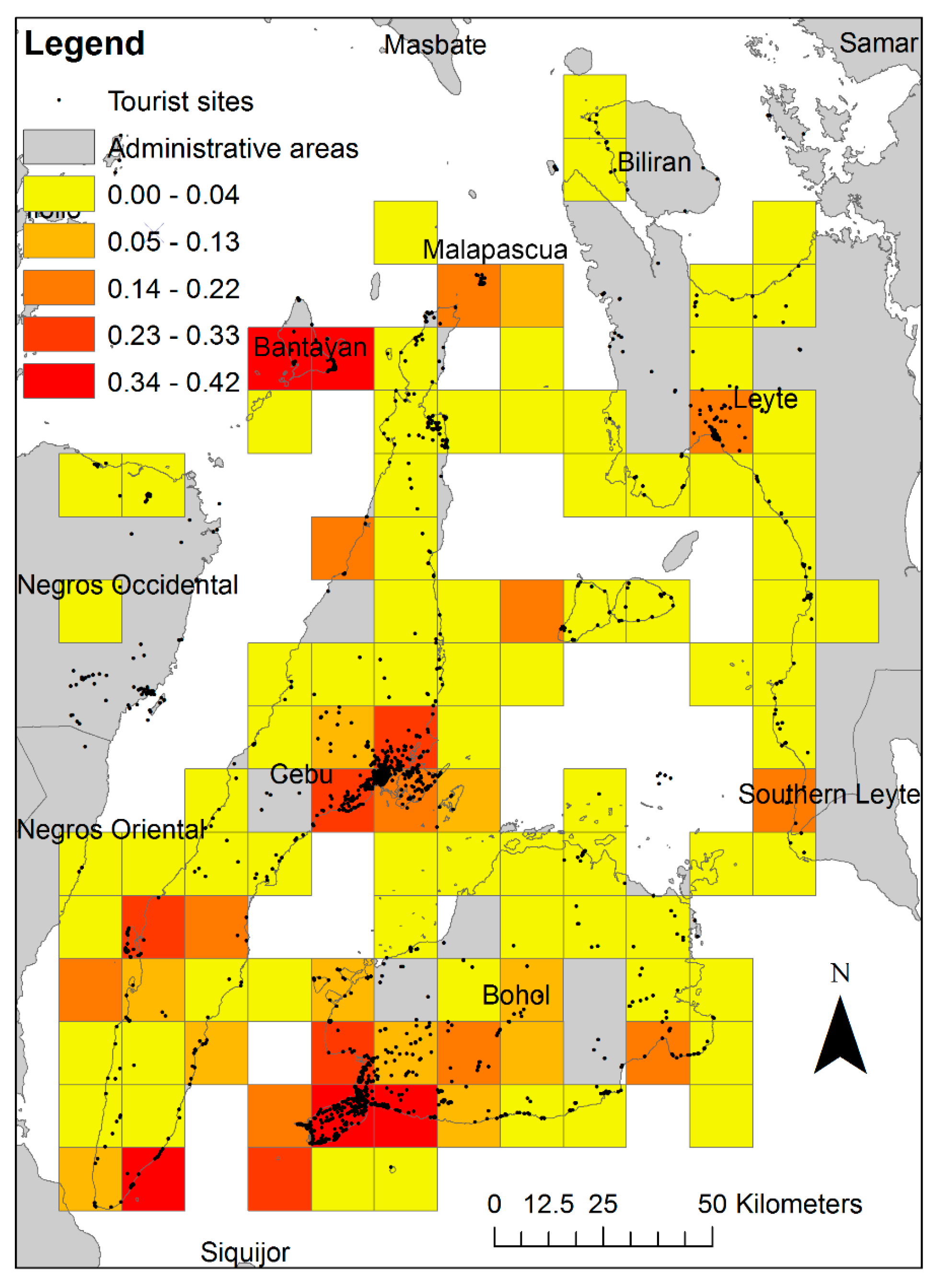
Tourism is a economically highly important industry. It is, however, vulnerable to disaster events. Geotagged social media data, as one of the forms of volunteered geographic information (VGI), has been widely explored to support the prevention, preparation, and response phases of disaster management, while little effort has been put on the recovery phase. A recently published study develops a scientific workflow and methods to monitor and assess post-disaster tourism recovery using geotagged Flickr photos, which involve a viewshed based data quality enhancement, a space-time bin based quantitative photo analysis, and a crowdsourcing based qualitative photo analysis. The developed workflow and methods have also been demonstrated in this paper through a case study conducted for the Philippines where a magnitude 7.2 earthquake (Bohol earthquake) and a super typhoon (Haiyan) occurred successively in October and November 2013. In the case study, we discovered spatiotemporal knowledge about the post-disaster tourism recovery, including the recovery statuses and trends, and the photos visually showing unfixed damages. The findings contribute to a better tourism rehabilitation of the study area. Future work mainly includes investigating the qualitative metadata of Flickr photos, photo classification based on user behaviors, and developing methods to minimize user sampling bias.
Yan, Y., M. Eckle, C.-L. Kuo, B. Herfort, H. Fan and A. Zipf (2017): Monitoring and Assessing Post-Disaster Tourism Recovery Using Geotagged Social Media Data. International Journal of Geo-Information, ISPRS IJGI. 6(5), 144; doi:10.3390/ijgi6050144