In agriculture, information about the spatial distribution of crop height is valuable for applications such as biomass and yield estimation, or increasing field work efficiency in terms of fertilizing, applying pesticides, irrigation, etc. Established methods for capturing crop height often comprise restrictions in terms of cost and time efficiency, flexibility, and temporal and spatial resolution of measurements. Furthermore, crop height is mostly derived from a measurement of the bare terrain prior to plant growth and measurements of the crop surface when plants are growing, resulting in the need of multiple field campaigns.
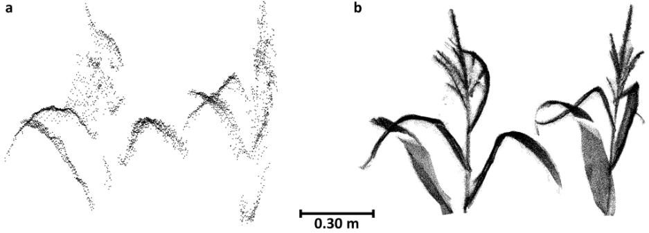
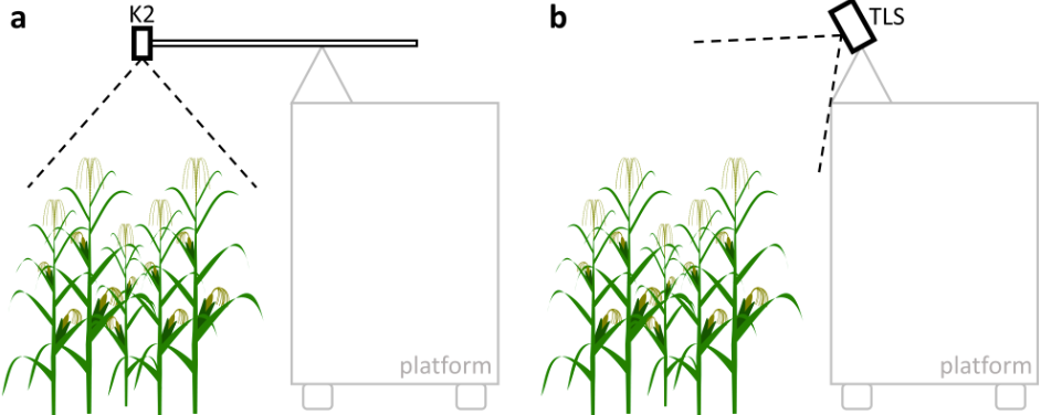
In our study, we examine a method to derive crop heights directly from data of a plot of full grown maize plants captured in a single field campaign with a low-cost 3D camera. The results of the study are now published as:
Hämmerle, M. & Höfle, B. (2016): Direct derivation of maize plant and crop height from low-cost time-of-flight camera measurements. Plant Methods 2016(12:50). doi:10.1186/s13007-016-0150-6

We examine single measurements captured with the 3D camera and a combination of the single measurements, i.e. a combination of multiple perspectives. The quality of both CHMs, and individual plant heights is improved by combining the measurements. The crop heights derived from the 3D camera measurements comprise an average underestimation of 0.06 m compared to terrestrial laser scanning (TLS) reference values.
We recommend the combination of multiple low-cost 3D camera measurements, removal of measurement artefacts, and the inclusion of correction functions to improve the quality of crop height measurements. Operating low-cost 3D cameras under field conditions on agricultural machines or on autonomous platforms can offer time and cost efficient tools for capturing the spatial distribution of crop heights directly in the field and subsequently to advance agricultural efficiency and productivity. More general, all processes which include the 3D geometry of natural objects can profit from low-cost methods producing 3D geodata.