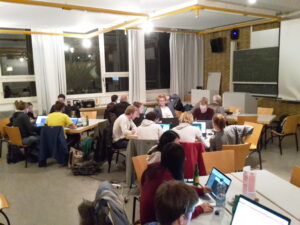
In the context of the international OpenStreetMap Geography Awareness Week, last Thursay, 17th November 2016, another mapping event was organized at the Geographical Institute of Heidelberg University. Sava, a region in the north of Madagascar, was herein mapped in cooperation with Missing Maps and the French NGO CartONG.
Madagascar is as one of the poorest countries in the world with more than 92% of the population living with an income under 2$ a day. It is also one of the most vulnerable countries regarding climate change. Especially Sava has to deal with an increase in storms and the disappearing of mangrove forests which formed a natural barrier against storms and cyclones.
Having a better and global understanding of the location of the population as well as its accessibility is crucial for NGOs and local actors to prepare emergency management programs. In this vein, CartONG started a project to enable mapping the most vulnerable parts of the island. For more information see task description here.
The event started with a small introduction to the OSM GeoWeek, followed by a project overview of Violaine Doutreleau of CartONG via skype. Furthermore the participants were shown the use of the offline editor JOSM for the digitization of the OpenStreetMap data.
In the process of this mapathon buildings were digitized on the basis of MapSwipe data. The MapSwipe app was developed by the GIScience Group/ disastermappers heidelberg and the Missing Maps Project to enable the classification of populated areas on the basis of satellite imagery. That way, settlement areas can already be detected before the “mapping” and thus the search for buildings shortens, with only tiles containing buildings becoming part of the digitization tasks.
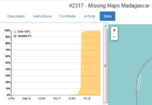
In only a few hours two complete tasks in the HOT OSM Tasking Manager created by CartONG on the basis of MapSwipe data were mapped by the Heidelberg volunteers!
A big thank you to all participants! We hope to see you soon at our next event!


