

We are happy to announce the launch of MapSwipe – an app that allows you to support humanitarian aid by simply using your mobile.
In a disaster or humanitarian crisis, knowledge regarding the location of possibly affected and vulnerable people is crucial to provide effective support. MapSwipe allows you to map these locations using your smartphone.
Following up on the “Heidelberg Process” developed by the disastermappers heidelberg/ GIScience Research Group in collaboration with the MissingMaps team, the app enables collecting information regarding the location of residential areas using satellite imagery and a microtasking approach.
A first implementation as Web-Application using the Pybossa Framework and the Evaluation of the results through the GIScience Research Group Heidelberg established the foundation of the development of this mobile app.
The disastermappers heidelberg/ GIScience Research Group are supporting the MissingMaps project with Mapathons and by conducting research on the use of OpenStreetMap data for humanitarian aid. The app is a result of this collaboration which provides an example on how research, practice and humanitarian aid can be combined to develop more efficient workflows (see also: Herfort et al 2016).
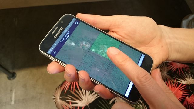
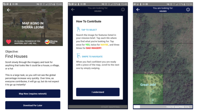
Contributors are asked to mark map tiles and to thereby provide information regarding inhabited regions.
One tap hereby signifies that residential features could be identified, a second tap indicates the likeliness of features. A third tap flags tiles with bad image quality. If no features are visible you can just swipe to the next tile and go on with the task.
The App allows you to contribute online as well as offline, using satellite imagery that can be downloaded beforehand. Therefore the app allows you to contribute from home just as easy as on the commute. The provided information can be utilized by mappers to furthermore digitize building structures, roads and other individual features. That way base maps that support the work of MSF, the Red Cross and other organizations are developed in a collaborative workflow.
Interested in becoming active yourself?
Learn more about MapSwipe at mapswipe.org, get the app and swipe and tap away!
MapSwipe is as of now available in the Google Play Store and Apple App Store!
Herfort, B., Eckle, M., de Albuquerque, J. P., (2016): Being specific about geographic information crowdsourcing: a typology and analysis of the Missing Maps project in South Kivu. 13th International Conference on Information Systems for Crisis Response and Management. ISCRAM 2016. Rio de Janeiro, Brazil.
Similar work is the core of the new unit disaster management and VGI for humanitarian aid of the to be established Heidelberg Institute of Geoinformation Technology (HeiGIT) which is core funded by the Klaus Tschira Stiftung Heidelberg.