Tag: machine leanring
-

Accurate road surface data for transportation, safety, and economic development
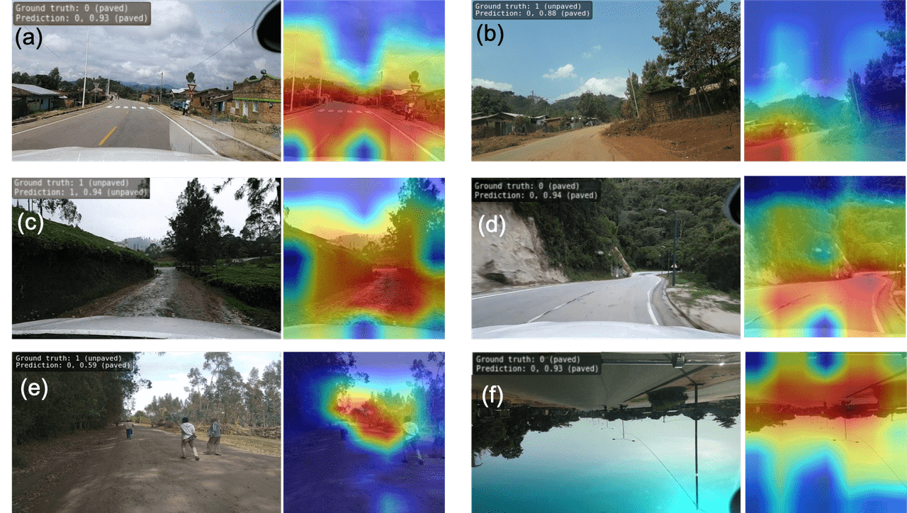
Researchers at HeiGIT (Heidelberg Institute for Geoinformation Technology) have publicly released a first of its kind planet-scale dataset on road surface type (paved or unpaved) using state-of-the-art GeoAI methods based on street-view imagery from Mapillary, in order to support humanitarian response, urban planning and progress towards the Sustainable Development Goals. Road surface information plays an essential…
-
Kick-off: AImon5.0 – Real-time monitoring of gravitational mass movements for critical infrastructure risk management with AI-assisted 3D metrology
In September 2023, our new research project AImon5.0 has been kicked-off. In this project the open-source frameworks HELIOS++ and py4dgeo of the 3DGeo research group will be combined to enhance current approaches for operational risk monitoring. AImon5.0 is an interdisciplinary collaboration project of the 3DGeo research group with DMT GmbH & Co. KG (project leader),…
-

Recap Road Quality Mapathon
Last Monday, on July 31st, we hosted a road quality mapathon, which saw the participation of students and researchers alike. Their collective efforts led to the classification of nearly 50% of all the pre-selected road pictures in 34 African countries. These valuable data points will be instrumental in training machine learning algorithms to identify paved…
-
Final meeting of the E-TRAINEE project
Last week, the 3DGeo research group hosted the final meeting of the E-TRAINEE project, finally and for the first time in presence. For almost three years now, we have been developing a research-oriented open-source e-learning course – soon to be published! The course on “Time Series Analysis in Remote Sensing for Understanding Human-Environment Interactions” teaches…
-
E-TRAINEE project: E-learning course on Time Series Analysis in Remote Sensing
The E-TRAINEE project is a new collaboration project for developing an “E-learning course on Time Series Analysis in Remote Sensing for Understanding Human-Environment Interactions” with Markéta Potůčková (Department of Applied Geoinformatics and Cartography, Charles University Prague) as PI of the project and Heidelberg University, University of Innsbruck and University of Warsaw as project partners. The…


