

Tag: dfg
-
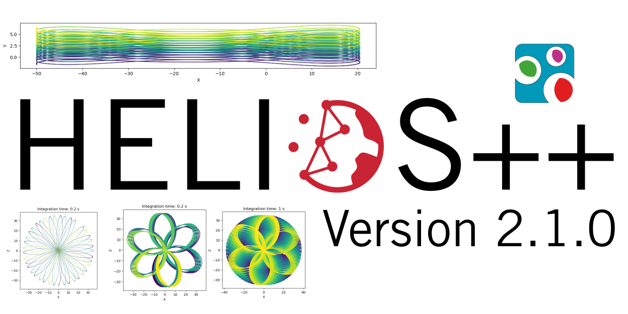
HELIOS++ Release: v2.1.0
We are happy to release a new minor version of HELIOS++: https://github.com/3dgeo-heidelberg/helios/releases What’s new in this release? We present a fully revised implementation of the Risley beam deflector that supports up to three prisms. What does this mean? You can now simulate scanners such as the DJI Zenmuse 2 and the Livox Mid Series in…
-
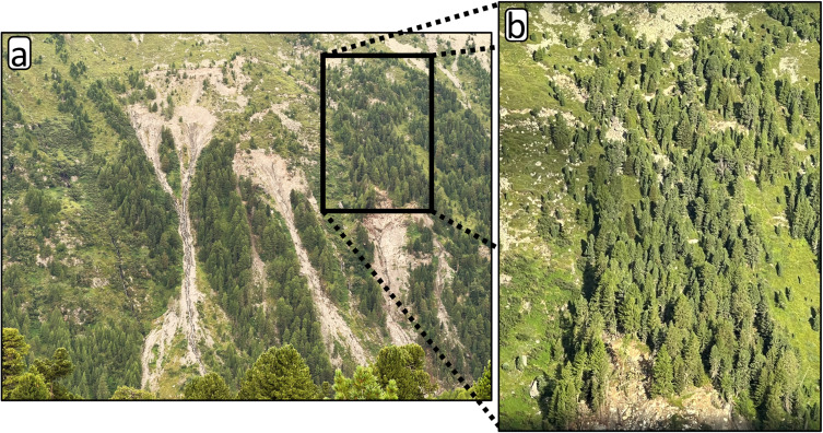
New Paper: Method for monitoring landslides in forested area
Tabernig, R., Albert, W., Weiser, H., Fritzmann, P., Anders, K., Rutzinger, M. & Höfle, B. (2025): Temporal aggregation of point clouds improves permanent laser scanning of landslides in forested areas. Science of Remote Sensing. Vol. 12, pp. 100254. DOI: https://doi.org/10.1016/j.srs.2025.100254 In our brand-new study ‘Temporal aggregation of point clouds improves permanent laser scanning of landslides…
-

3DGeo April Recap: Conferences
It was an exciting month for the 3DGeo research group in April. Three major conferences took place: Let’s give you some impressions below! JISDM The Joint International Symposium on Deformation Monitoring (JISDM) brings together experts on deformation monitoring from a range of fields such as photogrammetry, remote sensing and of course geodesy. It is a…
-
Major HELIOS++ Release: v2.0.0
We are happy to release a new major version of HELIOS++: https://github.com/3dgeo-heidelberg/helios/releases What’s new in this release? Installation The new way to install HELIOS++ is via the conda or mamba package managers. We recommend mamba or micromamba. After creating a dedicated Python environment for your HELIOS++ project and activating it, run: mamba install helios or…
-
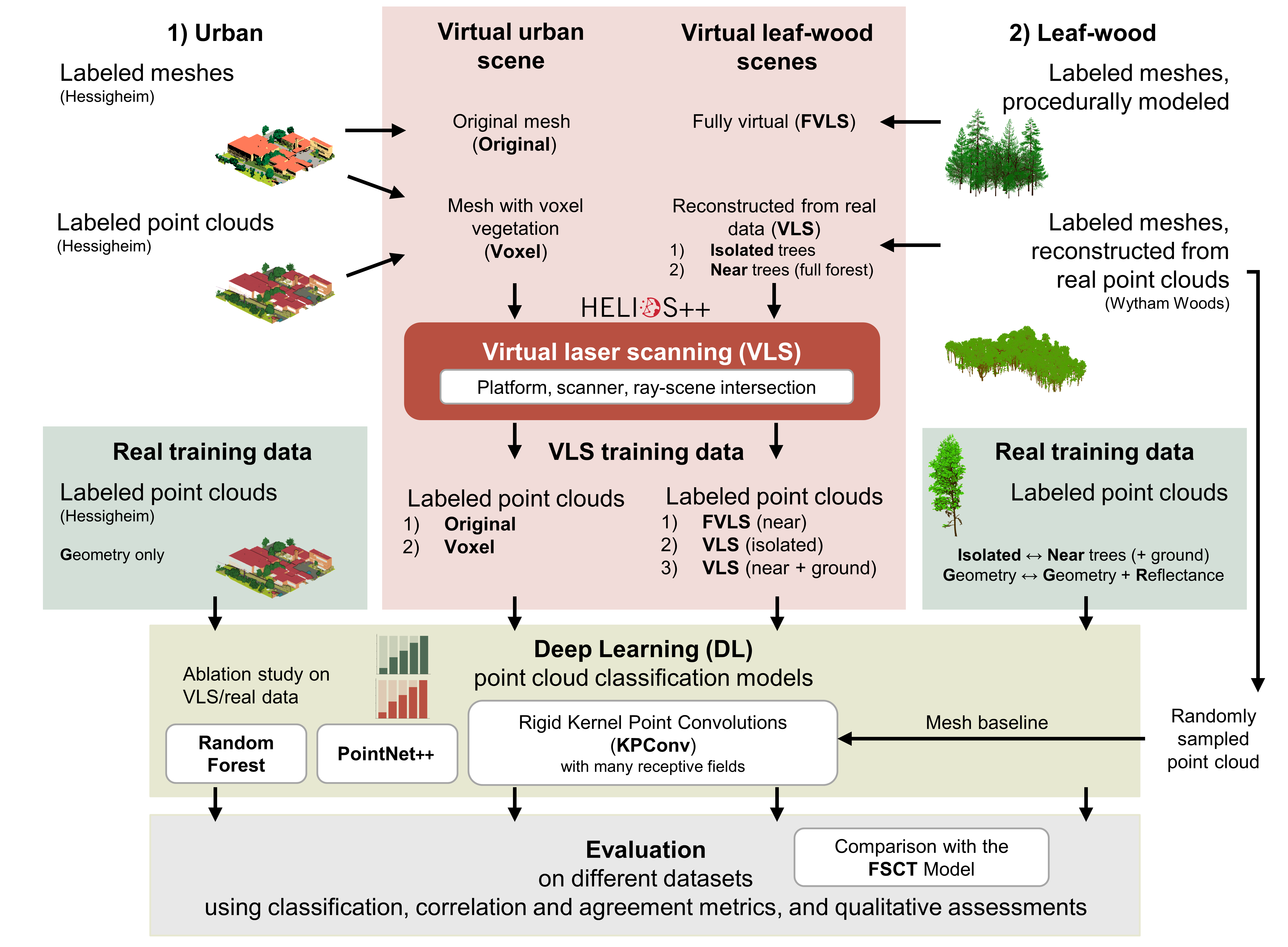
Deep learning with simulated laser scanning data for 3D point cloud classification
Esmorís, A.M., Weiser, H., Winiwarter, L., Cabaleiro, J.C. & Höfle, B. (2024): Deep learning with simulated laser scanning data for 3D point cloud classification. ISPRS Journal of Photogrammetry and Remote Sensing. Vol. 215, pp. 192-213. DOI: 10.1016/j.isprsjprs.2024.06.018 3D point clouds acquired by laser scanning are invaluable for the analysis of geographic phenomena. To extract information…
-
VirtuaLearn3D: New Preprint
We have published a preprint of our recent work in the VirtuaLearn3D project! Deep learning with simulated laser scanning data for 3D point cloud classification Esmorís, A.M., Weiser, H., Winiwarter, L., Cabaleiro, J.C. & Höfle, B. (2024) Laser scanning is an active remote sensing technique to acquire state-of-the-art spatial measurements in the form of 3D…
-
New paper on the potential of simulated laser scanning and field data to train forest biomass models
In great collaboration with colleagues from Karlsruhe (DE), Vienna (AT), Brno (CZ), Leipzig (DE), Raszyn (PL), and Berlin (DE), we published a paper investigating approaches to improve LiDAR-based biomass models when only limited sample plots with field data are available. The main work was carried out by PhD student Jannika Schäfer (IFGG, Karlsruhe Institute of…
-
DFG Software Grant
Successful proposal: Fostering a community-driven and sustainable HELIOS++ scientific software The 3DGeo Group and the Scientific Software Center (SSC) of Heidelberg University have been successful with their proposal in the DFG call “Research Software – Quality assured and re-usable”, together with two other project proposals at Heidelberg University (see press release). The main objective of…
-
🦇 Halloween release of HELIOS++, v1.3.0
We proudly present our Halloween release of HELIOS++, Version 1.3.0: https://github.com/3dgeo-heidelberg/helios/releases What’s new in this release? HELIOS++ now supports LiDAR simulation of dynamic scenes. We can now simulate laser scanning of scenes that change during the simulation. This is done by introducing rigid motions, which are defined with XML syntax in the scene XML file.…
-
Global Health Academy 2021: workshop material online
Last week, the Global Health Academy 2021 took place in an online format with a focus on the COVID-19 pandemics. The conference was conveyed by the Heidelberg Institute of Global Health (HIGH) and aimed at practitioners, researchers and PhD students in the public health domain. Dr. Sven Lautenbach with support by Steffen Knoblauch and Marcel…
-
Today & tomorrow GIScience Heidelberg Talks in Africa and Australia
This Wednesday and Thursday we have presentations from the GIScience research group Heidelberg on two remote contintents – both in Africa and in Australia: On Wednesday: First down under at GIScience Melbourne in Australia Rene Westerholt will present the work related to our PLATIAL18 workshop: Westerholt, R., Gröbe, M., Zipf, A. and Burghardt, D. (2018): Towards the statistical…