

Tag: CharAct4D
-
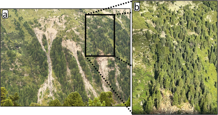
New Paper: Method for monitoring landslides in forested area
Tabernig, R., Albert, W., Weiser, H., Fritzmann, P., Anders, K., Rutzinger, M. & Höfle, B. (2025): Temporal aggregation of point clouds improves permanent laser scanning of landslides in forested areas. Science of Remote Sensing. Vol. 12, pp. 100254. DOI: https://doi.org/10.1016/j.srs.2025.100254 In our brand-new study ‘Temporal aggregation of point clouds improves permanent laser scanning of landslides…
-
CharAct4D – Unravelling Landscape Dynamics via Automatic Characterization of Surface Activity using Geographic 4D Monitoring
With her new project CharAct4D Dr. Katharina Anders has become part of the Eliteprogramme for Postdocs of the Baden-Württemberg Stiftung, which supports early career researchers to qualify for a professorship -check the related press release by Heidelberg University. Many congratulations, Katharina! Katharina’s research interests in the 3DGeo research group are method development for 3D/4D change analysis…