

Category: Research
-
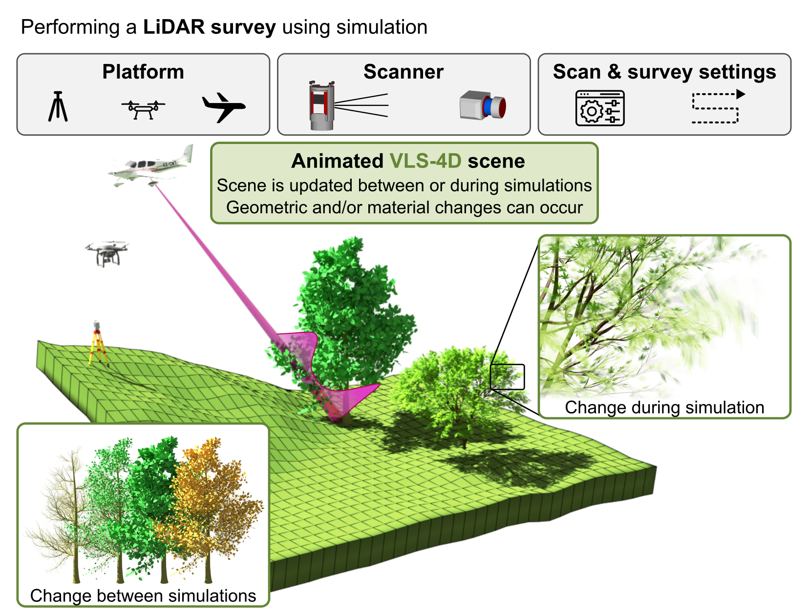
New paper: Advancing vegetation monitoring with VLS-4D
Weiser, H. & Höfle, B. (2025): Advancing vegetation monitoring with virtual laser scanning of dynamic scenes (VLS-4D): Opportunities, implementations and future perspectives. Methods in Ecology and Evolution. DOI: https://doi.org/10.1111/2041-210x.70189 Virtual laser scanning (VLS) is an established and valuable research tool in forestry. However, vegetation has traditionally been modelled as static, neglecting the influence of vegetation…
-
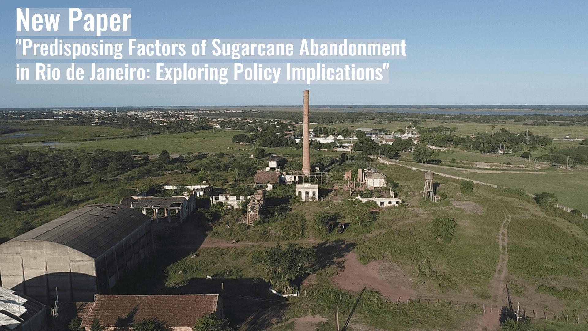
New Paper “Predisposing Factors of Sugarcane Abandonment in Rio de Janeiro: Exploring Policy Implications”
This study investigates sugarcane farmland abandonment in Rio de Janeiro State, Brazil, employing spatial regression techniques to identify the biophysical and accessibility factors that determine where abandonment occurs at the local scale. Cropland abandonment represents an agricultural land use change with significant socioeconomic and environmental implications. In Rio de Janeiro State, Brazil, sugarcane cultivation has…
-
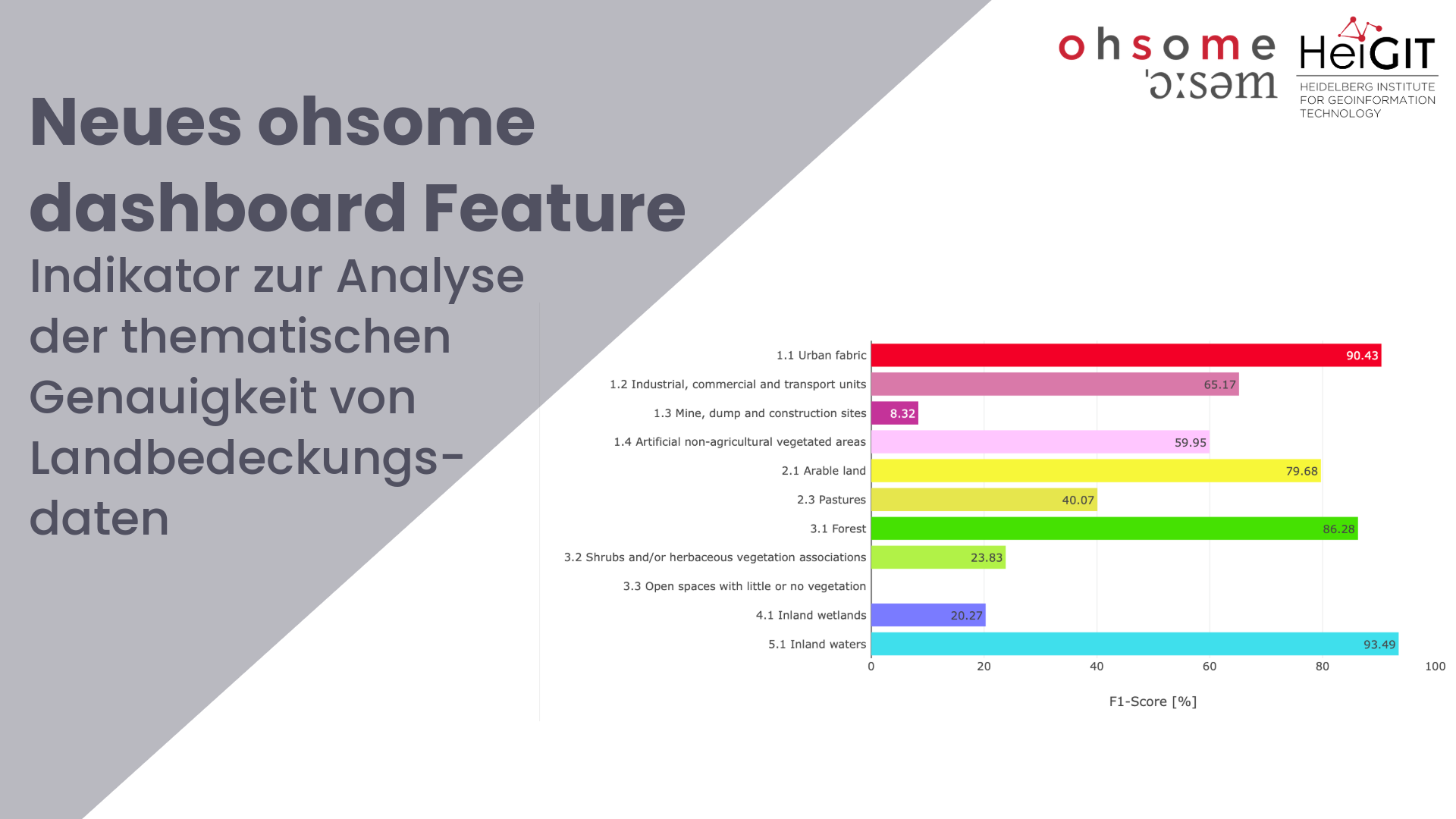
Enhancing OSM Data Quality Analysis: Thematic Accuracy of Land Cover in the ohsome Dashboard
Together with the German Federal Agency for Cartography and Geodesy (BKG) we released a new version of the ohsome dashboard, introducing a new indicator for assessing the thematic accuracy of land cover data in OpenStreetMap (OSM). This development is part of a broader project together with BKG on OSM data quality evaluation. New indicator: Thematic…
-
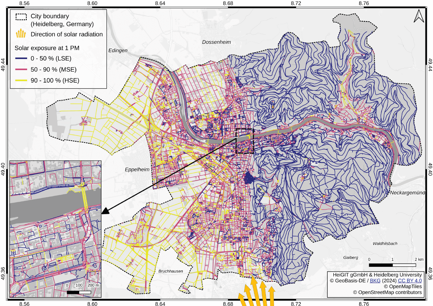
New paper “Mitigating heat stress by reducing solar exposure in pedestrian routing”
Using Heidelberg as a case study, researchers modeled time-dependent solar exposure for the entire pedestrian network by combining high-resolution DEM/DSM building and vegetation data with OpenStreetMap road data. Adapting to heat stress in cities is a major challenge under global warming, as both climate change and the urban heat island effect increase health risks worldwide.…
-
3D Sensor Practical
In June 2025, Ronald Tabernig and Hannah Weiser, researchers in the 3DGeo Research Group (Prof. Bernhard Höfle), held the annual 3D sensor practical, a two-day practical field course which took place in two exciting study sites close to Heidelberg: Our students learnt: Since we surveyed the same study sites last year, students will be able…
-

New paper: Mapping energy poverty indices in urban scale: A case study of Santiago de Chile
This study evaluates the applicability of macro-scale energy poverty indices in an urban context, using Santiago de Chile as a case study. Energy poverty (EP), understood as the inability of a household to meet its basic energy needs, is a global challenge exacerbated by rising energy prices, inflation, and economic instability. Accelerated urbanization and climate…
-
4DGeo Release: v1.0.0
First release of our 4DGeo Dashboard: https://github.com/3dgeo-heidelberg/4dgeo 4DGeo is an open-source, modular, super lightweight, web-based interactive dashboard application for visualizing 3D geodata time series. 🌐 Demo: https://3dgeo-heidelberg.github.io/4DGeo/💻 GitHub: https://github.com/3dgeo-heidelberg/4dgeo📖 Documentation: https://3dgeo-heidelberg.github.io/4DGeo/docs/ Play around with one of our use cases: Bees, a moving tree branch or a rockfall! Or fork the repo, try it out with…
-
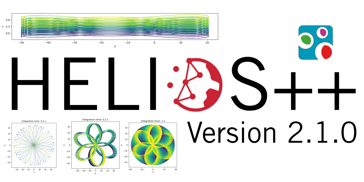
HELIOS++ Release: v2.1.0
We are happy to release a new minor version of HELIOS++: https://github.com/3dgeo-heidelberg/helios/releases What’s new in this release? We present a fully revised implementation of the Risley beam deflector that supports up to three prisms. What does this mean? You can now simulate scanners such as the DJI Zenmuse 2 and the Livox Mid Series in…
-
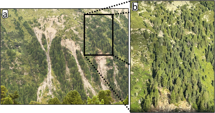
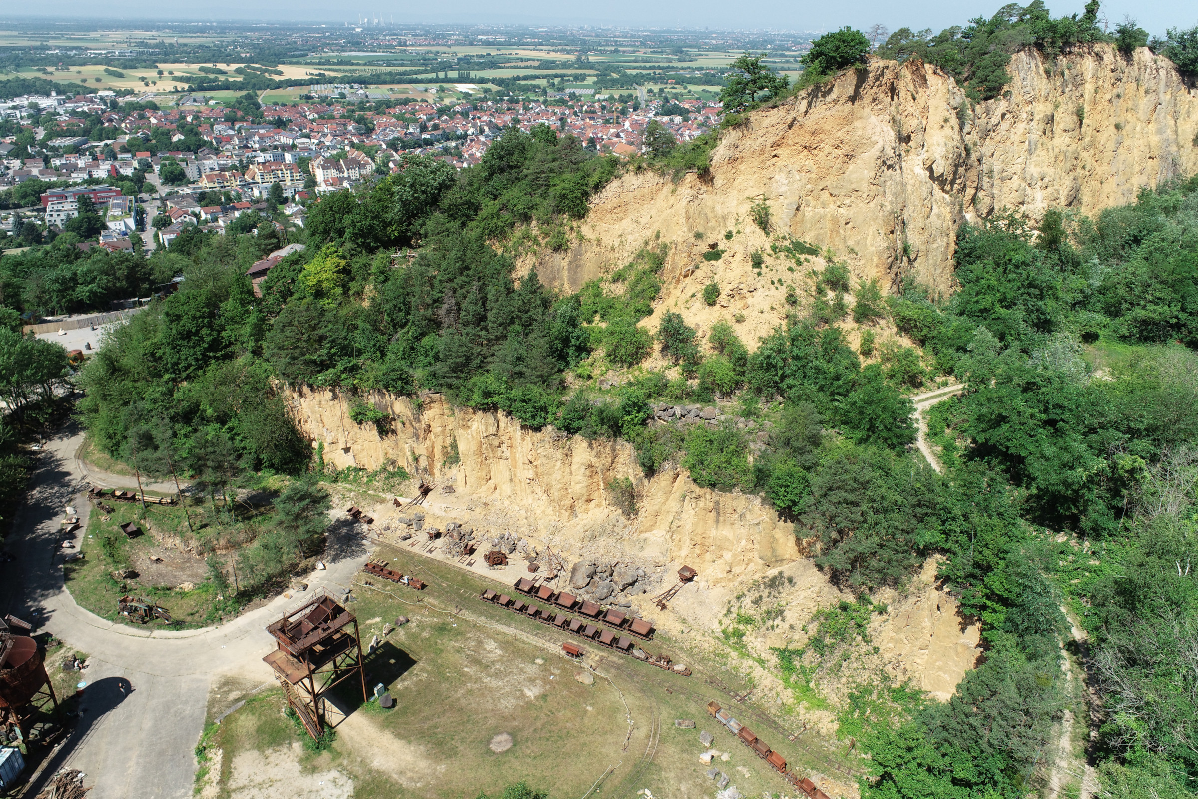
New Paper: Method for monitoring landslides in forested area
Tabernig, R., Albert, W., Weiser, H., Fritzmann, P., Anders, K., Rutzinger, M. & Höfle, B. (2025): Temporal aggregation of point clouds improves permanent laser scanning of landslides in forested areas. Science of Remote Sensing. Vol. 12, pp. 100254. DOI: https://doi.org/10.1016/j.srs.2025.100254 In our brand-new study ‘Temporal aggregation of point clouds improves permanent laser scanning of landslides…
-
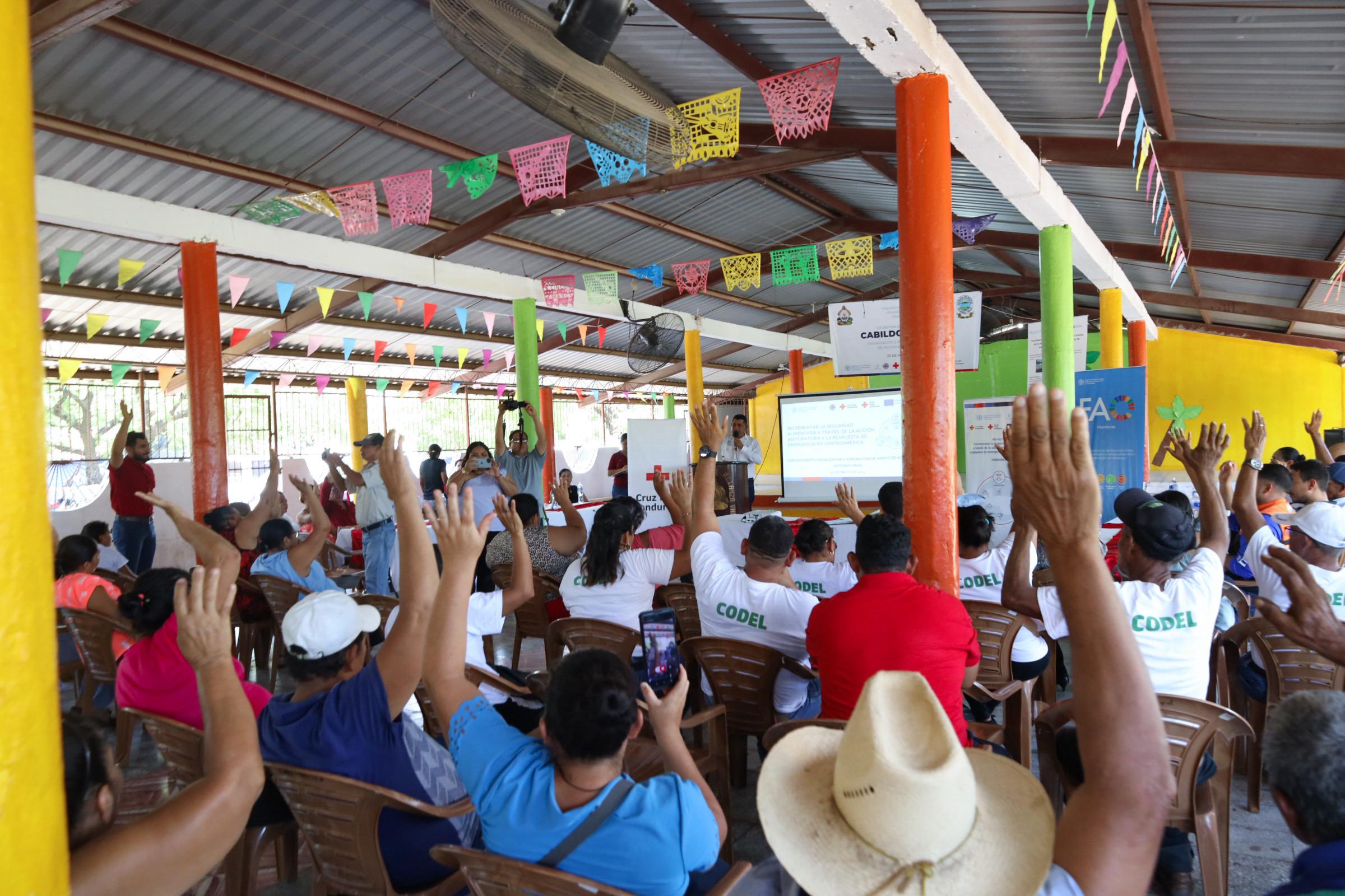
Flood risks in Honduras
The Sketch Map Tool was used in a joint effort between the Honduran Red Cross and the municipal government to update the municipal response plan and develop an annex focused on anticipatory actions. Participants were asked to map local knowledge about areas affected by flooding and critical infrastructure. The Sketch Map Tool was used during…
-
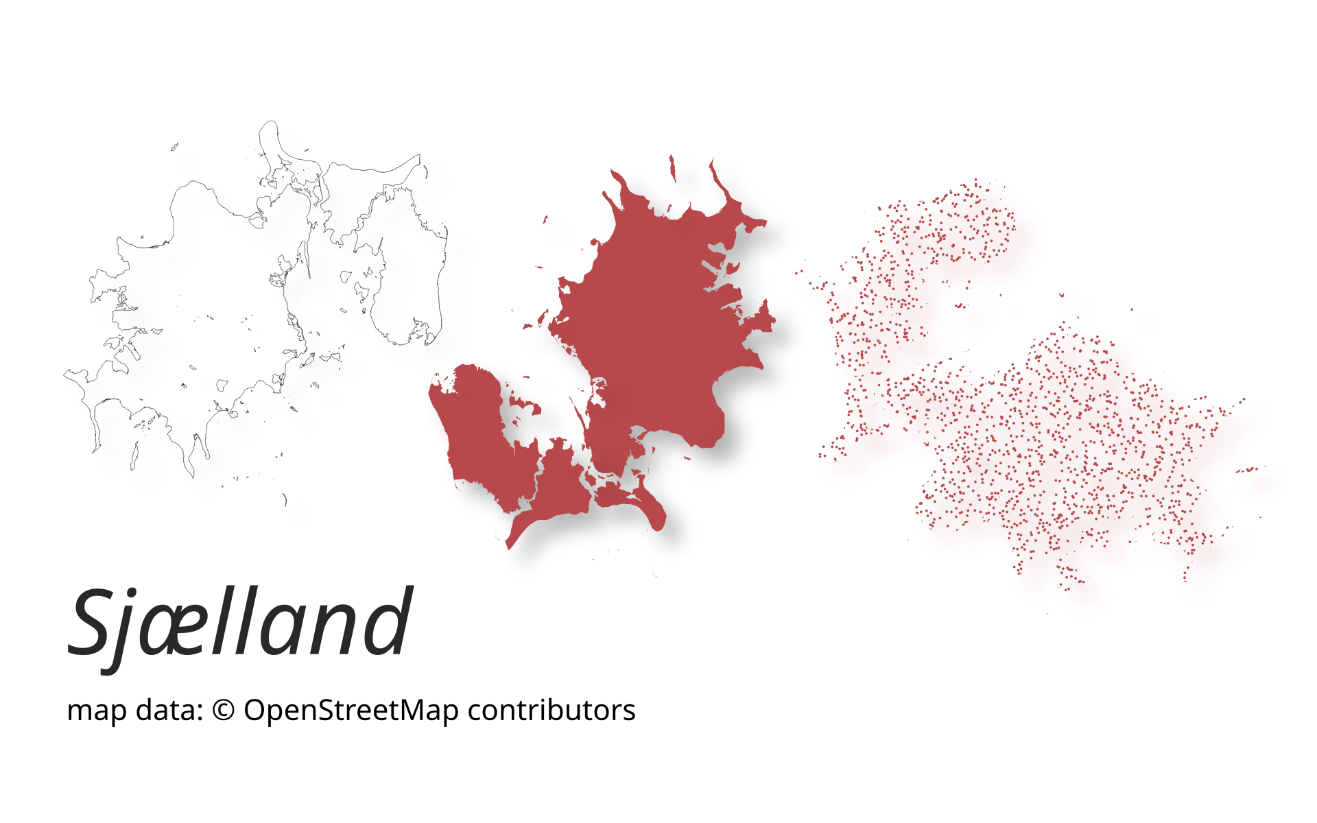
New release of ohsome-planet: Even faster processing of OSM history data in GeoParquet format
A new version of ohsome-planet (codename “Sjælland”) has been released. It is the newest version of HeiGIT´s command line tool, which transforms OpenStreetMap (history) PBF files into into an analysis-ready data format. We illustrate what ohsome-planet can do by assessing how many OSM edits used Bing Imagery as reference source. What is ohsome-planet? Working with…
-
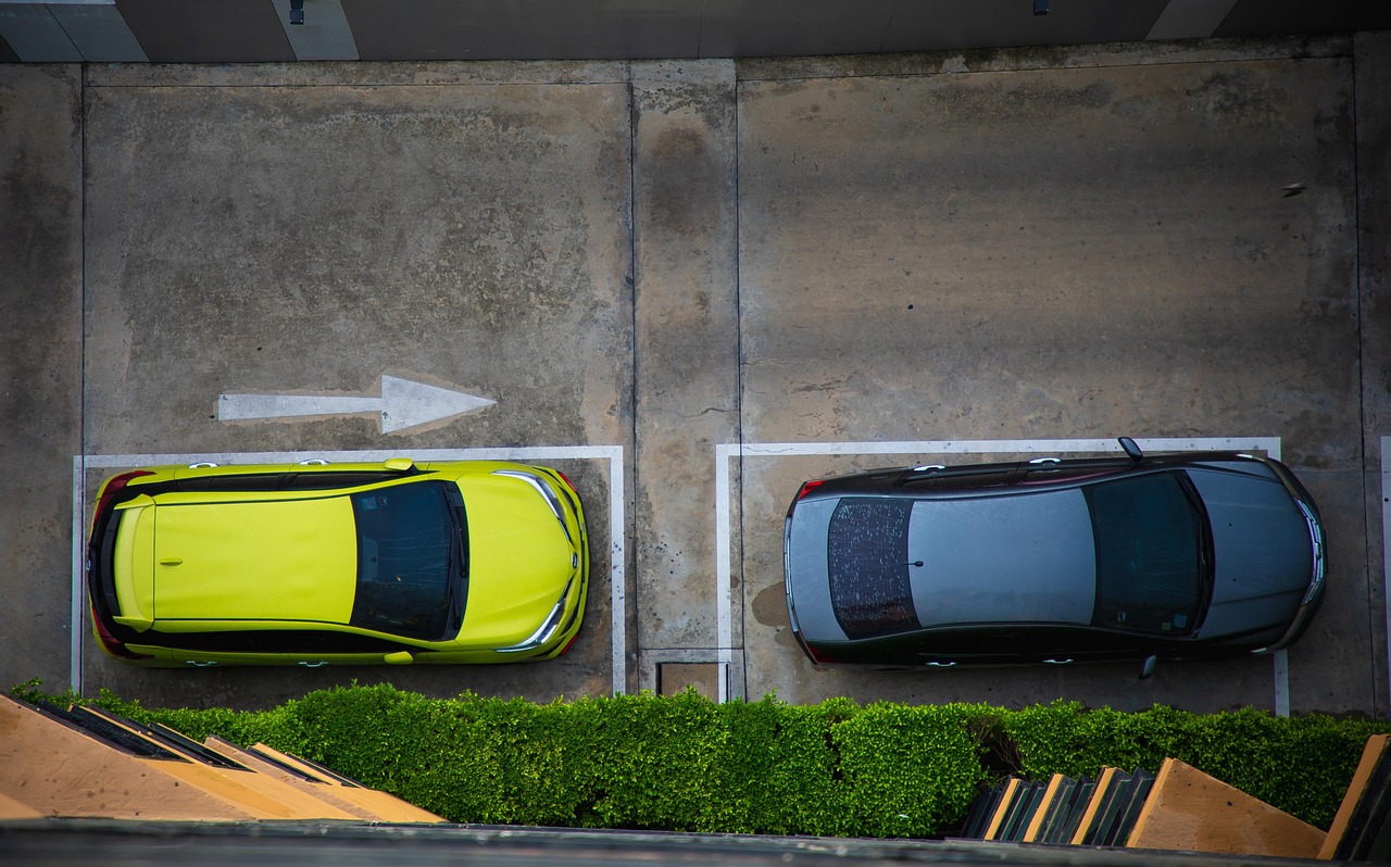
New Paper “Utilizing large language models to simulate parking search”
A study published on ScienceDirect evaluates the capability of LLMs to mimic human-like decision-making patterns in parking scenarios. Through experiments, researchers reproduce realistic trade-offs between cost, distance, and availability, while reflecting sociodemographic influences and bounded rationality. Parking behavior research traditionally focuses on how drivers choose parking locations, types, and search strategies, distinguishing between static and…