

Category: Research
-
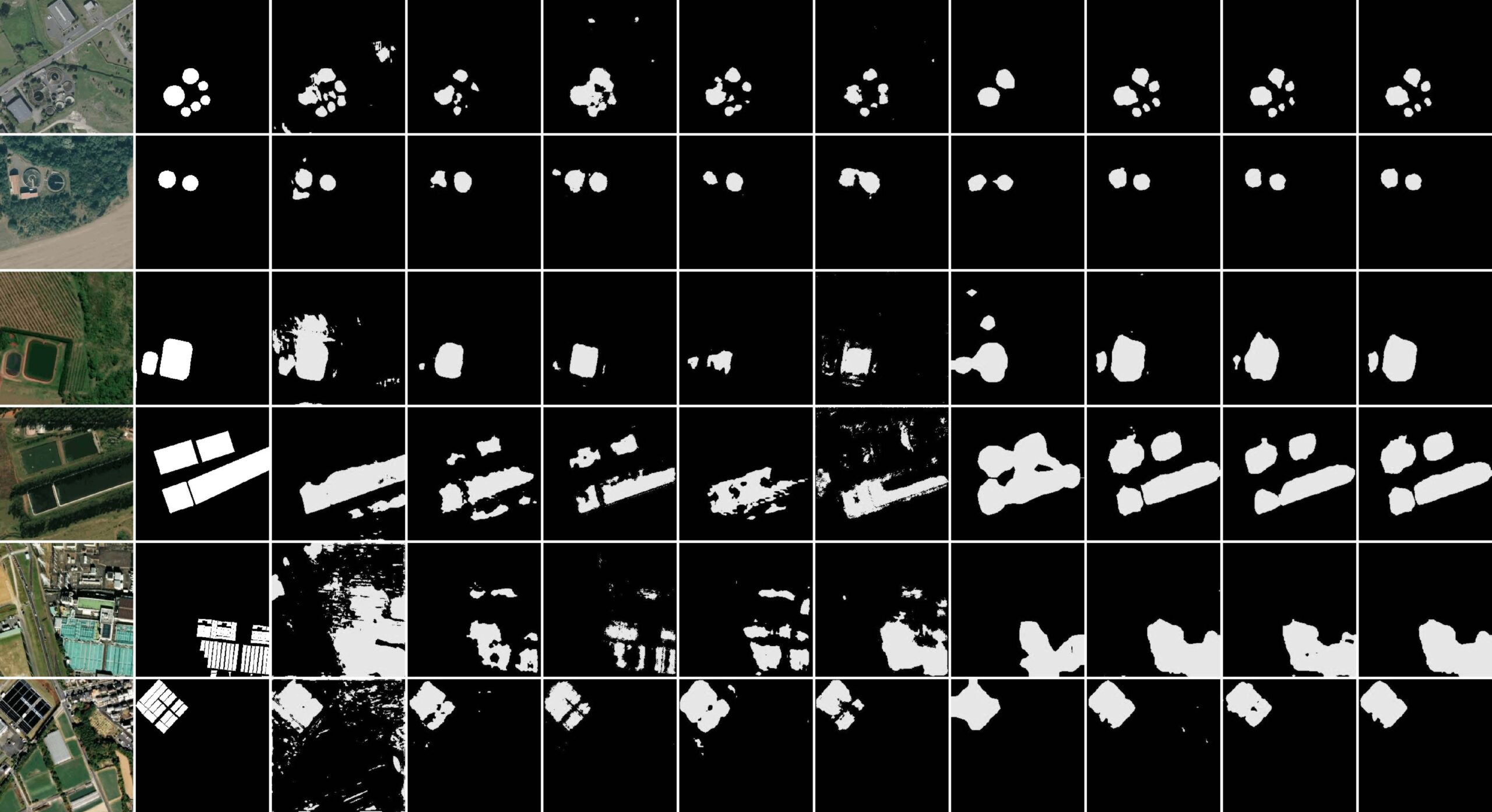
New paper “STVAE: Skip connection driven two-stream property Fusion Variational AutoEncoder for cross-region wastewater treatment plant semantic segmentation”
Wastewater treatment plants (WWTPs) play a crucial role in maintaining ecological balance and public health and are essential for advancing social sustainable development goals. However, the diverse architectural styles, scales, and environmental contexts of WWTPs—shaped by climate, topography, and regional economic conditions—pose significant challenges for generalizing segmentation algorithms. To address this, integrating knowledge from different…
-
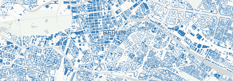
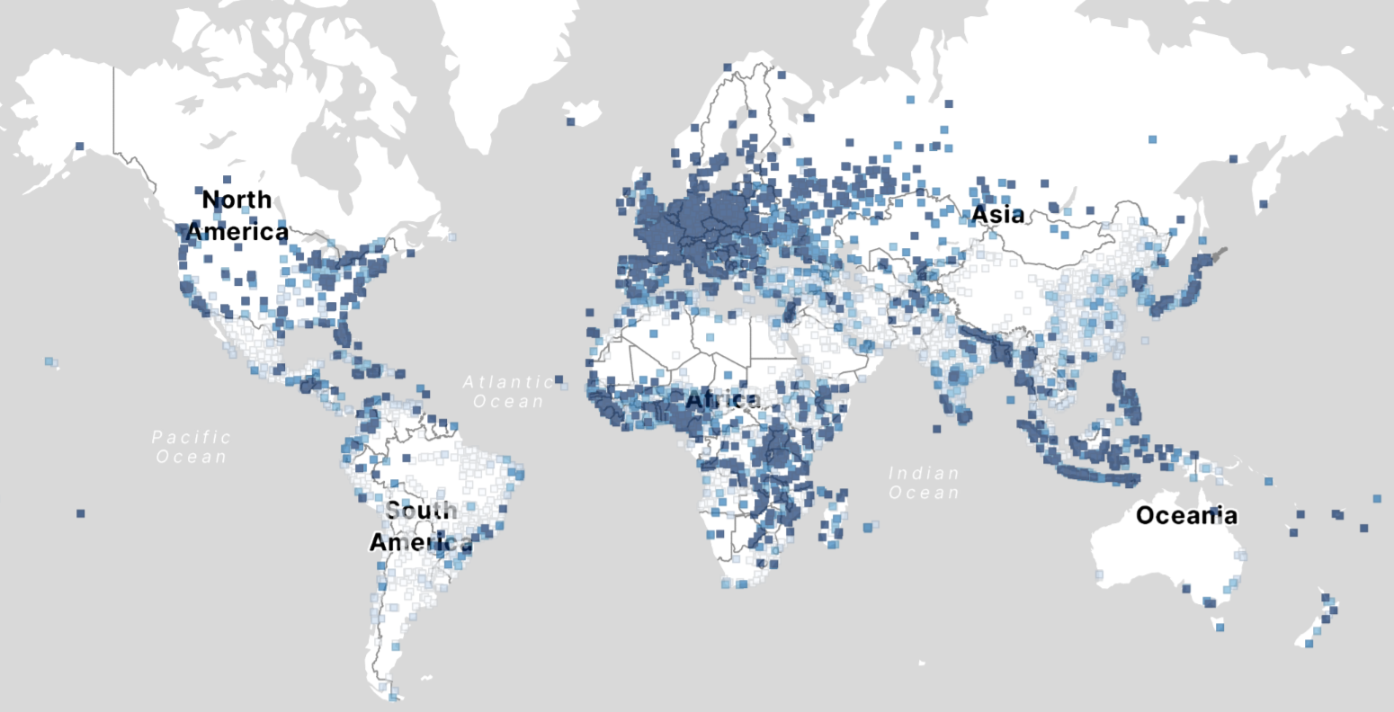
OSM Completeness with Overture maps data
Free and open-source map data has become a keystone for research across diverse fields. The extensive coverage of OpenStreetMap (OSM) data allows scientists to conduct independent studies without relying on corporate collaborations or investing heavily in proprietary datasets. However, OSM data coverage completeness varies significantly by location. Moreover, the latest data updates cannot always be…
-
ohsome-py 4.0.0
The ohsome-py Python package is a client for the ohsome API, designed to facilitate the extraction and analysis of historical OpenStreetMap (OSM) data. The package simplifies handling API requests and responses by converting them into pandas or GeoPandas data frames, making data analysis and visualization easier. With ohsome-py, you gain all the functionalities of the…
-
Announcing openrouteservice version 9.0.0: codename “Europa”
We are proud to announce the release of openrouteservice version 9.0.0, codename “Europa”. In this release, there are a number of new features that make running your own instance a whole lot easier, and some changes that improve the general routing results. For our API users, this release will not mean much, as just a…
-
Major HELIOS++ Release: v2.0.0
We are happy to release a new major version of HELIOS++: https://github.com/3dgeo-heidelberg/helios/releases What’s new in this release? Installation The new way to install HELIOS++ is via the conda or mamba package managers. We recommend mamba or micromamba. After creating a dedicated Python environment for your HELIOS++ project and activating it, run: mamba install helios or…
-
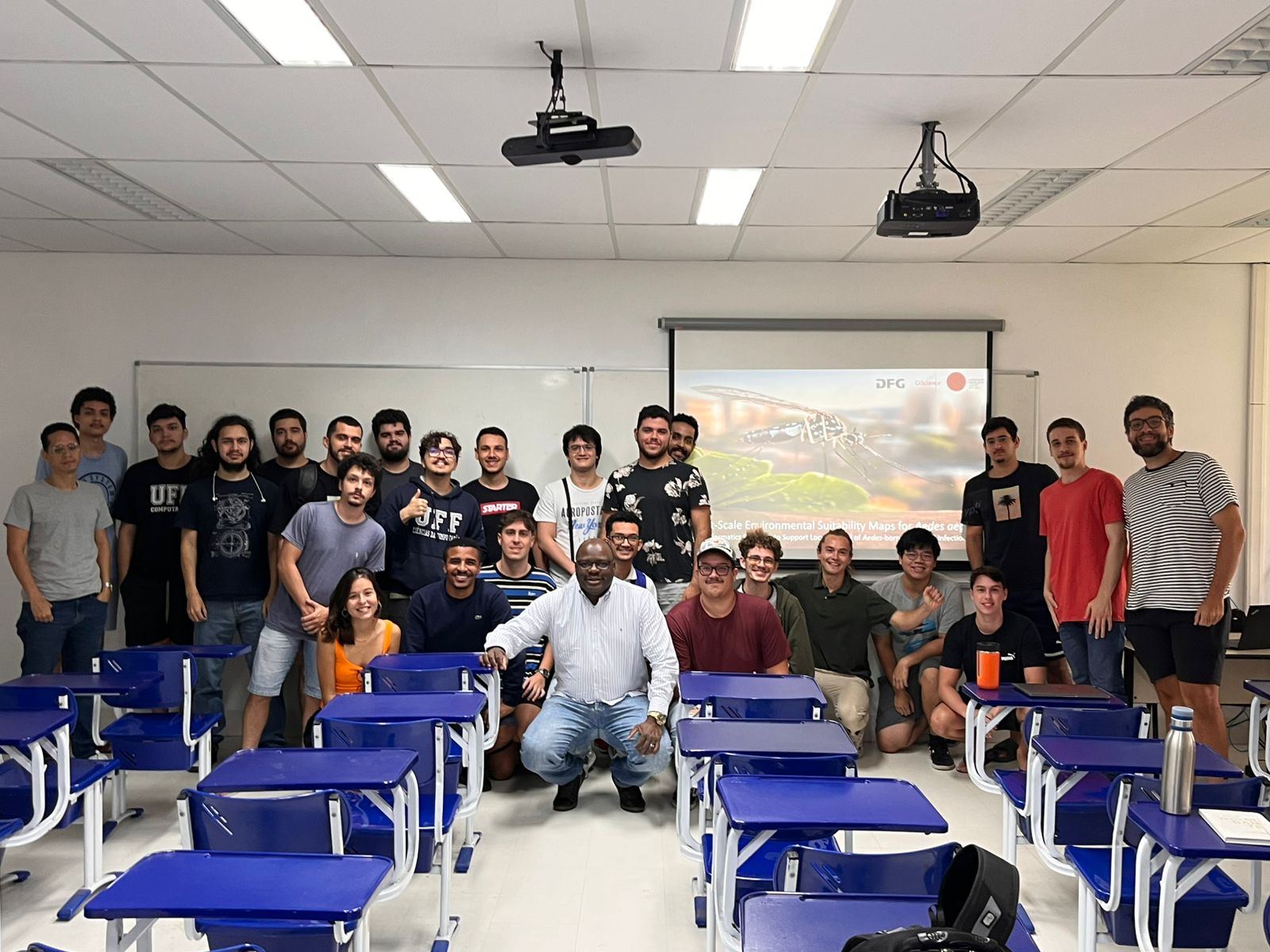
Research Visit to Rio de Janeiro
Building on ongoing efforts to enhance urban health management and mosquito-borne disease monitoring in the municipality of Rio de Janeiro, PhD candidate Steffen Knoblauch returned to the city for a second visit deepen collaborations and explore further applications of his research findings. He delivered lectures at several research institutions such as Universidade Federal do Rio…
-
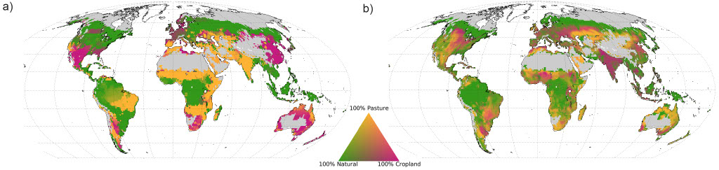
Reorganising land use: balancing food, water, and carbon storage
How can humanity meet the growing demand for food while addressing climate change and preserving vital water resources? A recent lecture by Sven Lautenbach, based on a paper addressing global land management, revisited this critical question. The findings reveal that a radical spatial reorganisation of land use could double food production, conserve water, and significantly…
-
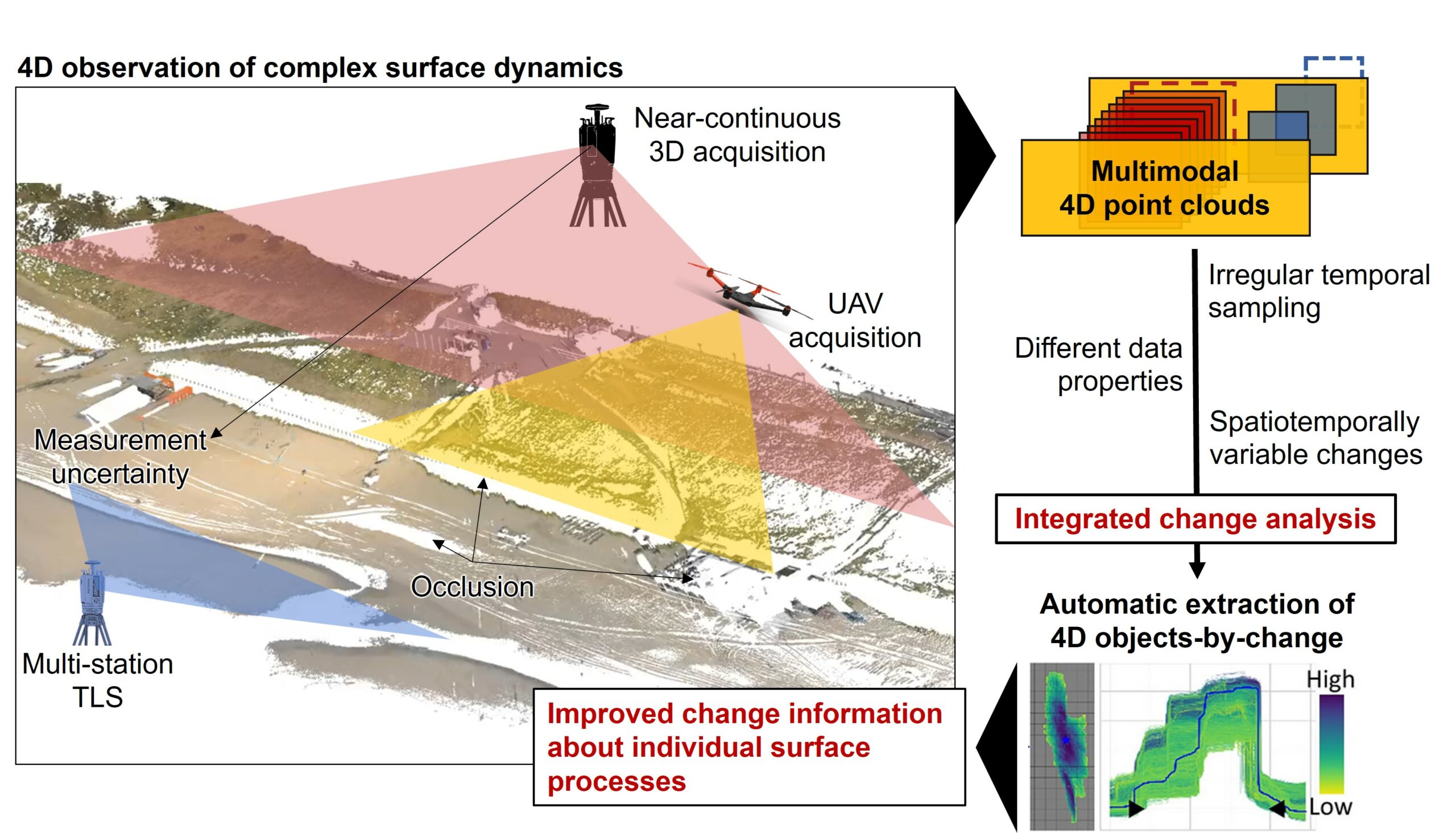
Kick-off: Extract4D Project
Last week, we, 3DGeo Heidelberg (Prof. Dr. Bernhard Höfle), had a kick-off meeting for our new joint research project Extract4D, led by Prof. Dr. Katharina Anders (TU Munich, Remote Sensing Applications). Here is a sneak peek at this exciting research project. Background The Earth’s surface is constantly being shaped by wind, water and gravity. Observing…
-
New Paper: GeoAI for Science and the Science of GeoAI
GeoAI integrates AI, geospatial big data, and high-performance computing for solving data- and computation-intensive geospatial problems. This field has gained continuous momentum, driven by strong demands in geography and the rapid advancement of AI. Wenwen Li´s paper “GeoAI for Science and the Science of GeoAI”, published in the latest edition of the Journal of Spatial…
-
New Paper: “Enriching building function classification using Large Language Model embeddings of OpenStreetMap Tags”
Rapid global urbanization is placing immense pressure on planners to make informed decisions that promote sustainable growth. A crucial aspect of this challenge is understanding how urban buildings are used. Traditionally, classifying the function of buildings—such as residential or commercial—relies on costly and subjective on-site surveys. However, advances in AI are poised to transform this…
-
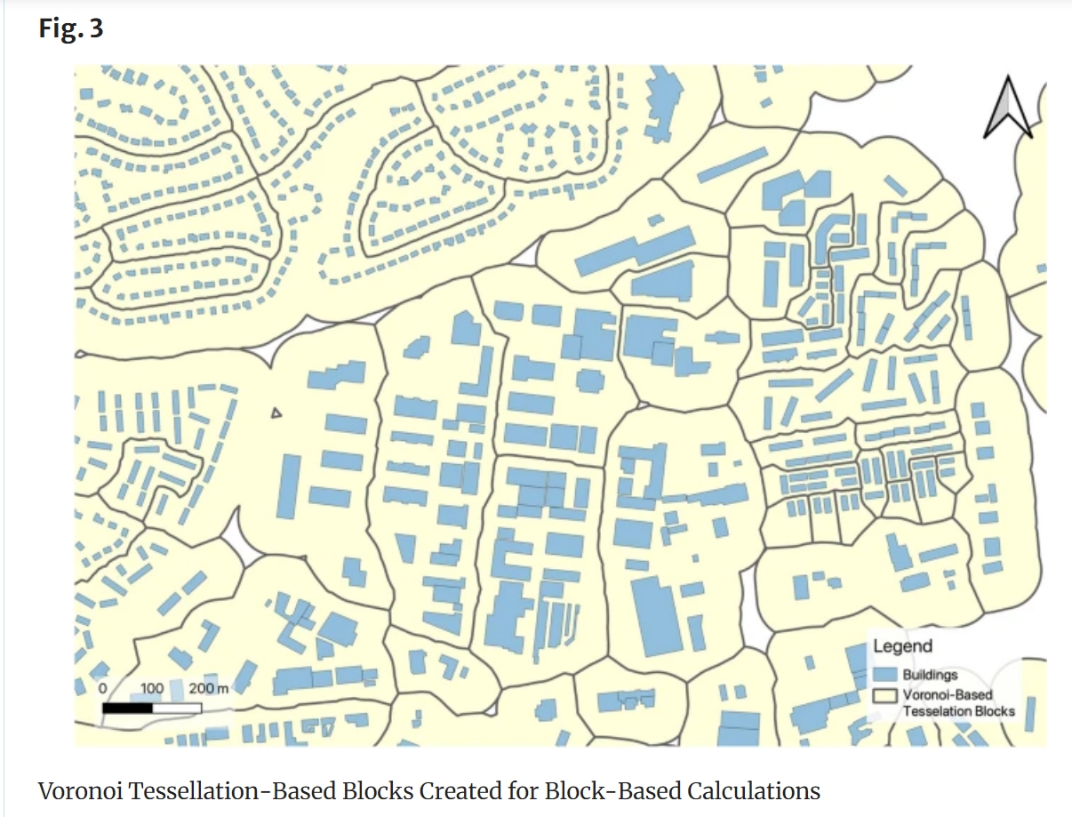
Analysis of OSM building data completeness using new data
With thousands of people mapping in OSM every day, missing building data in urban centers is steadily decreasing. Since OSM is a widely used source for projects researching urban phenomena around the world, a good data quality and an even distribution are important factors. If a spatial bias is present but not accounted for, researchers…
-
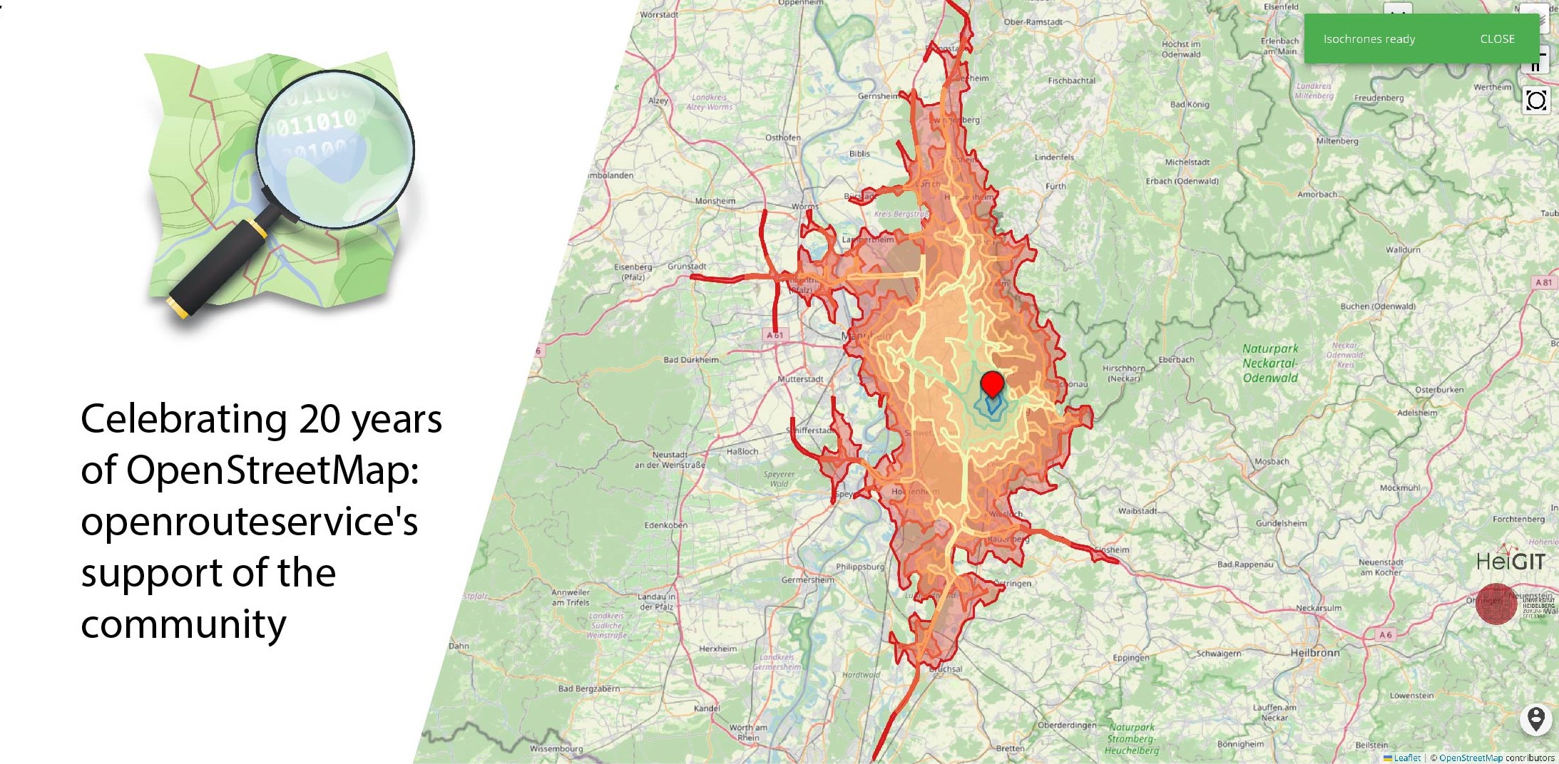
Celebrating 20 Years of OpenStreetMap: Openrouteservice’s Support of the Community
August 9 marks a turning point for the global mapping community: the 20th anniversary of OpenStreetMap (OSM). For two decades, OSM has revolutionized the way we perceive and interact with maps, transforming them from static representations to dynamic, community-driven resources. OpenStreetMap began as a visionary project aimed at creating a free, editable map of the…