Category: External Projects
-

2022 #30DayMapChallenge Round-Up Part 2: Deleted Maps
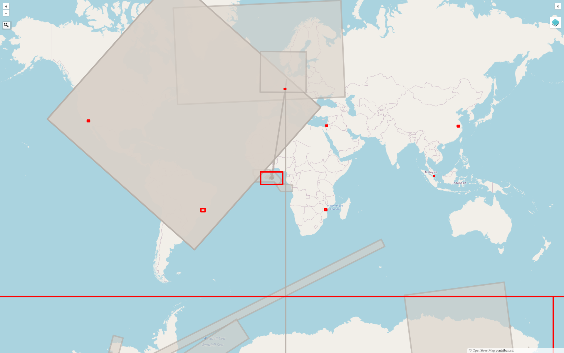
Featured photo: The deleted map displays all deleted elements within the analyzed areas (red). Gray rectangles represent deleted buildings. This past November, our teams at HeiGIT and GIScience participated in Topi Tjukanov’s Twitter event #30DayMapChallenge, where mappers display their creativity and ingenuity with a set of 30 daily prompts ranging from colors to specific datasets…
-

Training on digitalization of participatory mapping in Kuala Lumpur
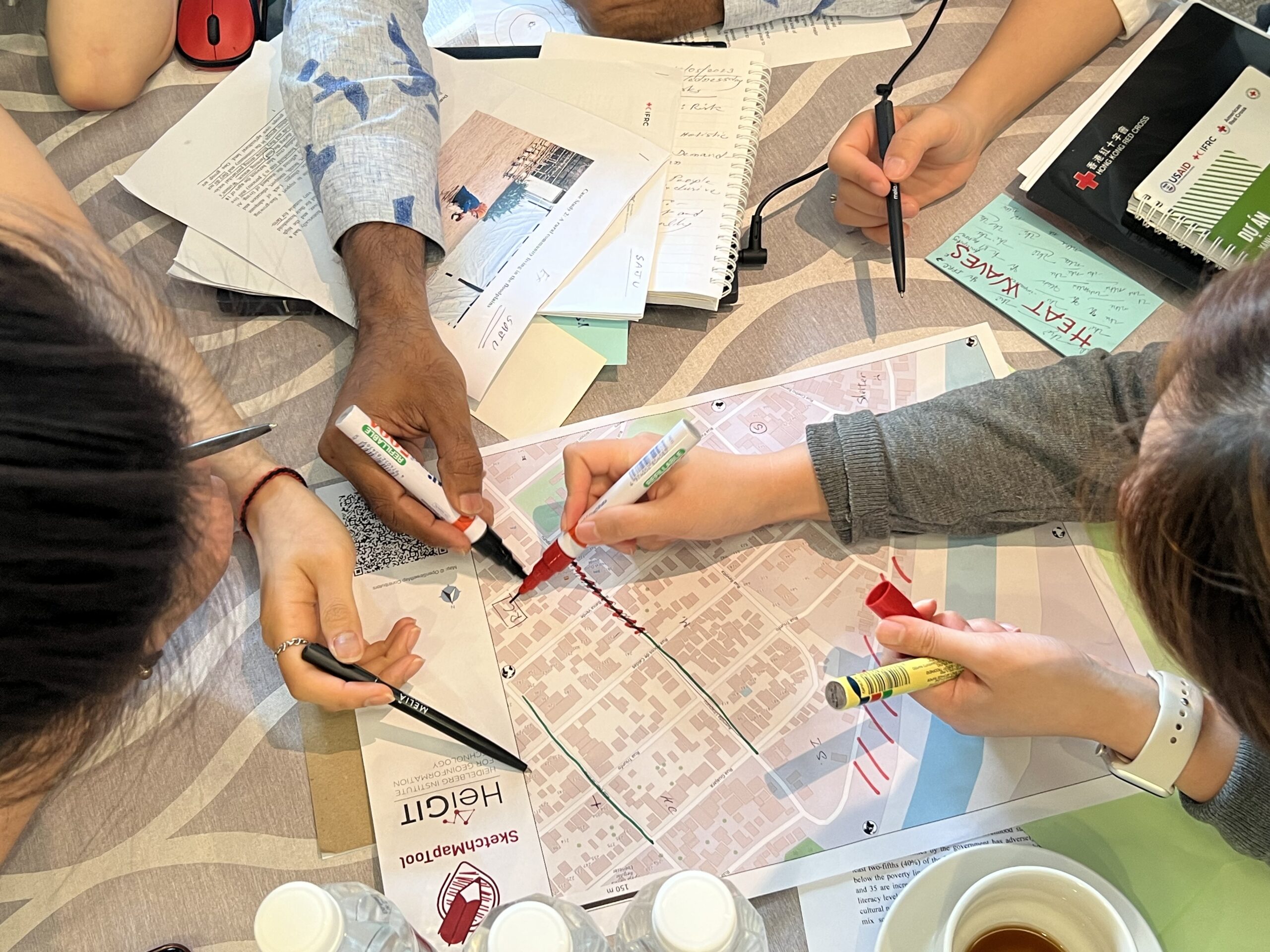
Featured Image: Training participants simulating a participatory mapping on the ground with the SketchMapTool. Last week, HeiGIT team member Anne Schauß held a workshop session in Kuala Lumpur, Malaysia, during a training of the International Federation of Red Cross and Red Crescent Societies (IFRC). The international training focused on community resilience and how to assess…
-

#30DayMapChallenge Round-Up Part 1: Germany Three Ways
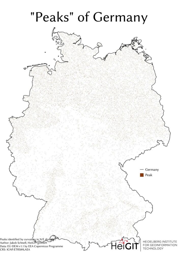
Featured Image: The peaks of Germany identified by curvature in N/E direction, Jakob Schnell’s contribution for Day 7 (Raster) of the #30DayMapChallenge. This past November, our teams at HeiGIT and GIScience participated in Topi Tjukanov’s Twitter event #30DayMapChallenge, where mappers display their creativity and ingenuity with a set of 30 daily prompts ranging from colors to…
-
Danziger Scholarship Applications Extended to Aug. 31
Do you know an African student hoping to do a PhD in GIScience at the University of Heidelberg? The Robert and Christine Danziger Scholarship deadline has been extended to August 31. Up-and-coming doctoral students from Africa, especially Ghana and West and Central Africa, are invited to apply for financial support. Applicants can apply for a…
-
UndercoverEisAgenten auf Social-Media
Permafrost ist gefrorener Boden und in der Arktis weit verbreitet. Gebäude und Straßen werden auf ihm gebaut. Doch was passiert, wenn diese Böden durch die Klimaerwärmung zunehmend auftauen? Zusammen mit jungen Bürgerwissenschaftler*innen in der kanadischen Arktis und Deutschland gehen wir auf Spurensuche! Wir freuen uns sehr über den Start unserer Social-Media-Kanäle! Erfahrt mehr über das…
-
Towards climate neutral science: the Pledge4Future CO2e emission calculator
Under pressure from the decision of the Federal Constitutional Court in spring 2021, the German government has amended its climate targets. The new coalition also wants to stick to these and pursue the goal of greenhouse gas neutrality by 2045. Emissions are to be reduced by 65 percent by 2030 compared to 1990 (Presse- und…
-
Diskussionsrunde zum Thema «Humanitäre Kartographie» bei den Mannheimer einander.Aktionstagen 2021
Im Rahmen der Aktionstage 2021 des Mannheimer Bündnis, bietet Mannheimer Mapathons e.V. eine offene Diskussionsrunde zum Thema «Humanitäre Kartographie» an. Auf dem Podium: Melanie Eckle-Elze, Benjamin Herfort (Disastermappers-HD) und Sandra Sudhoff (CartONG-France). Anschließend wird es für alle Teilnehmer*innen eine Gelegenheit geben, an einer «Probefahrt» zur Kartierung auf OpenStreetMap im PC-Raum teilzunehmen. Die Veranstaltung (live) findet…
-
GIScience/HeiGIT researchers and geography students with Pledge4Future web app official winners of the “The Climate Challenge Hackathon”
Pledge4Future is a free web app for the calculation and visualisation of work-related per capita CO2e emissions in research. The aim is to provide individuals and work groups with a simple tool for the long-term reduction of greenhouse gas emissions towards compliance with the Paris Climate Agreement. The calculation includes heating, electricity, business travel and…
-
Monitoring OSM and Tasking Manager to Map 1 Billion
In 2020, the Humanitarian OpenStreetMap Team (HOT) received funding from seven donors through TED’s Audacious Project. This has accelerated HOT’s ambition to map an area home to one billion people. HOT is working to add places at high risk of natural disaster or experiencing poverty to OpenStreetMap by significantly scaling-up support for local mapping communities.…
-
Openrouteservice for complex route optimization in new QGIS extension by Regionalverband Ruhr
(Deutsche Version unten) The Regionalverband Ruhr (Team 9-2 Geodata Technology) has used the potential of HeiGIT’s openrouteservice (ORS) in a new QGIS extension and thereby created another possible application for the ORS: The tool “Location and Route Optimization of Addresses” allows to search and locate addresses and to find the optimal routes between them. This…
-
Third International Mapathon on Mon 17.05.2021 by disastermappers heidelberg, MAMAPA, CartONG, HuMap and OSM Ghana
Dear mappers, on Monday 17.5.2021, 18.00pm a third international mapathon together with disastermappers heidelberg, MAMAPA, CartONG, HuMap and OSM Ghana will take place, which will give you some insights in mapping for humanitarian purposes from the perspective of different organizations and people around the world! For beginners we will offer a mapping introduction as usual,…
-
Die Stadt Mannheim nutzt openrouteservice für die Routenplanung in ihrem Online-Stadtplan
Seit kurzem nutzt die Stadt Mannheim openrouteservice (ORS) von HeiGIT für das Routing von Fußgängern, Fahrräder, Autos, LKW und Rollstuhlfahrern im Online-Stadtplan für die breite Öffentlichkeit, d.h. die Bürger und Besucher von Mannheim. Sie können es hier verwenden: https://www.gis-mannheim.de/mannheim/index.php?bl=wms_web_grau&service=mannheim<=mod_ors Dies zeigt, wie openrouteservice leicht in verschiedenste Clients und Apps integriert werden kann. Openrouteservice verwendet die…


