

Author: Pia Zaruba
-
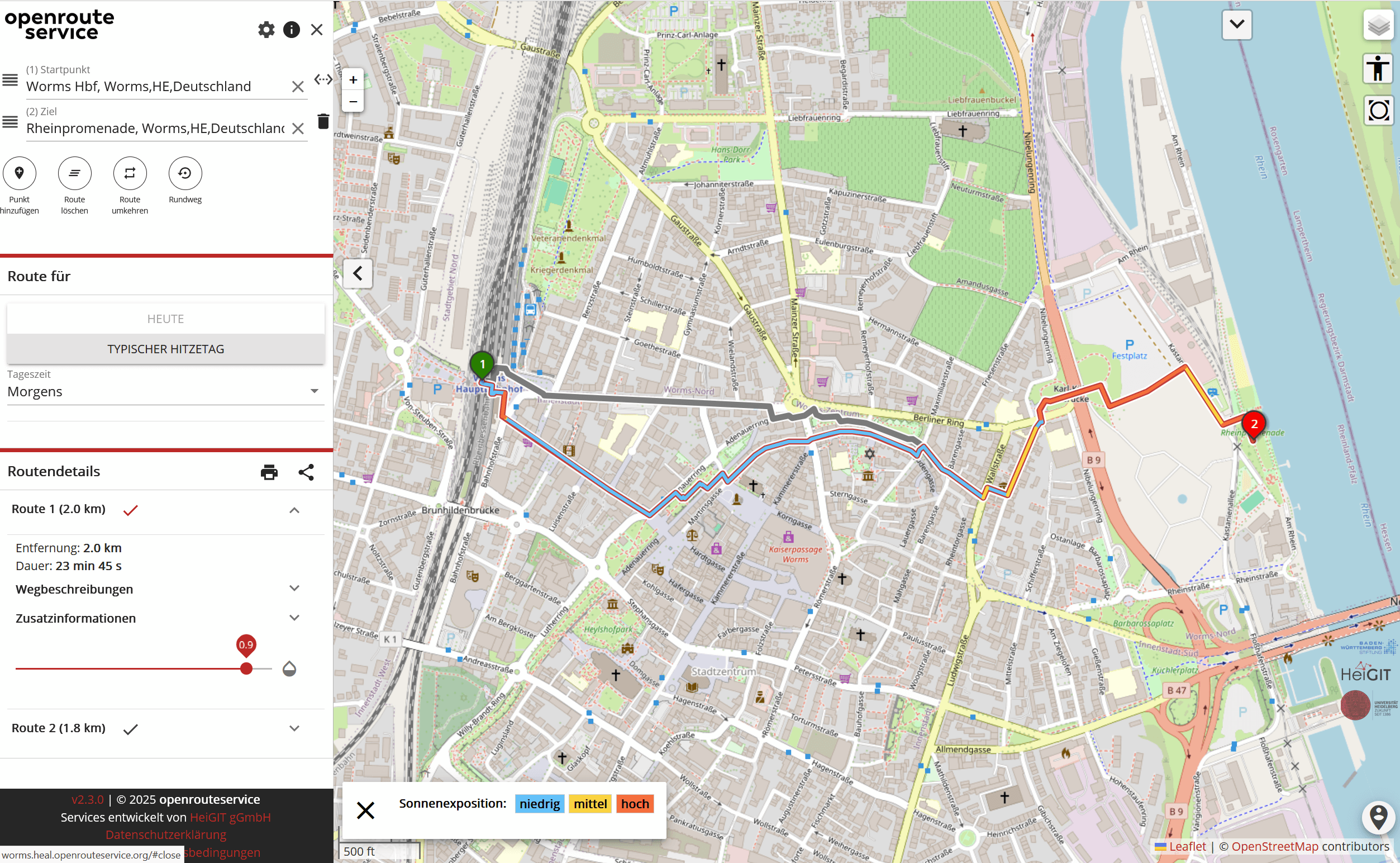
A Routing App to Avoid the Heat: HEAL App now available also for Worms
As summer temperatures soar, being outdoors poses rising health risks, especially in urban areas and for vulnerable groups like the elderly, children, and citizen with pre-existing conditions. The HEAL project launched a routing app to help citizens avoid heat stress, supporting climate adaptation and public health during hot weather periods. Initially developed for Heidelberg, the…
-
Including Local Communities in Colombia´s Risk Governance with Participatory Mapping
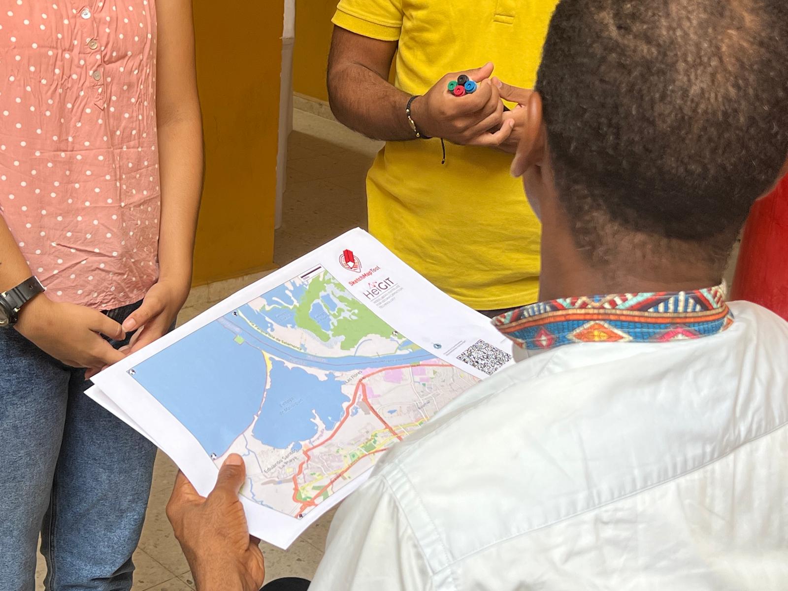
In June 2024, researchers from the Urban Big Data Centre (UBDC) and HeiGIT (Heidelberg Institute for Geoinformation Technology) carried out a joint field trip to Colombia to strengthen participatory mapping collaborations. The visit included workshops, partner meetings, and field activities with communities, universities, and government institutions, with a focus on the use and development of…
-
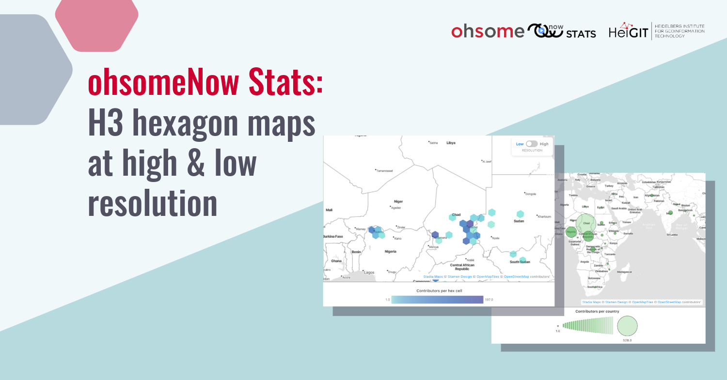
Another milestone for ohsomeNow: H3 hexagon maps at high and low resolution
The ohsomeNow Stats dashboard has been updated to enhance its visual and functional elements. This facilitates the exploration of OpenstreetMap (OSM) mapping activities across space and time. New H3 hexagon maps at high and low resolution One of the most notable improvements is the new mapping interface. Previously, country-level visualizations were limited and lacked spatial…
-
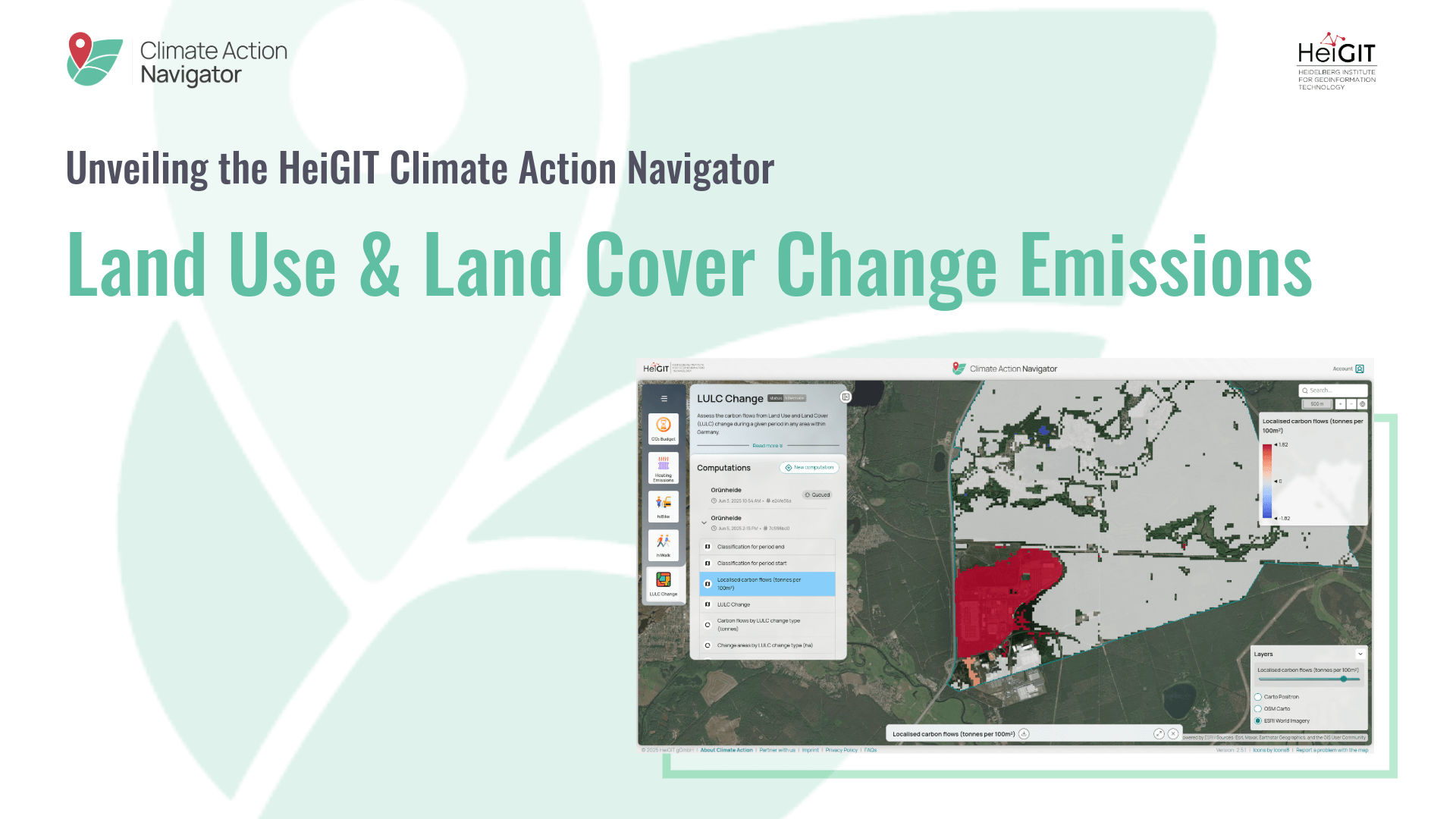
Unveiling the HeiGIT Climate Action Navigator Part 4 – Land Use and Land Cover Change Emissions
The Climate Action Navigator (CAN) is HeiGIT’s interactive dashboard offering high-resolution data and key climate indicators, ranging from the quality and availability of mobility infrastructure to CO2 emissions from heating of residential buildings. In this blog article, we will have a closer look at Land Use and Land Cover (LULC) Change Emissions. The LULC Change…
-
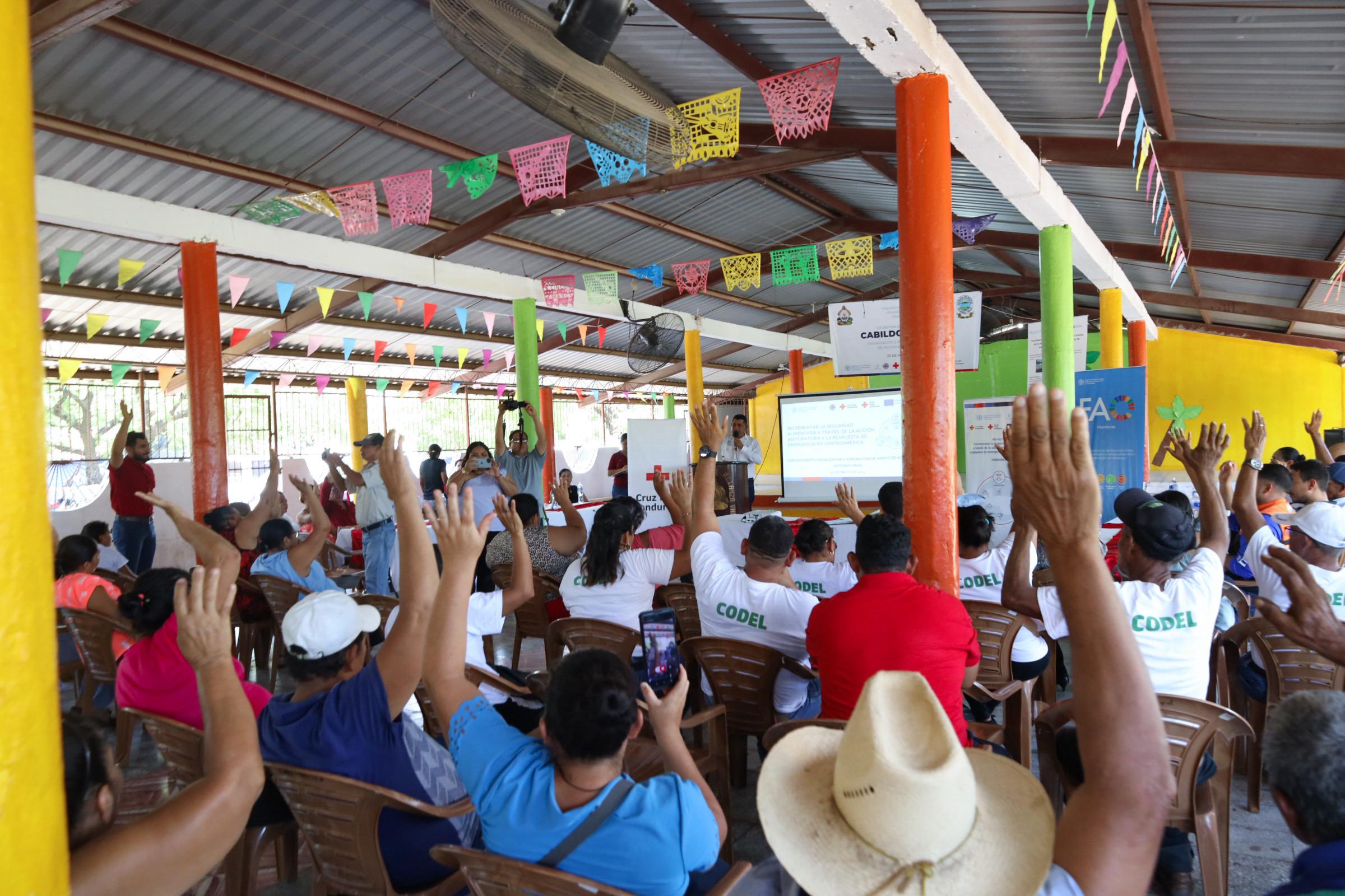
Flood risks in Honduras
The Sketch Map Tool was used in a joint effort between the Honduran Red Cross and the municipal government to update the municipal response plan and develop an annex focused on anticipatory actions. Participants were asked to map local knowledge about areas affected by flooding and critical infrastructure. The Sketch Map Tool was used during…
-
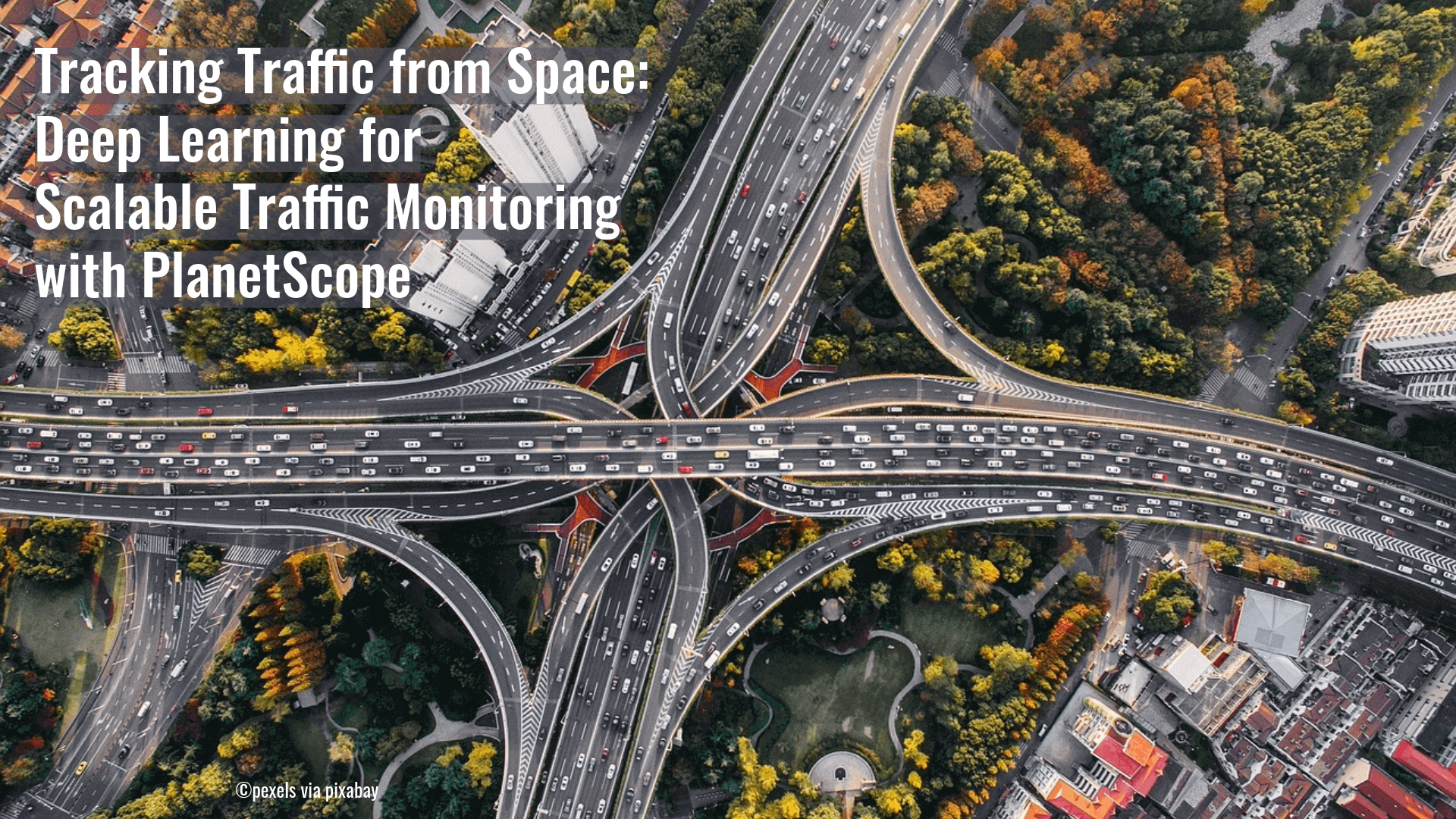
New Paper “Deep learning enhanced road traffic analysis”
A recent study has demonstrated a novel approach to the large-scale monitoring of road traffic. Rather than relying on radar or mobile sensors, the team used PlanetScope’s Super Dove satellite imagery to detect moving vehicles and estimate their speed. By implementing a Keypoint R-CNN learning model, the researchers were able to track the subtle “motion…
-
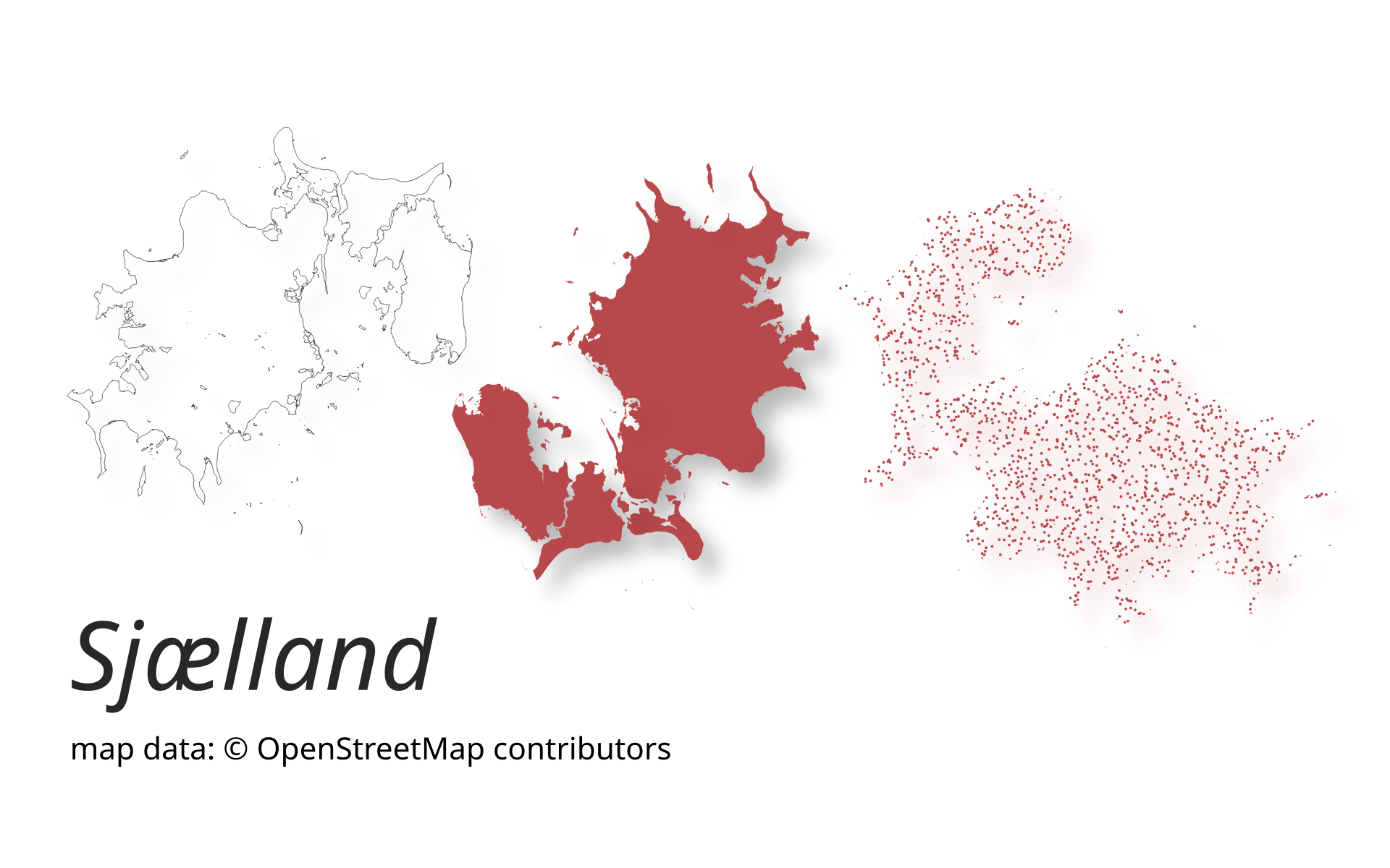
New release of ohsome-planet: Even faster processing of OSM history data in GeoParquet format
A new version of ohsome-planet (codename “Sjælland”) has been released. It is the newest version of HeiGIT´s command line tool, which transforms OpenStreetMap (history) PBF files into into an analysis-ready data format. We illustrate what ohsome-planet can do by assessing how many OSM edits used Bing Imagery as reference source. What is ohsome-planet? Working with…
-
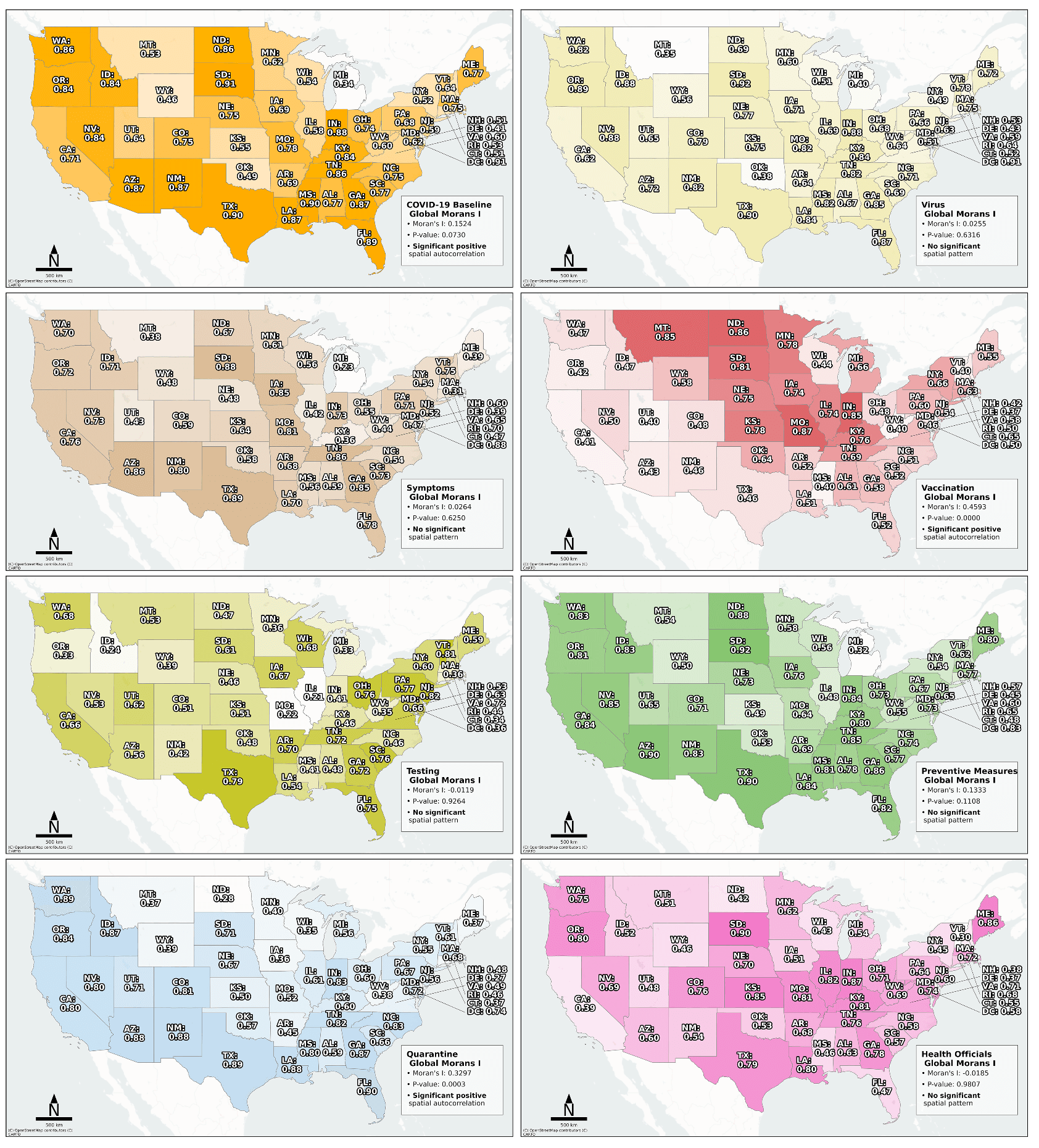
New Paper “How politics affect pandemic forecasting”
Searching for early warning systems during the COVID-19 pandemic, the researchers explored how digital data sources such as geo-social media (e.g. posts on platforms like X, formerly Twitter, that include location data) could improve the disease’s transmission dynamics. This data offers a valuable tool for local event detection. The study investigated how geo-social media topics…
-

New Paper “Utilizing large language models to simulate parking search”
A study published on ScienceDirect evaluates the capability of LLMs to mimic human-like decision-making patterns in parking scenarios. Through experiments, researchers reproduce realistic trade-offs between cost, distance, and availability, while reflecting sociodemographic influences and bounded rationality. Parking behavior research traditionally focuses on how drivers choose parking locations, types, and search strategies, distinguishing between static and…
-
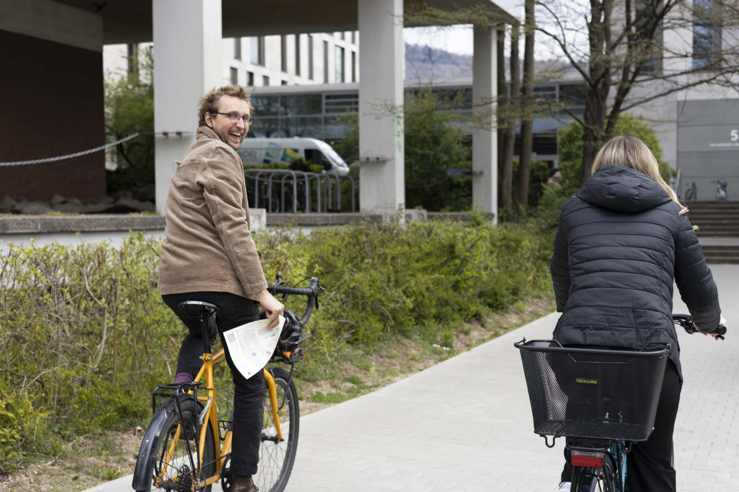
HeiGIT and GIScience take part in STADTRADELN
This year, the team from HeiGIT is once again participating in the nationwide cycling initiative STADTRADELN. For 21 days, teams across Germany collect bicycle kilometers, raising awareness for climate protection, sustainable mobility, and improved cycling infrastructure. The campaign promotes environmentally friendly transportation – not only in the everyday lives of the participants but also as…
-
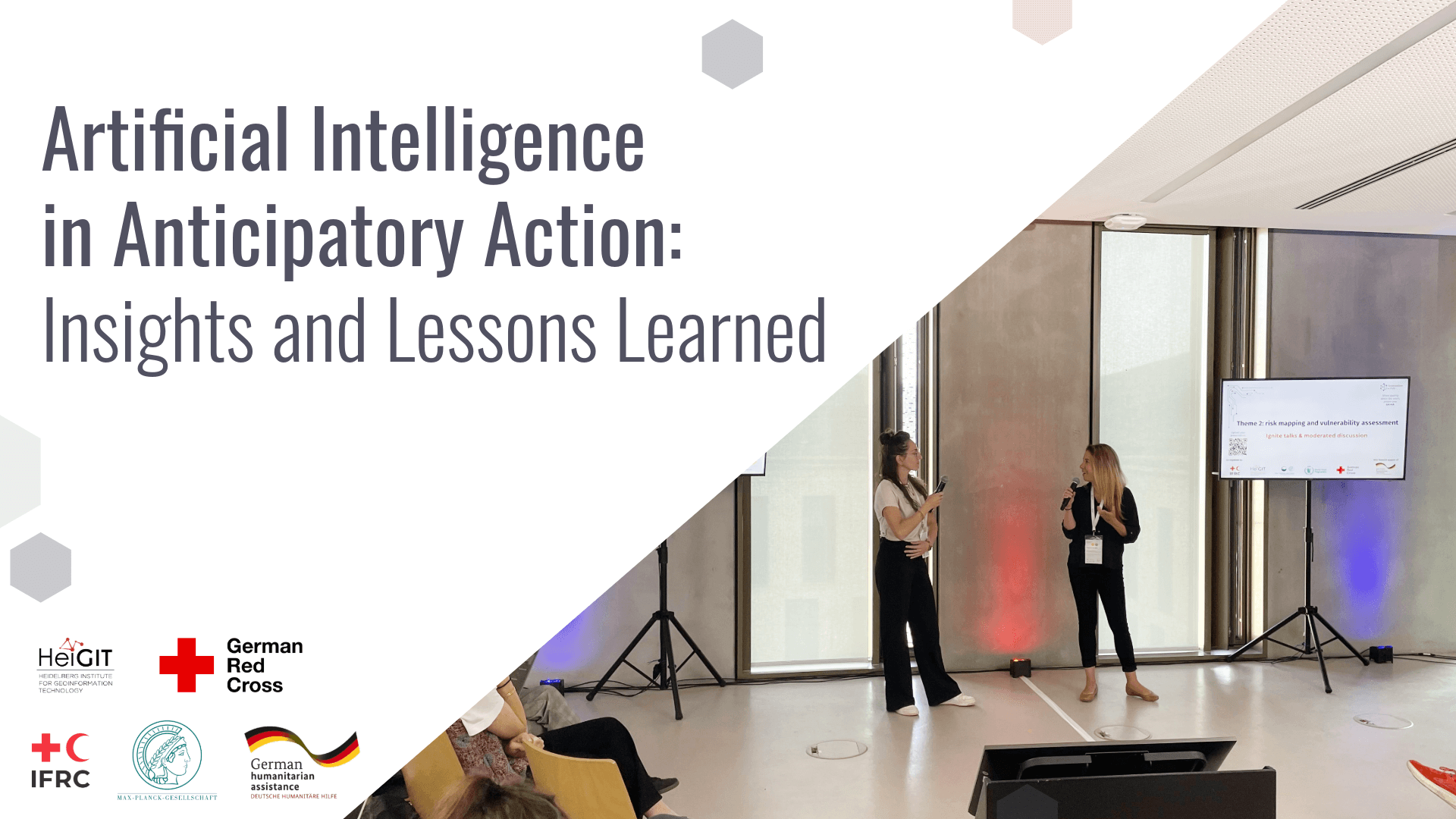
Artificial Intelligence in Anticipatory Action: Insights and Lessons Learned
Artificial Intelligence holds great promise for strengthening Anticipatory Action by improving hazard forecasting, vulnerability mapping, and decision support, but must be tailored to real-world humanitarian contexts to really be of benefit. A recent workshop brought together practitioners, researchers, and tech experts to identify gaps, share learnings, and explore how AI can be responsibly and effectively…
-
HGG lecture: Resource Use and Resilience: Pre-Columbian Terrace Agriculture in Southern Peru
The last HGG lecture of this summer term 2025 will look at the terraced landscapes in the Peruvian Andes, focussing on human-environment interactions.