

Author: Pia Zaruba
-

HeiGIT and GIScience take part in STADTRADELN
This year, the team from HeiGIT is once again participating in the nationwide cycling initiative STADTRADELN. For 21 days, teams across Germany collect bicycle kilometers, raising awareness for climate protection, sustainable mobility, and improved cycling infrastructure. The campaign promotes environmentally friendly transportation – not only in the everyday lives of the participants but also as…
-
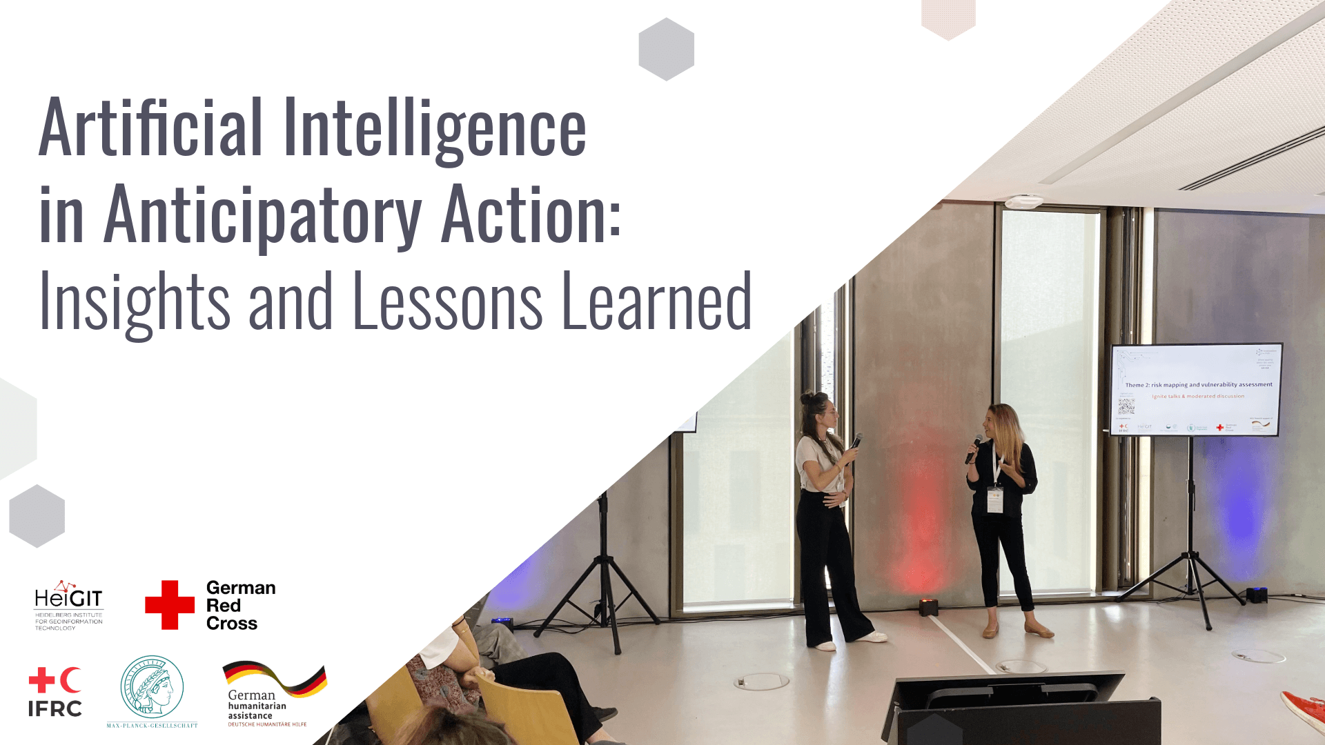
Artificial Intelligence in Anticipatory Action: Insights and Lessons Learned
Artificial Intelligence holds great promise for strengthening Anticipatory Action by improving hazard forecasting, vulnerability mapping, and decision support, but must be tailored to real-world humanitarian contexts to really be of benefit. A recent workshop brought together practitioners, researchers, and tech experts to identify gaps, share learnings, and explore how AI can be responsibly and effectively…
-
HGG lecture: Resource Use and Resilience: Pre-Columbian Terrace Agriculture in Southern Peru
The last HGG lecture of this summer term 2025 will look at the terraced landscapes in the Peruvian Andes, focussing on human-environment interactions.
-
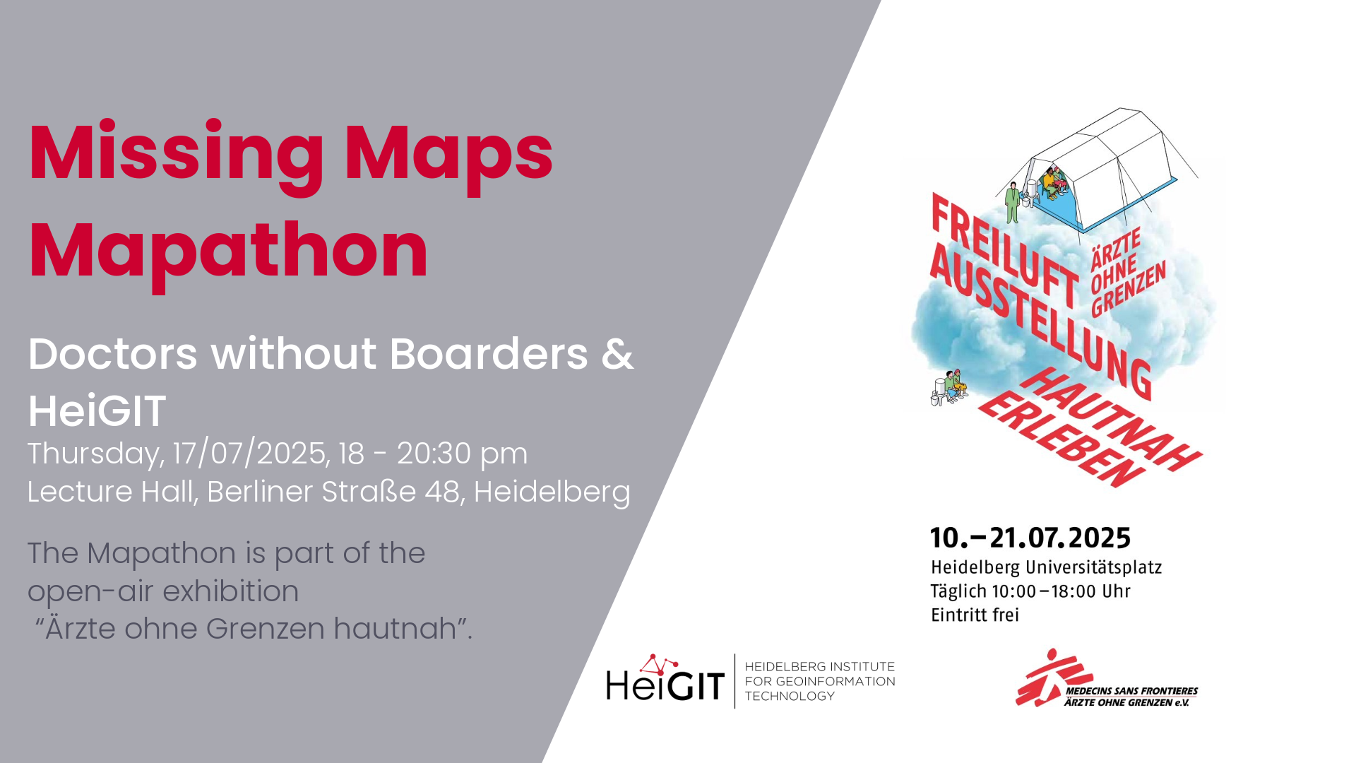
Mapathon with Doctors without Boarders
The lack of geographical data makes providing humanitarian aid more difficult. This is particularly the case in situations of disaster, when geographical data and routing data are crucial for coordinating help. In certain regions, however, this data still remains incomplete. During Mapathons, volunteers map these areas and provide the missing data. As part of this…
-
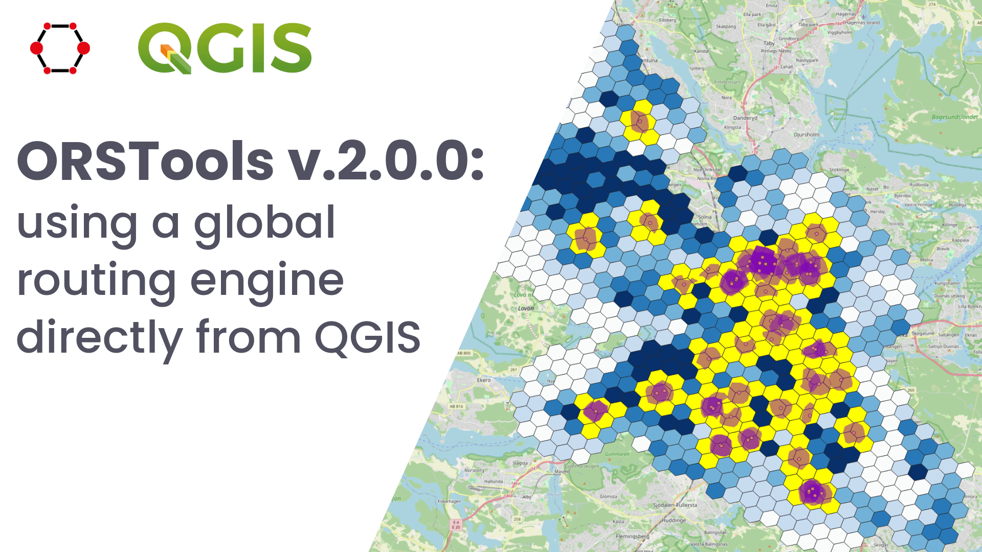
Release of QGIS plugin ORSTools v.2.0.0 & QGIS User Conference
What is ORSTools? With ORSTools, most of the functionalities of openrouteservice are directly accessible in QGIS. The plugin offers a toolset, including routing, isochrone generation and matrix calculations. These functions can be used interactively in the map canvas or applied to point files within the processing framework. Output files come with rich attribute data such…
-
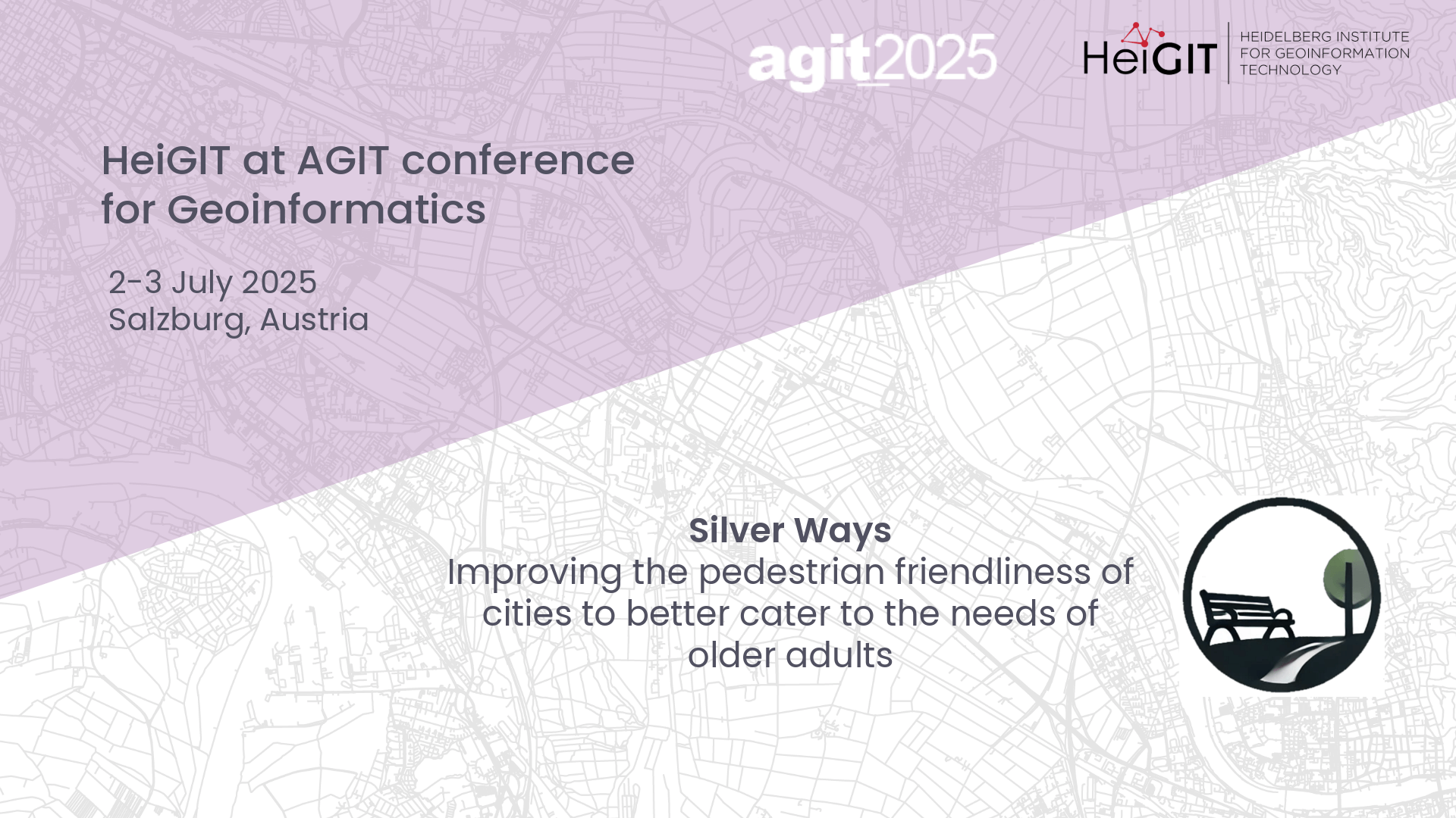
Presenting Silver Ways project at AGIT
At this year’s AGIT conference in Salzburg, Austria, GIScience and HeiGIT will host a poster session to our new Silver Ways project, developing a walkable routing system to cater the needs of older adults.
-
HGG lecture: Vietnam – Between Coffee and Karst
This HGG lecture is given by students from the Institute of Geography at Heidelberg University who participated in the Vietnam excursion.
-
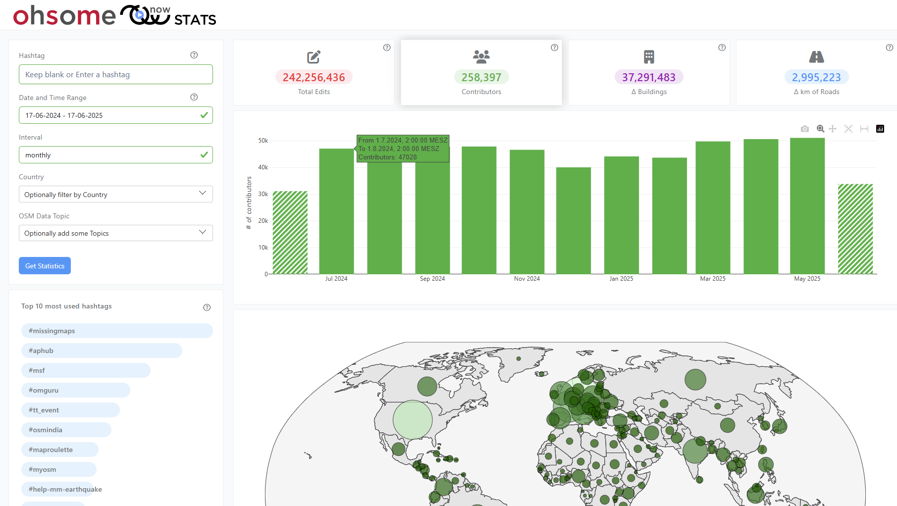
New insights into global mapping with the updated ohsomeNow Stats
The enhanced ohsomeNow Stats dashboard now provides near real-time access to all OpenStreetMap contributions since 2005, enabling more flexible and detailed analysis of global mapping activities. ohsomeNow stats provides a comprehensive overview of mapping activities in near real time. The dashboard was developed as part of our long-term cooperation with the Humanitarian OpenStreetMap Team (HOT),…
-
Heat perception of Heidelberg residents using the Sketch Map Tool and KoboToolbox
Students of the Institute of Geography at Heidelberg University explored local perceptions of urban heat in Heidelberg’s old town as part of a 2024 seminar on GIS for Disaster Risk Reduction and Humanitarian Aid. The project, supported by Heidelberg Institute for Geoinformation Technology (HeiGIT), tested participatory mapping using the Sketch Map Tool combined with KoboToolbox. The…
-
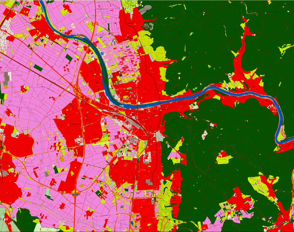
LaVerDi Project: Integrating OSM and satellite data for landscape monitoring
This project explores how OpenStreetMap data can complement satellite imagery for tracking land cover changes in Germany. Using a small test area, we compare datasets over time to better understand how real-world changes are reflected in OSM—and how this knowledge can support automated monitoring. The Federal Agency for Cartography and Geodesy (BKG) has partnered with…
-
HGG lecture: Glaciers – from process understanding to early warning systems to symbols of the climate crisis
The third HGG lecture is about the function of glaciers as early warning systems for climate change and how this has changed over the years.
-
HeiGIT at QGIS User Conference
HeiGIT will present two sessions on openrouteservice. ORSTools – using a global routing engine directly from QGIS Monday, June 2 2025, 16:30–17:00 (Europe/Stockholm), Statisten Getting from A to B fast and efficiently is central to mobility analysis and requires both road network data and a route calculation algorithm capable of using it. This session introduces…