

Author: David Orth
-

HeiGIT at XP Days Germany: Insights into Working in Floating Teams
Two of our colleagues, Johannes Link and Jakob Schnell, are set to attend XP Days Germany 2024, where they’ll be sharing their insights on working in floating teams at HeiGIT. XP Days Germany is a community-driven, participatory conference for software developers, designers and testers, offering a space to exchange ideas and experiences. The conference will…
-
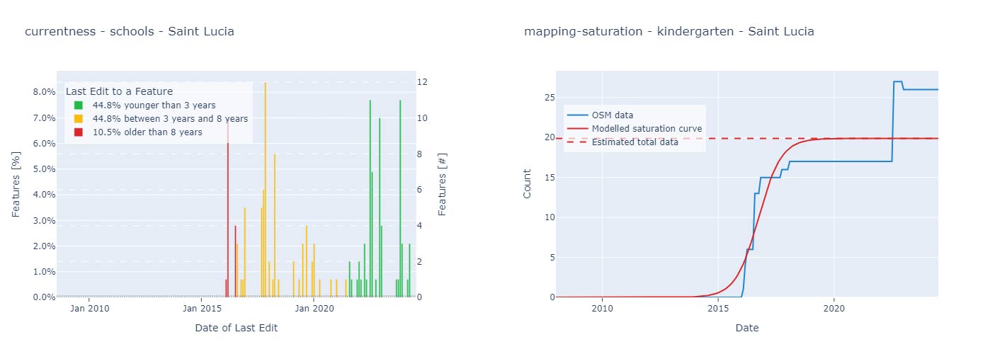
Quality Assessment for World Bank GEEST Methodology
A workgroup of the World Bank is researching and evaluating the key spatial factors affecting women’s employment opportunities in the renewable energy sector. Their research aimed to develop an analytical tool, the Gender Enabling Environments Spatial Tool (GEEST), designed to assess localities based on how supportive they are in enabling women to access employment or…
-
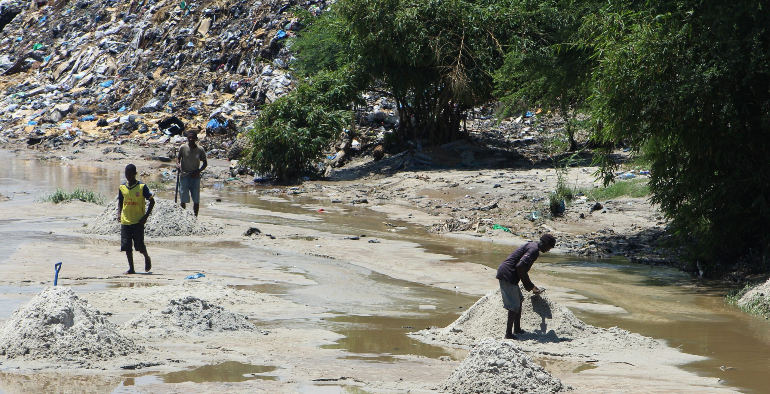
New Paper: “UAV-Assisted Municipal Solid Waste Monitoring for Informed Disposal Decisions”
Solid waste pollution is the cause of many environmental and health risks, especially in areas where waste is generated in large quantities but cannot be properly disposed of. Knowledge of the size and location of dump sites is required to keep waste management efficient and low-cost. When the extent of these dump sites needs to…
-
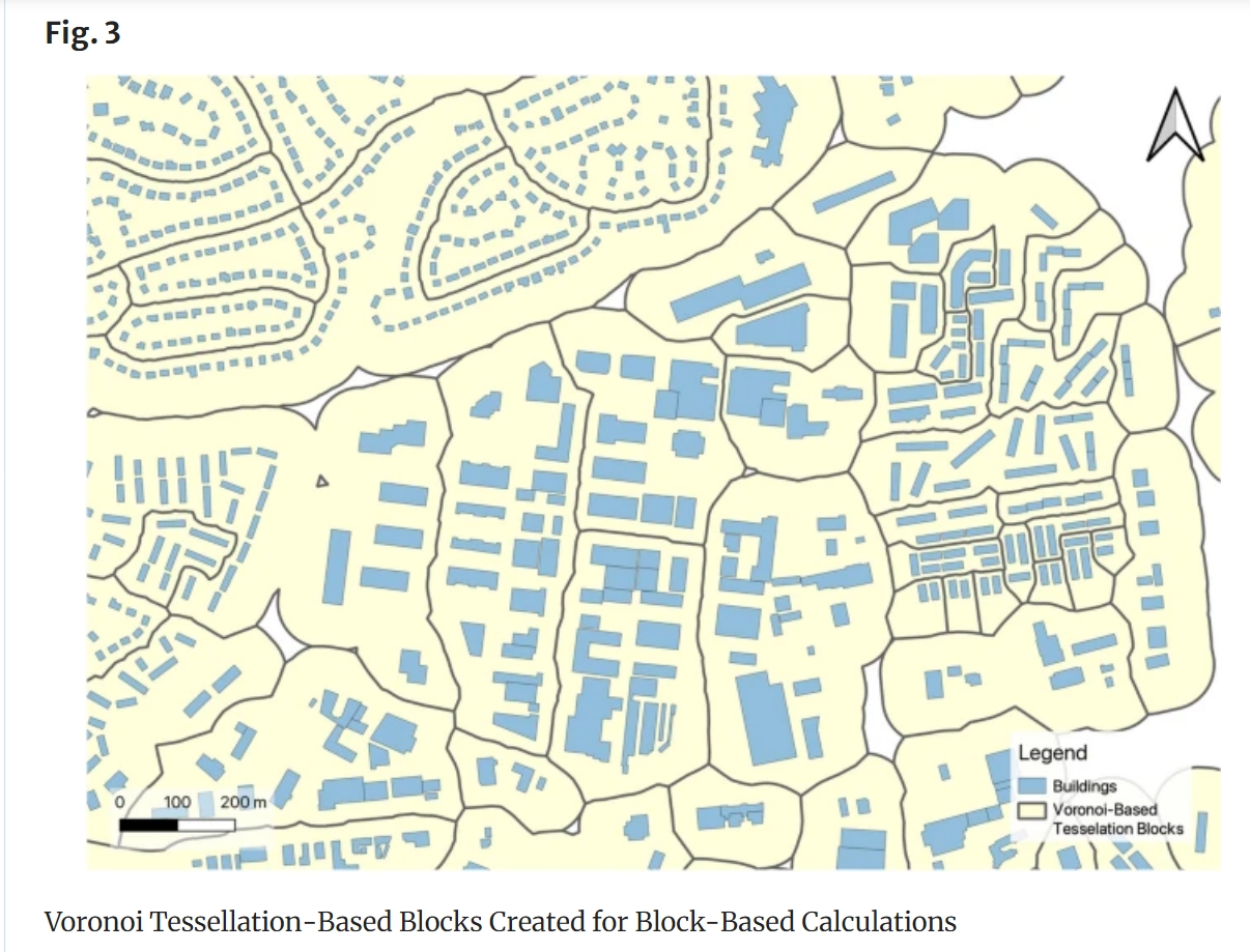
New Paper: “Enriching building function classification using Large Language Model embeddings of OpenStreetMap Tags”
Rapid global urbanization is placing immense pressure on planners to make informed decisions that promote sustainable growth. A crucial aspect of this challenge is understanding how urban buildings are used. Traditionally, classifying the function of buildings—such as residential or commercial—relies on costly and subjective on-site surveys. However, advances in AI are poised to transform this…
-
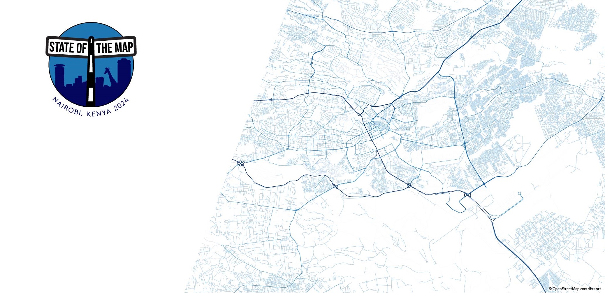
HeiGIT at State of the Map in Nairobi, Kenya
State of the Map is the annual event for all mappers and OpenStreetMap users. In 2024 the State of the Map conference will be taking place from September 6 to 8 in Nairobi, Kenya as well as online. The conference programme contains talks, workshops, discussion rounds and more. Four talks as well as a workshop…
-
World Humanitarian Day – How Maps can Help Aid Workers
August 19th marks World Humanitarian Day (WHD) to recognize the efforts of humanitarian workers and to advocate for the survival, well-being and dignity of people affected by crises, and for the safety and security of aid workers. One of many factors that are essential for effective humanitarian response and the security of people on site…
-
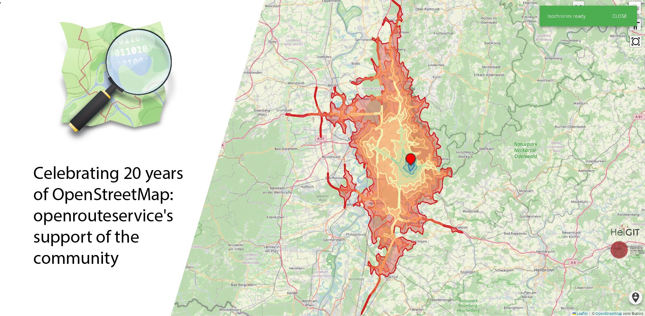
Celebrating 20 Years of OpenStreetMap: Openrouteservice’s Support of the Community
August 9 marks a turning point for the global mapping community: the 20th anniversary of OpenStreetMap (OSM). For two decades, OSM has revolutionized the way we perceive and interact with maps, transforming them from static representations to dynamic, community-driven resources. OpenStreetMap began as a visionary project aimed at creating a free, editable map of the…
-
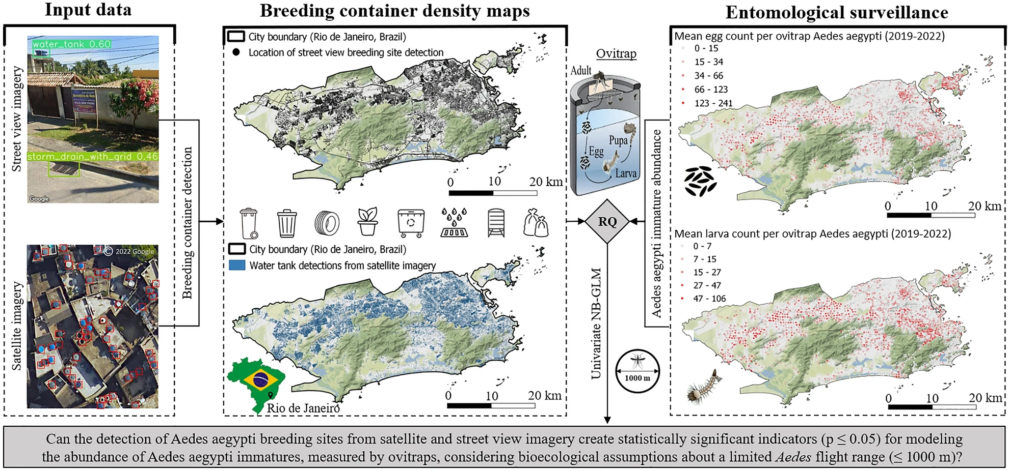
New Paper in Nature ‘Scientific Reports’: „High-resolution Mapping of Urban Aedes Aegypti Immature Abundance Through Breeding Site Detection Based on Satellite and Street View Imagery“
Knoblauch, S; Su Yin, M.; Chatrinan, Krittin; Rocha, Antonio A. de A.; Haddawy, P.; Biljecki, F.; Lautenbach, S.; Resch, B.; Arifi, D.; Jänisch, T.; Morales, I.; and Zipf, A published the paper ‘High-resolution mapping of urban Aedes aegypti immature abundance through breeding site detection based on satellite and street view imagery’ in Nature Scientific Reports.…
-

Heigit and PLANUM Join Forces: A Guide to Co-developing Climate Action Indicators
HeiGIT and PLANUM, are happy to announce their cooperation in the field of climate action. PLANUM is committed to driving positive change through innovative engineering solutions. The company specializes in sustainable planning, making them a crucial partner in our pursuit of creating impactful and practical solutions to combat climate change. At HeiGIT, the newly established…
-
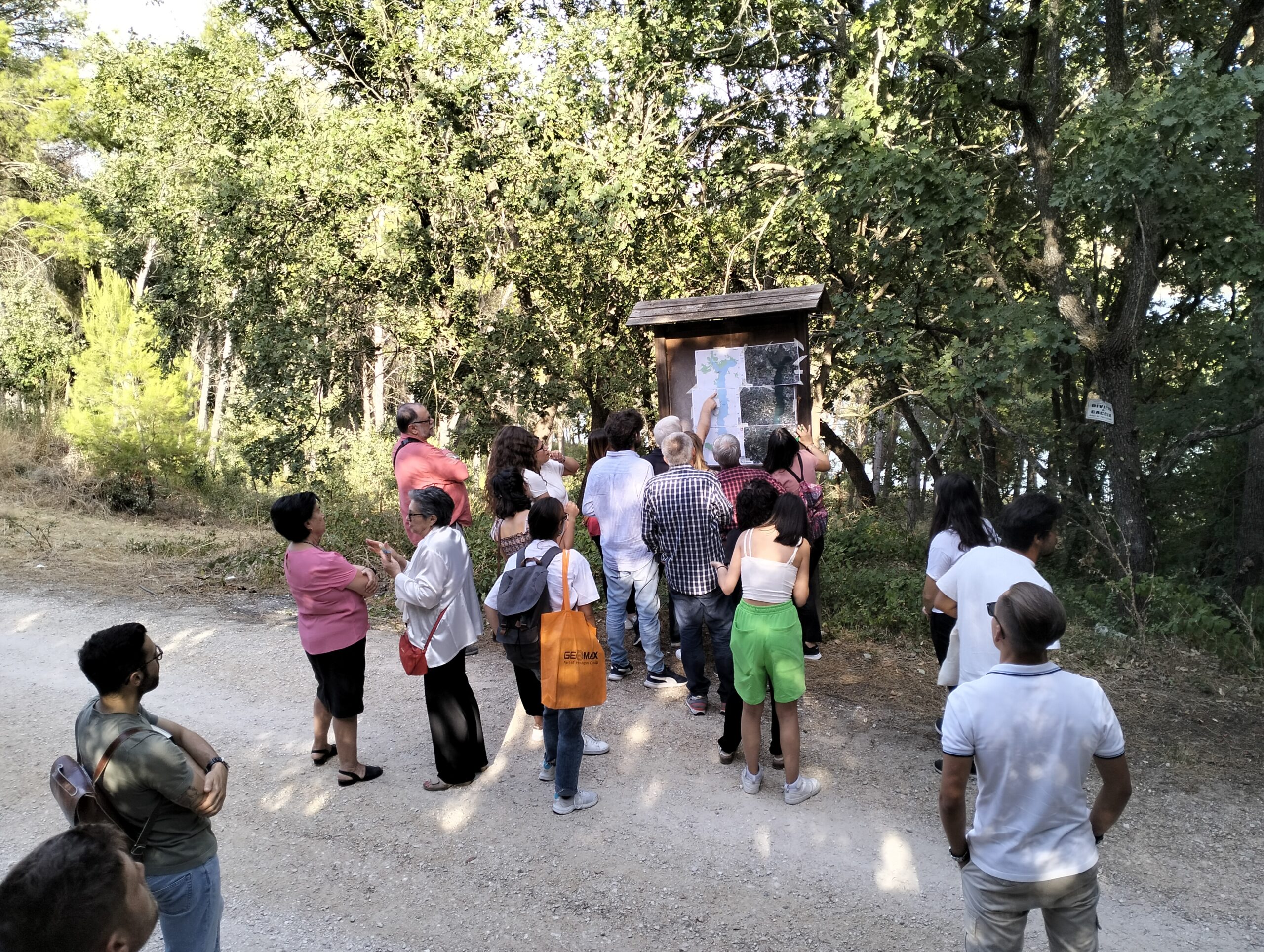
Participatory Mapping for Cultural Landmarks
Claudio Sossio De Simone is a PhD candidate at the University of Rome Tor Vergata in the field of Cultural Heritage, Education and Territory. His research interests include GIS science and geoinformation applied to cultural heritage, as well as the geo-historical study of rural landscapes. The Sketch Map Tool was used as part of his…
-
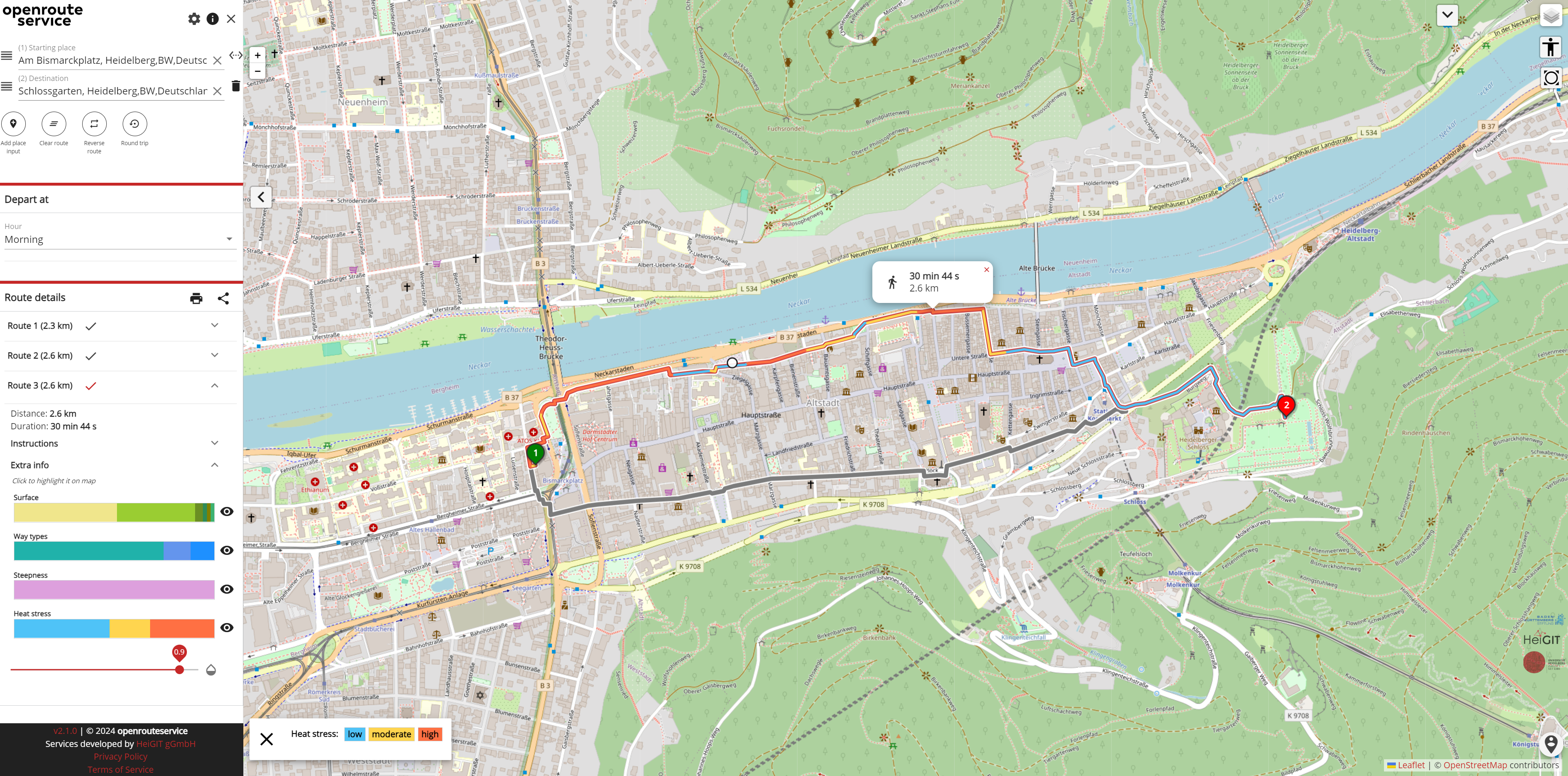
Staying Safe in the Heat: Routing App for Heidelberg
As summer temperatures soar, the health risks associated with heat stress become increasingly significant. This issue is particularly pronounced in urban areas such as Heidelberg and other cities, where dense building structures and limited green spaces exacerbate the problem. Vulnerable population groups such as the elderly, children and people with pre-existing conditions are especially susceptible…
-
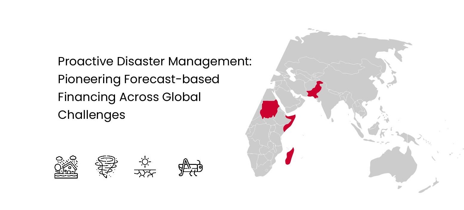
Proactive Disaster Management: Pioneering Forecast-based Financing Across Global Challenges
Forecast-based Financing (FbF) is an innovative approach to disaster management that focuses on taking early action based on meteorological forecasts and risk assessments to mitigate the impacts of potential disasters. Instead of waiting for a disaster to strike and then responding, FbF enables preemptive measures that can significantly reduce the negative consequences on affected populations.…