

Author: David Orth
-
GeoAI4Water III Thailand
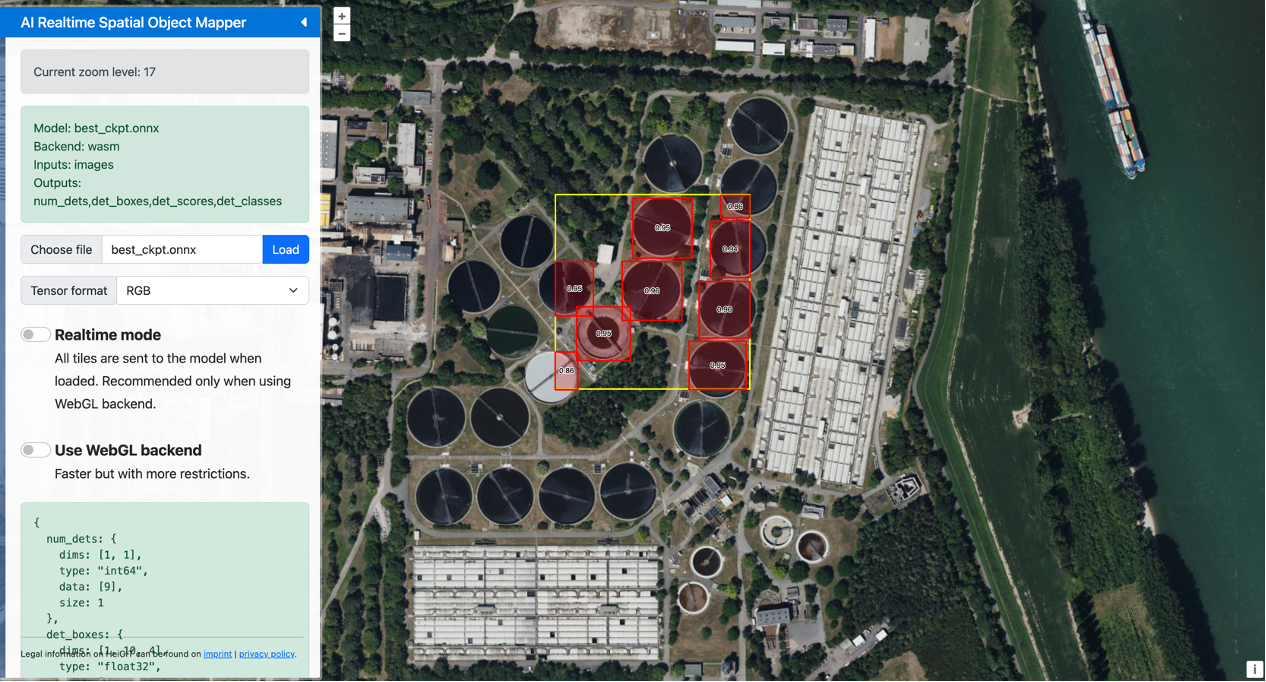
In times of natural disasters and other emergencies, access to reliable data on critical infrastructure can mean the difference between a swift recovery and prolonged crisis. Building on the success of previous initiatives, the GeoAI4Water III project is taking a step forward by developing a comprehensive dataset of Wastewater Treatment Plants (WTPs) across Thailand. This…
-
Job Opening: Postdoctoral Position in GIScience Research Group at Heidelberg University
Heidelberg University is a comprehensive university with a strong focus on research and an international outlook. With around 30,000 students and 8,400 employees, including numerous top researchers, it is a globally respected institution that also has outstanding economic significance for the Rhine-Neckar metropolitan region. At the Institute of Geography, GIScience Research Group the following position…
-
Job Opening: PhD Position in GIScience Research Group at Heidelberg University
Heidelberg University is a comprehensive university with a strong focus on research and an international outlook. With around 30,000 students and 8,400 employees, including numerous top researchers, it is a globally respected institution that also has outstanding economic significance for the Rhine-Neckar metropolitan region. At the Institute of Geography, GIScience Research Group the following position…
-
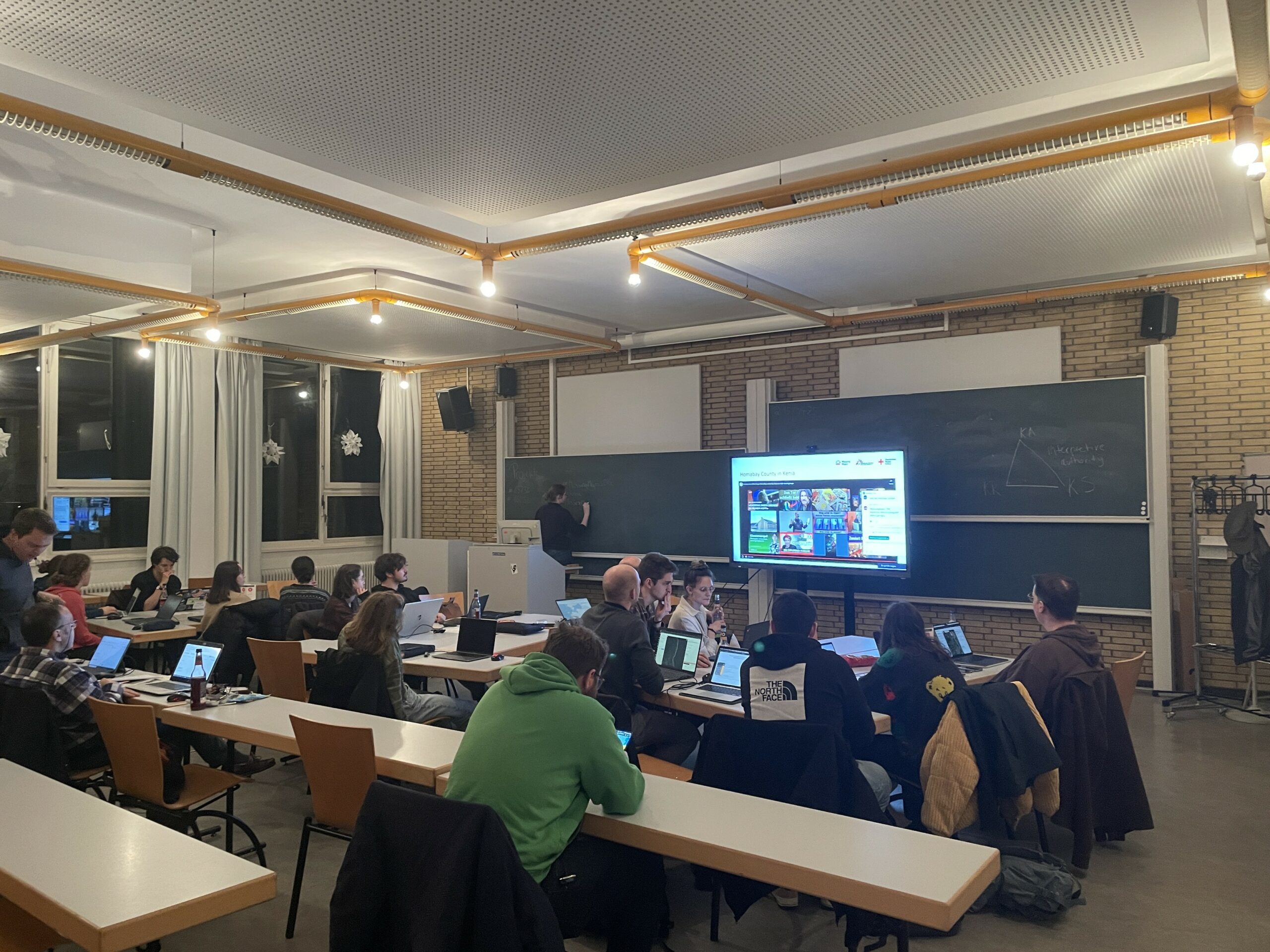
Mapathon on November 18
As part of the annual “Geography Awareness Week”, we are organizing a mapathon together with Doctors Without Borders, the German Red Cross and the University of Würzburg. When: Monday, November 18th, 7p.m. Where: Heidelberg, Berliner Straße 48 in the “Hörsaal” lecture hall What is a Mapathon?In order to be able to help people in crisis…
-
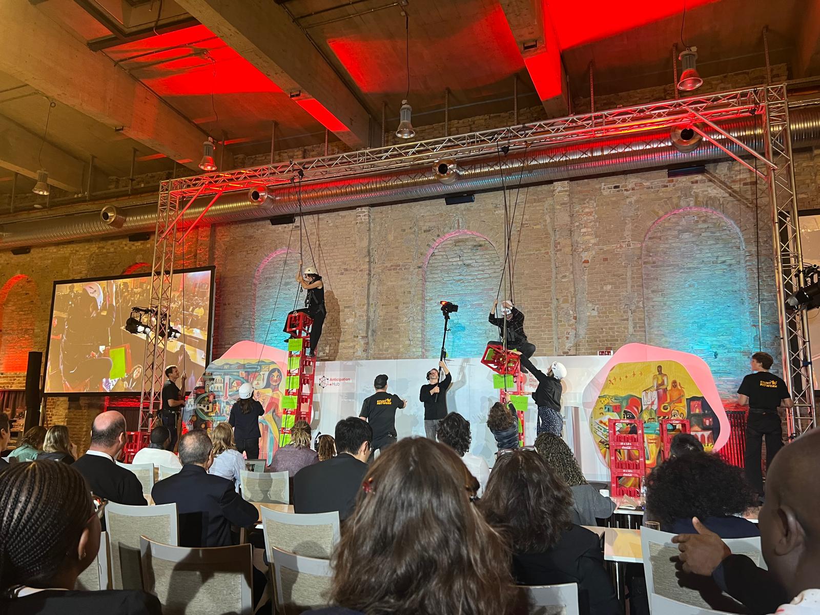
HeiGIT at the Global Dialogue Platform Berlin
Stuntmen, jugglers, humanitarians stacking and climbing boxes, wildcard sessions – not the usual things you would expect at a conference. But all of these shaped this year’s Global Dialogue Platform and helped participants to leave their usual comfort zones. In dynamic discussions, interactive workshops, plenaries and side sessions, humanitarian practitioners, policymakers, tech experts and many…
-
Openrouteservice Feature Updates: Export and Snap Endpoints
The openrouteservice (ORS) continuously evolves, bringing a suite of new features: the export and snap endpoints. These new features will change the way users interact with and process routing data, making it easier to handle complex use cases or pre-process points for routing queries. Export Feature While openrouteservice does not directly provide tools for network…
-

Balancing Walkability and Climate Mitigation in Urban Design
Recently, our colleague Kirsten von Elverfeldt attended the Walk21 Conference in Lisbon, an inspiring event dedicated to reimagining cities by transforming car-centered spaces into active, livable, and vibrant environments for people. The conference was filled with innovative ideas and strategies from around the world, showcasing how urban mobility can improve quality of life. One standout…
-
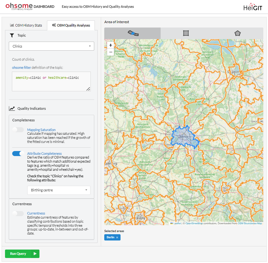
New Features for the ohsome Quality API and Dashboard
*Title image: Fig. 1: New UI of the ohsome dashboard In the last few weeks, a lot of work has been put into expanding the functionalities of the ohsome Quality API. Most notably, the ohsome dashboard now has a new Quality indicator ready for use: the Attribute Completeness indicator. The ohsome quality API and the…
-
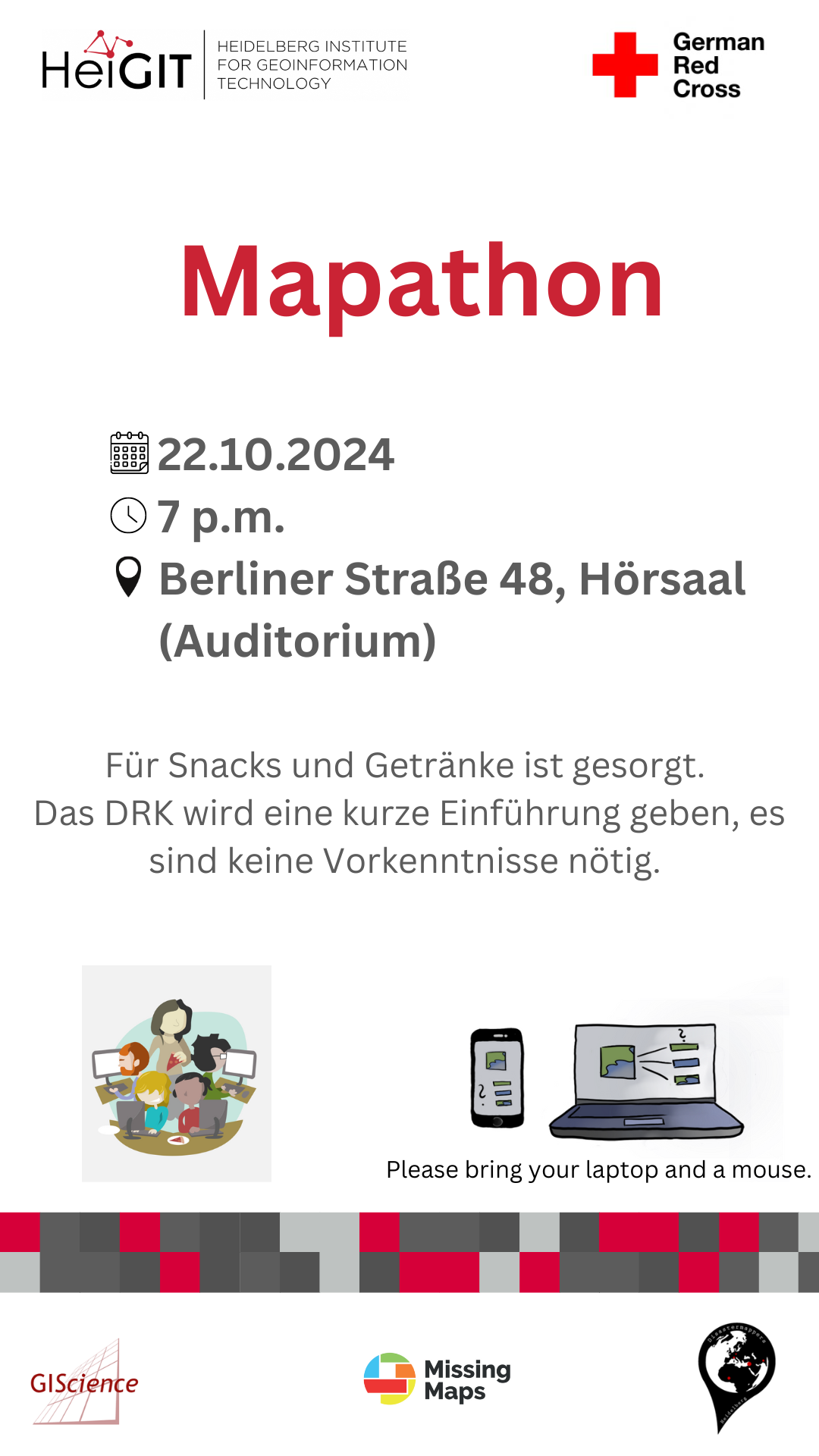
Mapathon on October 22
When: Tuesday, 22.10.2024, at 7 p.m. Where: Berliner Straße 48, Hörsaal After a short introduction into the region and subject of this mapping task, you will also get instructions how to map. The Mapathon will be a collaboration with the Missing Maps project. Everyone is welcome and no previous knowledge is needed!Do bring your laptop…
-
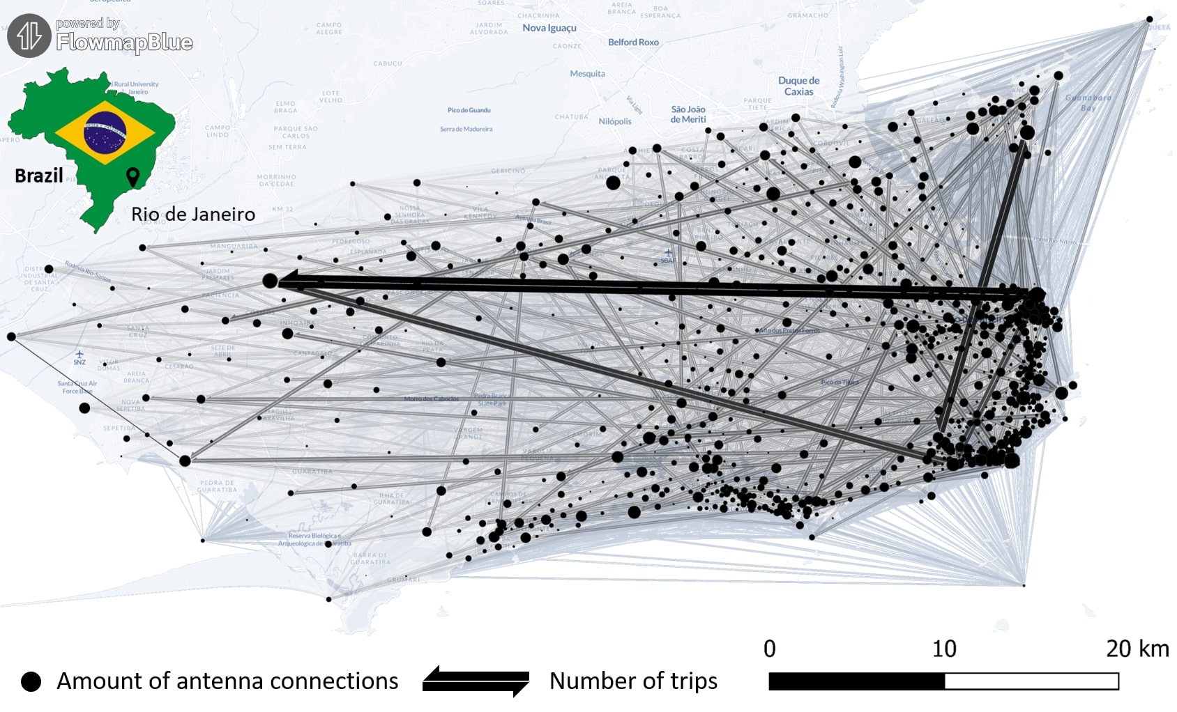
New Paper “Long-term validation of inner-urban mobility metrics derived from Twitter/X”
Data on mobility behavior can yield valuable insights that are beneficial for various applications such as public policy, emergency response, and urban planning. As the availability of freely-accessible mobility data is limited, the attention to X (formerly known as Twitter) as a data source has increased. Users of the platform can tag their online posts…
-
The Heads behind the Climate Action Team
At HeiGIT, the recently established Climate Action team is a group of dedicated professionals of diverse backgrounds and areas of expertise working together to drive impactful environmental solutions. The climate crisis is one of the most urgent challenges for society, and its impacts are becoming increasingly severe. However, there is a large gap between awareness…
-
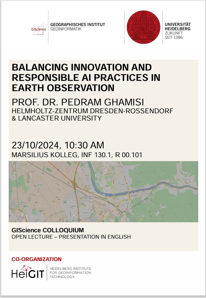
GIScience Colloquium by Pedram Ghamisi on responsible AI on 23 October 2024
We are very pleased to soon host guest speaker Prof. Dr. Pedram Ghamisi, head of the machine learning group (FWGE-L) at Helmholtz-Zentrum Dresden-Rossendorf, Germany (HZDR) & visiting full professor at Lancaster University, UK. Prof. Dr. Pedram Ghamisi will give a lecture on ´Balancing Innovation and Responsible AI Practices in Earth Observation: A Few Examples´. The…