

Search results for: “deep learning”
-
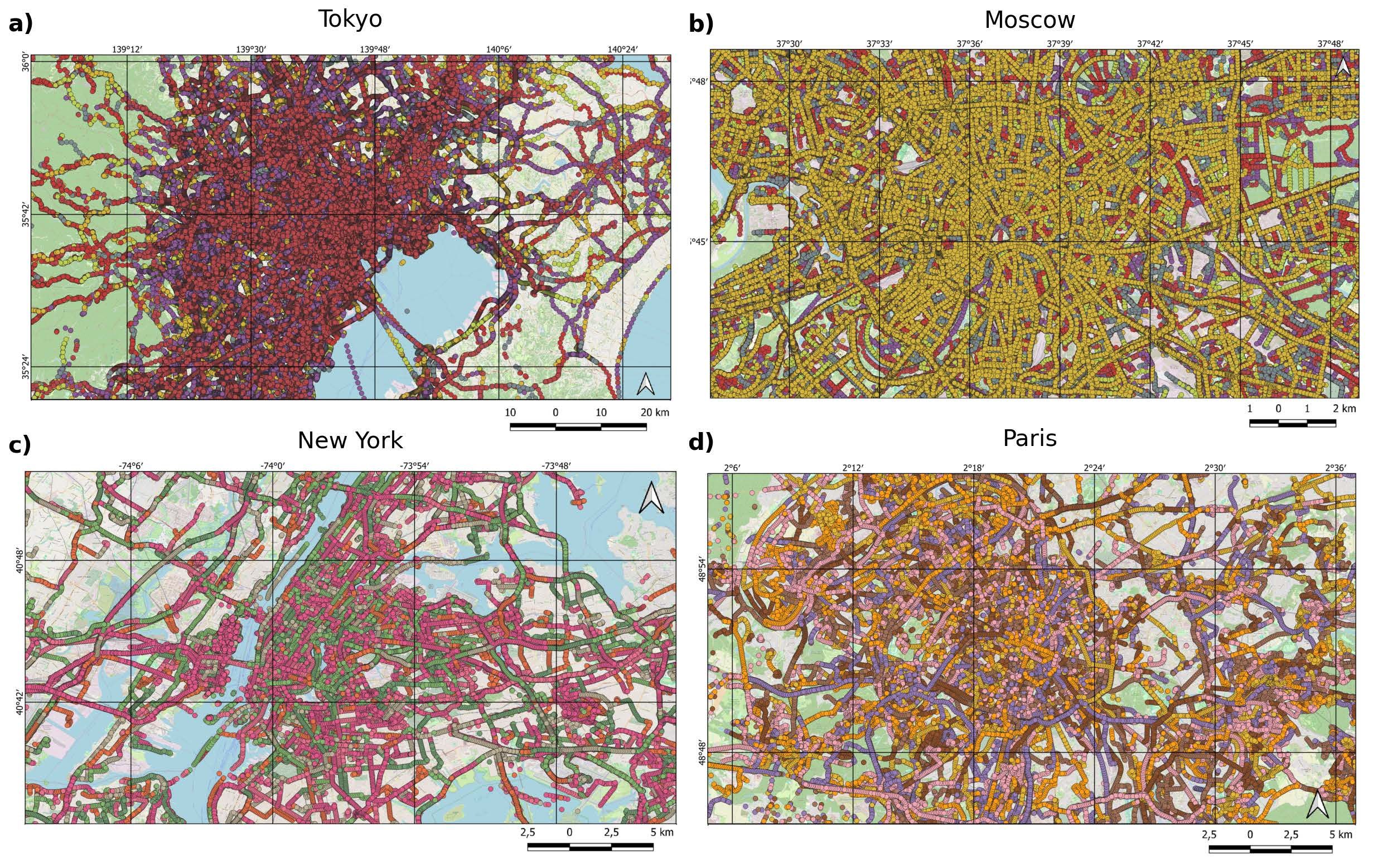
New Paper: “Paved or unpaved? A Deep Learning derived Road Surface Global Dataset from Mapillary Street-View Imagery”
The paper addresses the global shortage of detailed road surface data by leveraging street-view imagery from Mapillary and advanced deep learning techniques. Traditional datasets like OpenStreetMap (OSM) often lack comprehensive road surface attributes—with only about 30–40% coverage—hindering applications such as travel time estimation, disaster response routing, urban planning, and environmental assessments. To fill this gap,…
-
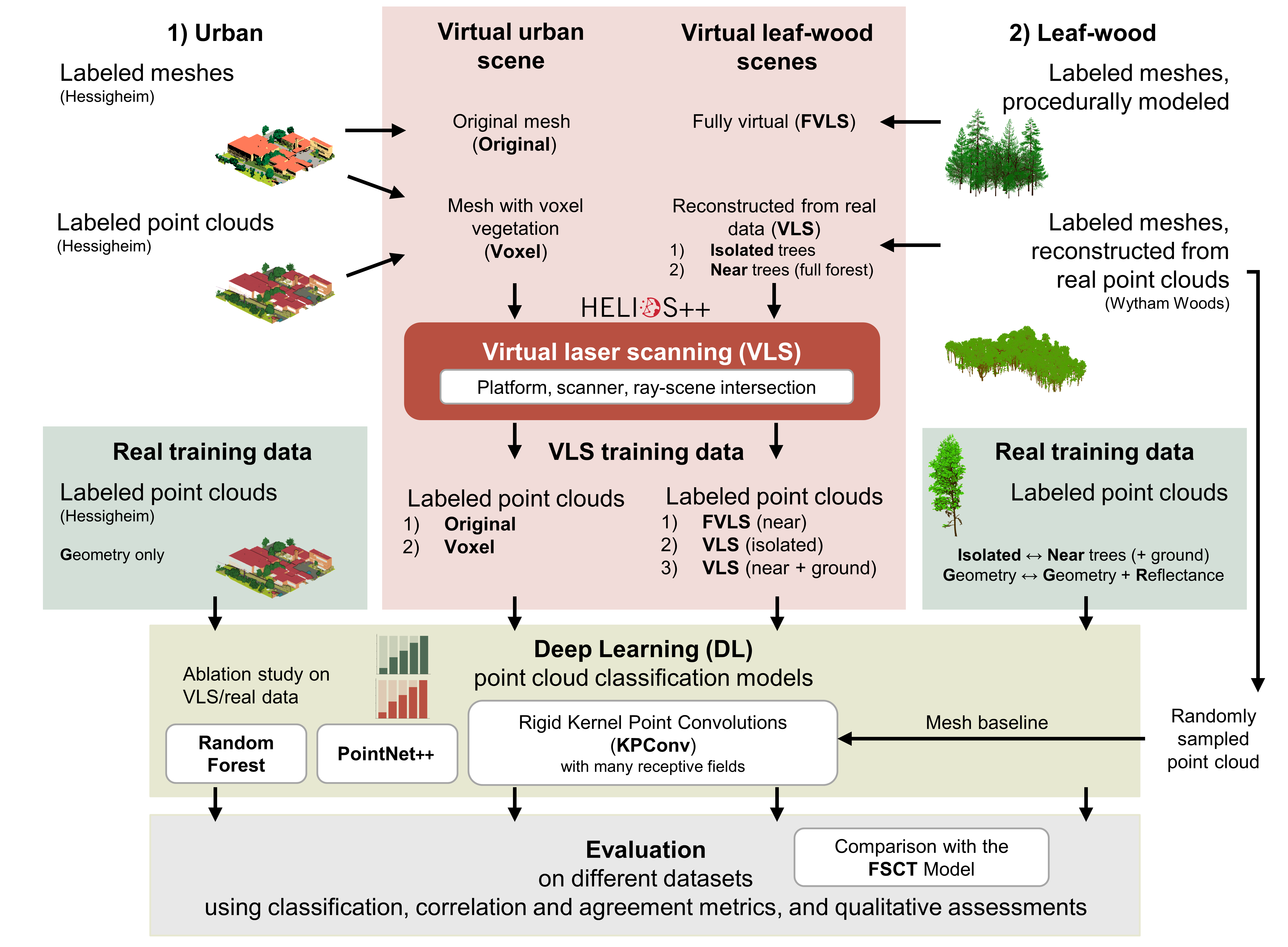
Deep learning with simulated laser scanning data for 3D point cloud classification
Esmorís, A.M., Weiser, H., Winiwarter, L., Cabaleiro, J.C. & Höfle, B. (2024): Deep learning with simulated laser scanning data for 3D point cloud classification. ISPRS Journal of Photogrammetry and Remote Sensing. Vol. 215, pp. 192-213. DOI: 10.1016/j.isprsjprs.2024.06.018 3D point clouds acquired by laser scanning are invaluable for the analysis of geographic phenomena. To extract information…
-
GeoAI4Water 2 Applies Deep Learning to Detect Critical Infrastructure for Disaster Planning
Context During natural disasters and other catastrophic events, quickly identifying and distributing resources is essential. Even a brief delay in evacuating residents or sourcing water can significantly hamper relief efforts and prevent effective disaster management. The HeiGIT and GIScience teams have been actively designing tools to assist in disaster preparation and response, from working with partners to build community resilience to activating our disaster…
-
Job Offer: Deep Learning Engineer (m/f/d, up to 100%)
Are you a highly motivated individual who loves designing and developing machine learning and deep learning systems? Do you want to use your machine learning expertise for the benefit of society and the environment? Do you want to improve the availability and quality of geospatial data and further develop geoinformatics methods used for open, non-profit…
-
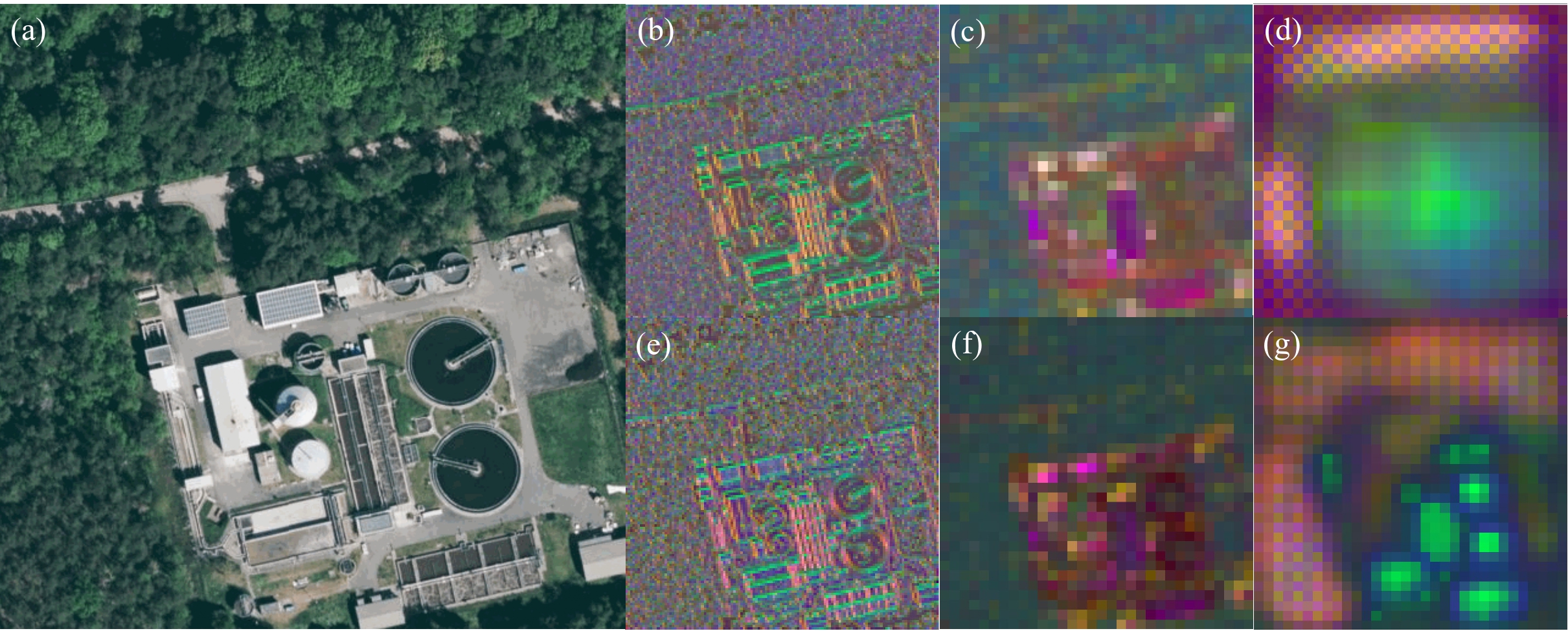
Leveraging OpenStreetMap and Multimodal Remote Sensing Data with Joint Deep Learning for Wastewater Treatment Plants Detection
Humans rely on clean water for their health, well-being, and various socio-economic activities. During the past few years, the COVID-19 pandemic has been a constant reminder of about the importance of hygiene and sanitation for public health. The most common approach to securing clean water supplies for this purpose is via wastewater treatment. To date,…
-
Online seminar ‘Deep learning from Volunteered Geographical Information: a case study of humanitarian mapping with OpenStreetMap’
We invite to the upcoming online seminar at the Urban Analytics Lab seminar series at the National University of Singapore (NUS): ‘Deep learning from Volunteered Geographical Information: a case study of humanitarian mapping with OpenStreetMap’ on 29 April (9am German time, 3pm Singapore time) By Hao Li, GIScience Research Group, Heidelberg University @GIScienceHD As an emerging topic,…
-
Automatic mapping of national surface water with OpenStreetMap and Sentinel-2 MSI data using deep learning
Large-scale mapping activities can benefit from the vastly increasing availability of earth observation (EO) data, especially when combined with volunteered geographical information (VGI) using machine learning (ML). High-resolution maps of inland surface water bodies are important for water supply and natural disaster mitigation as well as for monitoring, managing, and preserving landscapes and ecosystems. In…
-
Talk: Deep Learning for Point Cloud Processing
Lukas Winiwarter of the 3DGeo group was invited by the Austrian Society of Surveying and Geoinformation (OVG) to give a talk on the application of deep learning on point clouds, which took place on March 24. In his talk, Lukas presented four different state-of-the-art approaches to consider the irregular, unordered structure of point clouds, which…
-
Inferencing indoor room semantics using random forest and relational graph convolutional networks (deep learning)
Semantically rich maps are the foundation of indoor location‐based services. Many map providers such as OpenStreetMap and automatic mapping solutions focus on the representation and detection of geometric information (e.g., shape of room) and a few semantics (e.g., stairs and furniture) but often still neglect room usage. To mitigate the issue, a new published paper…
-
Introducing ohsome2label tool to generate training samples from OpenStreetMap for geospatial deep learning
After more than a decade of rapid development of volunteered geographic information (VGI), VGI has already become one of the most important research topics in the GIScience community. Almost in the meantime, we have witnessed the ever-fast growth of geospatial deep learning technologies to develop smart GIServices and to address remote sensing tasks, for instance,…
-
ISPRS IJGI highlights our work on deep learning of Street Art from VGI and Street View Images
We are pleased to share that because of the response to our work, ISPRS IJGI selected our paper on Detecting Graffiti with Street View Images and Deep Learning to be highlighted as a title story through some graphics on the journals main page. Novack T, Vorbeck L, Lorei H, Zipf A. (2020): Towards Detecting Building Facades…