

The OpenStreetMap (OSM) and openrouteservice (ORS) provide free geospatial data that serve a multitude of research and practical applications. OSM thrives on its community-driven approach, ensuring its data is always up-to-date and versatile. ORS takes this a step further by providing sophisticated routing services for various modes of transport, including walking, cycling, driving, and wheelchair users. This makes ORS indispensable for projects needing precise and current routing information.
One such application is the digital school route planner, developed by the Initiative for Safer Roads. The primary goal of the digital school route planner is to improve road safety on school routes. Road safety is one of the greatest concerns parents have in regards to their children’s school commute, considering the existing road infrastructure not suitable to send their children to school independently. Consequently, a large number of children are driven to school by car, which contributes to traffic congestion and increases the risk of accidents.
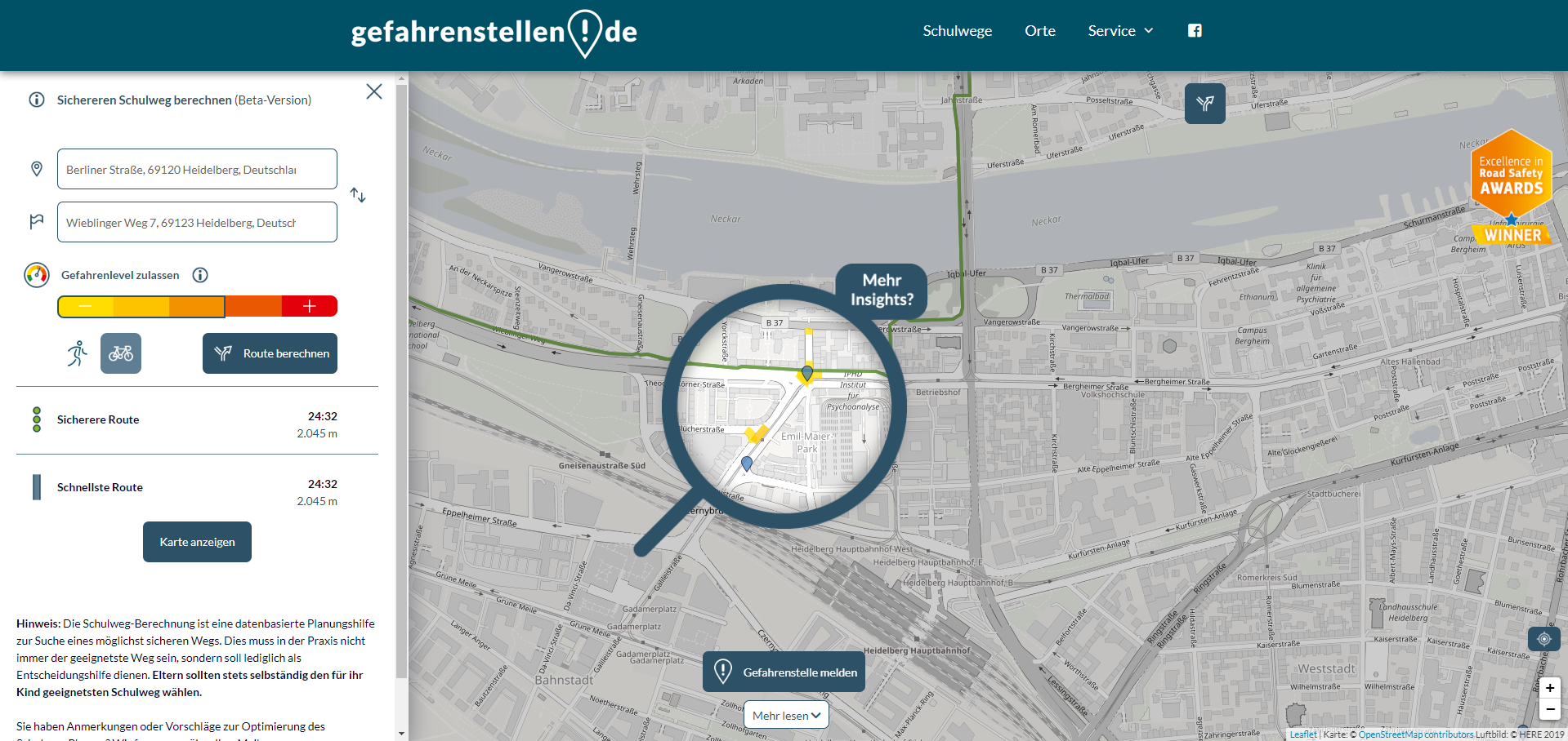
The digital school route planner assists parents and children in finding the safest routes to school by foot or bike. It uses a Germany-wide map of danger spots, which incorporates accident data from the police, reports from road users, and other factors such as weather conditions and braking data. Using the openrouteservice API, this data is used to generate safe route suggestions to avoid dangerous areas. Thanks to the constantly updated OSM data, the app remains reliable and relevant under changing conditions. Additionally, users can mark hazardous spots directly in the app, contributing to the continuous improvement of the data.
The Initiative for Road Safety cites several benefits of digital school route planning for students. Children can benefit from the additional physical activity and can build orientation skills, independence and self confidence. In the long run, digital school route planning and similar measures might also lead to decreasing traffic congestion in school areas, as less parents require to drive their children to school, which would further reduce danger in school traffic.
It is our main objective is the continuous support of research, either by providing free access to our hosted services or with guidance on how to use your infrastructure. Stay connected with us through our social media channels and blog to be abreast of future developments and releases related to ORS and advancements in geospatial technology. If you are interested in finding out what we can provide for your use-case, please feel free to check out openrouteservice.org or reach out to us.