

While the international community has made progress in adopting goals and agreements in the field of climate change mitigation, efforts to reduce greenhouse gas (GHG) emissions are significantly lacking behind global ambitions for acceptable climate change. In a recently published perspective in the journal Climate Action, we discuss whether a window of opportunity for more effective climate action is emerging due to the convergence of new scientific and technological opportunities to provide high-resolution information on GHG emissions and emerging polycentric governance forms. We hypothesize that scientific and technological developments in the geophysical sciences and geoinformatics could provide the information policy makers need to put in place effective policies on climate change mitigation and to have measures to verify the effectiveness of their mitigation policies. To contribute to a better understanding of these developments and the requirements for effective climate action, new forms of inter- and transdisciplinary research become urgently necessary.
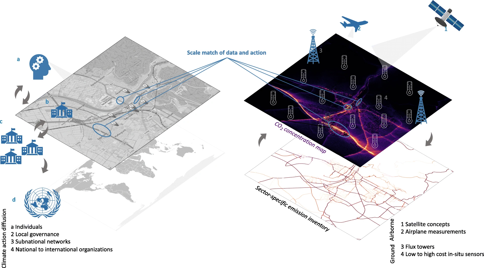 Fig: The rise of a suite of observations such as satellite concepts (1), airplane measurements (2), flux towers (3) and low-cost as well as high-cost sensors (4) enables a scale match of data and action. This can lead to a new awareness of hyperlocal emission mitigation potential as well as emission validation possibilities and thus, can trigger climate action by a citizens and b local governance, which can further diffuse within c sub-national networks and d national to international organizations. Src.: https://link.springer.com/article/10.1007/s44168-022-00007-4/figures/2
Full publication:
M Jungmann, S N Vardag, F Kutzner, F Keppler, M Schmidt, N Aeschbach, U Gerhard, A Zipf, S Lautenbach, A Siegmund, T Goeschl & A Butz: Zooming-in for climate action—hyperlocal greenhouse gas data for mitigation action?. Climate Action 1, 8 (2022). https://doi.org/10.1007/s44168-022-00007-4
Related HCE project: GeCO: Generating high-resolution CO2 maps by Machine Learning-based geodata fusion and atmospheric transport modelling”