

On 1st March 2021, the Swiss Federal Office of Topography (SwissTopo) released all official geodata according to the principles of “Open Government Data (OGD)”. With this step, Swisstopo is making large volumes of high quality geodata freely accessible. We are most excited about the 3D data, which includes digital surface models, digital terrain models and classified point clouds!
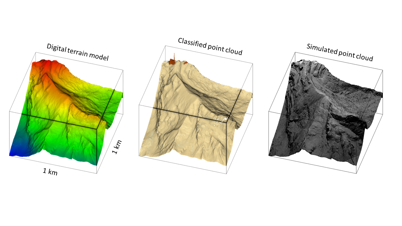
As we believe that open data is a key element to promote more transparent, inclusive and effective research, we thought to ourselves: Let’s combine SwissTopo open data and our own open software HELIOS++. HELIOS++ is a general-purpose software package for simulation of laser scanning campaigns, developed and maintained by the 3DGeo Research Group.
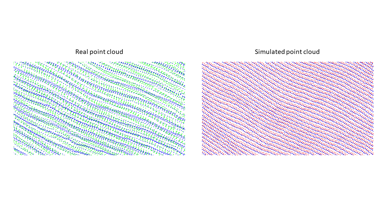
We loaded a DTM-tile of Säntis (2,502 m a.s.l.) to HELIOS++ and conducted a virtual airborne laser scanning campaign.
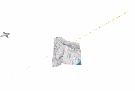
Although the exact acquisition settings of the Swisstopo airborne laser scanning campaign are not known, we can configure a simulation that comes reasonably close to the real acquisition:
Such data can be used to complement real data in many use cases. Some examples include the generation of training data for machine learning, especially deep learning, for the validation of algorithms working on point clouds, for acquisition parameter surveys, or for experimentation with novel sensors (see our previous blog post).
Download the Säntis survey here (until 1st April 2021) and reproduce it with the command:
run\helios data\surveys\demo\swisstopo_demo.xml –lasOutput
Documentation of HELIOS++ can be found in the GitHub wiki. Our paper on HELIOS++ is available as a preprint on arXiv:
Winiwarter, L., Esmorís Pena, A., Weiser, H., Anders, K., Martínez Sanchez, J., Searle, M., Höfle, B. (2021): Virtual laser scanning with HELIOS++: A novel take on ray tracing-based simulation of topographic 3D laser scanning. arXiv:2101.09154. [cs.CV]
For more information, visit the HELIOS++ project website: https://uni-heidelberg.de/helios
HELIOS++ is funded in part by the BMBF in the frame of the LOKI project (funding code: 03G0890) and by the DFG in the frame of the SYSSIFOSS project (project number: 411263134).
![]()