
Airborne laser scanning (ALS) data of the Arctic permafrost research region Trail Valley Creek (TVC) has just been published for open access on the data library PANGAEA:
Anders, Katharina; Antonova, Sofia; Boike, Julia; Gehrmann, Martin; Hartmann, Jörg; Helm, Veit; Höfle, Bernhard; Marsh, Philip; Marx, Sabrina; Sachs, Torsten (2018): Airborne Laser Scanning (ALS) Point Clouds of Trail Valley Creek, NWT, Canada (2016). PANGAEA, DOI: 10.1594/PANGAEA.894884
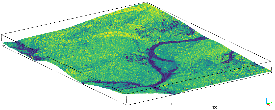
The data was acquired in 2016 using the AWI Polar5 science plane and subsequently processed in the frame of the PermaSAR project in a joint effort of the 3DGeo research group and the Permafrost Research Unit at AWI. The classified point cloud is published together with the derived Digital Terrain Model (DTM) and vegetation height rasters. The terrain probability method used to classify ground points in the ALS data in the frame of the PermaSAR project is available on the GIScience gitlab as Python script.
By the way, the acquisition was repeated this year, so that multitemporal analyses will be possible as soon as the 3D point cloud data of 2018 is processed.
The PermaSAR project is funded by the BMWi/DLR in the framework “Entwicklung von innovativen wissenschaftlichen Methoden und Produkten im Rahmen der TanDEM-X Science Phase”.