

The “Dresdner Flächennutzungssymposium” is an annual event aimed at fostering the discussions about current devolepment regarding land use changes in Germany. During two days experts from government agencies, private companies and research institutions come together and elaborate the latest trends in different session. This years symposium took place from May 3-4. Almost all presentations covered the topics volunteered geographic information and crowdsourced geo data to some extend.
Our group member Benjamin Herfort gave a talk in the session “user generated geo data” on the results of the 3D-MAPP project. Within the 3D-MAPP project we explored the potential and challenges related to the crowdsourcing of geo information from 3D point cloud data. Our results show that even for 3D data sets crowdsourcing can be a promising approach to capture information that is difficult to derive using automated methods alone. The findings may contribute to the development of further crowdsourcing applications to support land use change monitoring. Also the assessment of 3D building geometries and parameters such as building function are possible use cases.
For further information take a look at the project page.
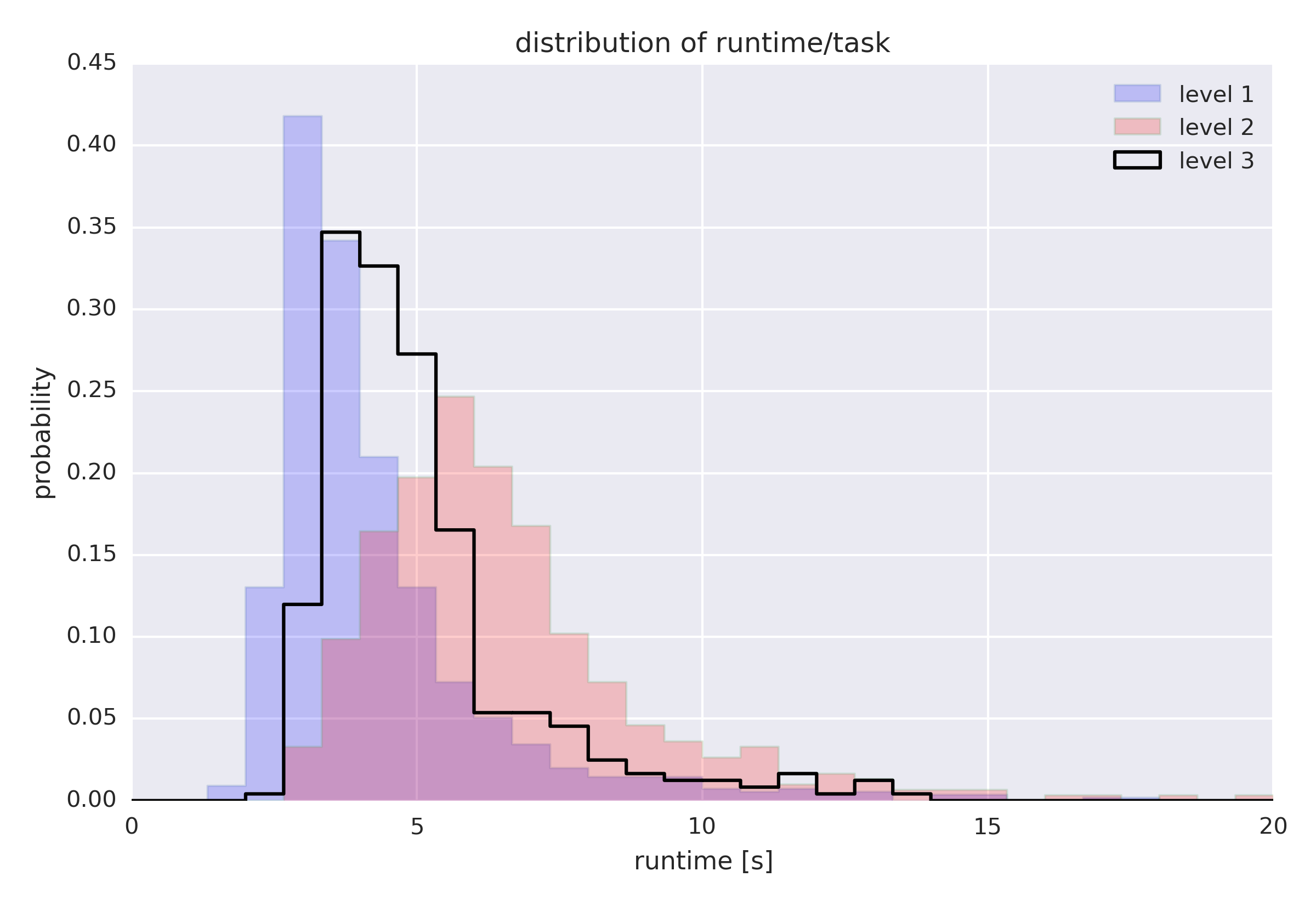
Figure: Volunteers can solve 3D micro mapping tasks in a short time (less than 10 seconds).