

On the GIScience GITHub, two new tools are now available:
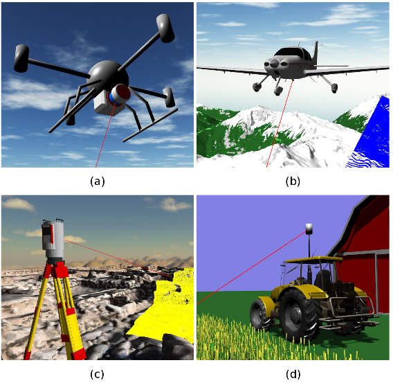
The Heidelberg LiDAR Operations Simulator HELIOS is a software package for interactive real-time simulation and visualization of terrestrial, mobile and airborne laser scanning surveys.
Own virtual scenes can be generated by combining for example terrain models with other objects (buildings, vegetation). Own scan positions as well as scanning devices on static or mobile platforms (incl. airborne) can be defined and used for scanning the scene virtually. The result of a virtual HELIOS scan is a 3D point cloud of the scanned objects.
HELIOS and the data produced with it can be used for verifying point cloud analysis algorithms, for planning scanning campaigns on the basis of coarse existing 3D models, for learning and teaching how laser scanning works, and much more.
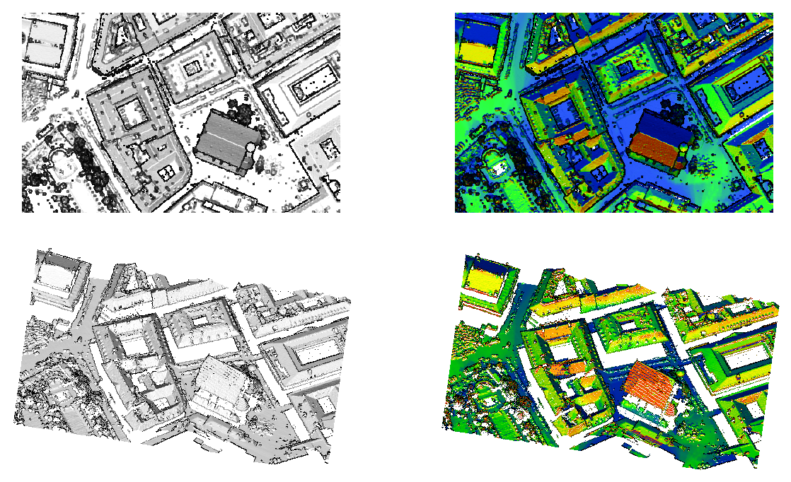
With the command line tool VOSTOK (Voxel Octree Solar Toolkit), a detailed model of incoming solar radiation distribution can be calculated for a 3D point cloud. Shadows cast by occluding structures like buildings and vegetation are taken into account.
VOSTOK works by transforming the input point cloud into a voxel volume with configurable resolution (voxel size). The voxels are represented as a sparse octree, and incoming sunlight and shadowing effects are simulated by raycasting on the voxel octree geometry.
Feel free to use and contribute!
Further reading
Bechtold, S. & Höfle, B. (2016): HELIOS: A Multi-purpose LiDAR Simulation Framework for Research, Planning and Training of Laser Scanning Operations With Airborne, Ground-based Mobile and Stationary Platforms. In: ISPRS Ann. Photogramm. Remote Sens. Spatial Inf. Sci., III-3, pp. 161-168. DOI: 10.5194/isprs-annals-III-3-161-2016
Regvat, R., Hämmerle, M., Marx, S., König, K. & Höfle, B. (2014): 3D-Punktbasierte Solarpotenzialanalyse für Gebäudefassaden mit freien Geodaten. In: Strobl, J., Blaschke, T., Griesebner, G. & Zagel, B.: Angewandte Geoinformatik 2014. Beiträge zum 26. AGIT-Symposium Salzburg, pp. 196-204, ISBN 978-3-87907-543-0.