Participatory Sensing (PS) is a concept which enables laymen to easily gather geodata with standard low-cost mobile devices, offering new and efficient opportunities for agricultural monitoring. The integration of local agricultural knowledge may help to better understand complex phenomena such as the association between climate variability, crop yields and undernutrition.
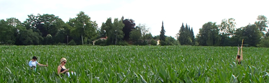
In our new study we present a methodological approach for crop height assessment based on PS. In-field crop height variations of a maize field in Heidelberg, Germany, are gathered with smartphones and handheld GPS devices by 19 participants.
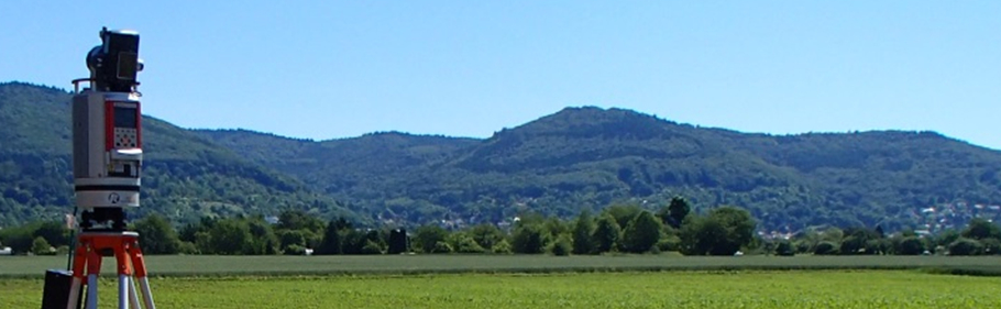
The comparison of crop height values measured by the participants to reference data based on terrestrial laser scanning (TLS) results in R2 = 0.63 for the handheld GPS devices and R2 = 0.24 for the smartphone-based approach. RMSE for the comparison between crop height models derived from PS and TLS data is 10.45 cm (GPS devices) and 14.69 cm (smartphones). Furthermore, the results indicate that incorporating participants’ cognitive abilities in the data collection process potentially improves the quality data captured with the PS approach.
The proposed PS methods serve as a fundament to collect agricultural parameters on field-level by incorporating local people. Combined with other methods such as remote sensing, PS opens new perspectives to support agricultural development.
Further reading of the full text:
Marx, S., Hämmerle, M., Klonner, C. & Höfle, B. (2016): 3D Participatory Sensing with Low-Cost Mobile Devices for Crop Height Assessment – A Comparison with Terrestrial Laser Scanning Data. PLOS ONE. Vol. 11 (4), pp. 1-22.