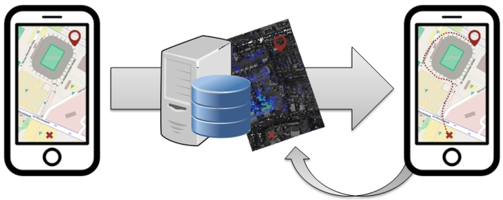
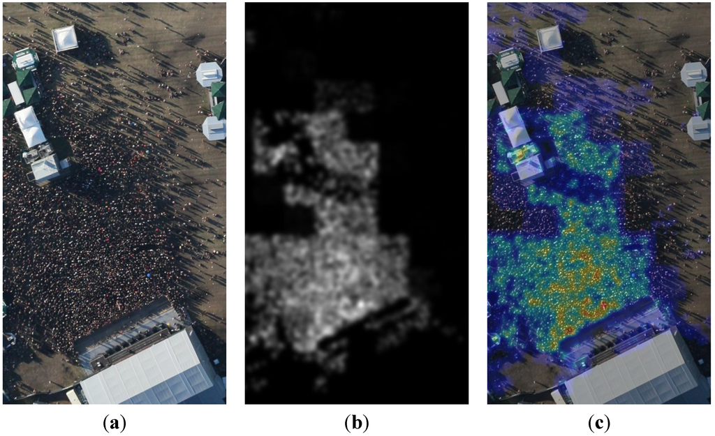
In our research “Routing in Dense Human Crowds Using Smartphone Movement Data and Optical Aerial Imagery“, we propose a navigation approach for smartphones that enables visitors of major events to avoid crowded areas or narrow streets and to navigate out of dense crowds quickly. Two types of sensor data are integrated. Real-time optical images acquired and transmitted by an airborne camera system are used to compute an estimation of a crowd density map. For this purpose, a patch-based approach with a Gabor filter bank for texture classification in combination with an interest point detector and a smoothing function is applied. Furthermore, the crowd density is estimated based on location and movement speed of in situ smartphone measurements. This information allows for the enhancement of the overall crowd density layer. The composed density information is input to a least-cost routing workflow. Two possible use cases are presented, namely (i) an emergency application and (ii) a basic routing application. A prototypical implementation of the system is conducted as proof of concept. Our approach is capable of increasing the security level for major events. Visitors are able to avoid dense crowds by routing around them, while security and rescue forces are able to find the fastest way into the crowd.
Reference:
Hillen, F., Meynberg, O. & Höfle, B. (2015): Routing in Dense Human Crowds Using Smartphone Movement Data and Optical Aerial Imagery. ISPRS International Journal of Geo-Information. Vol. 4 (2), pp. 974-988.