

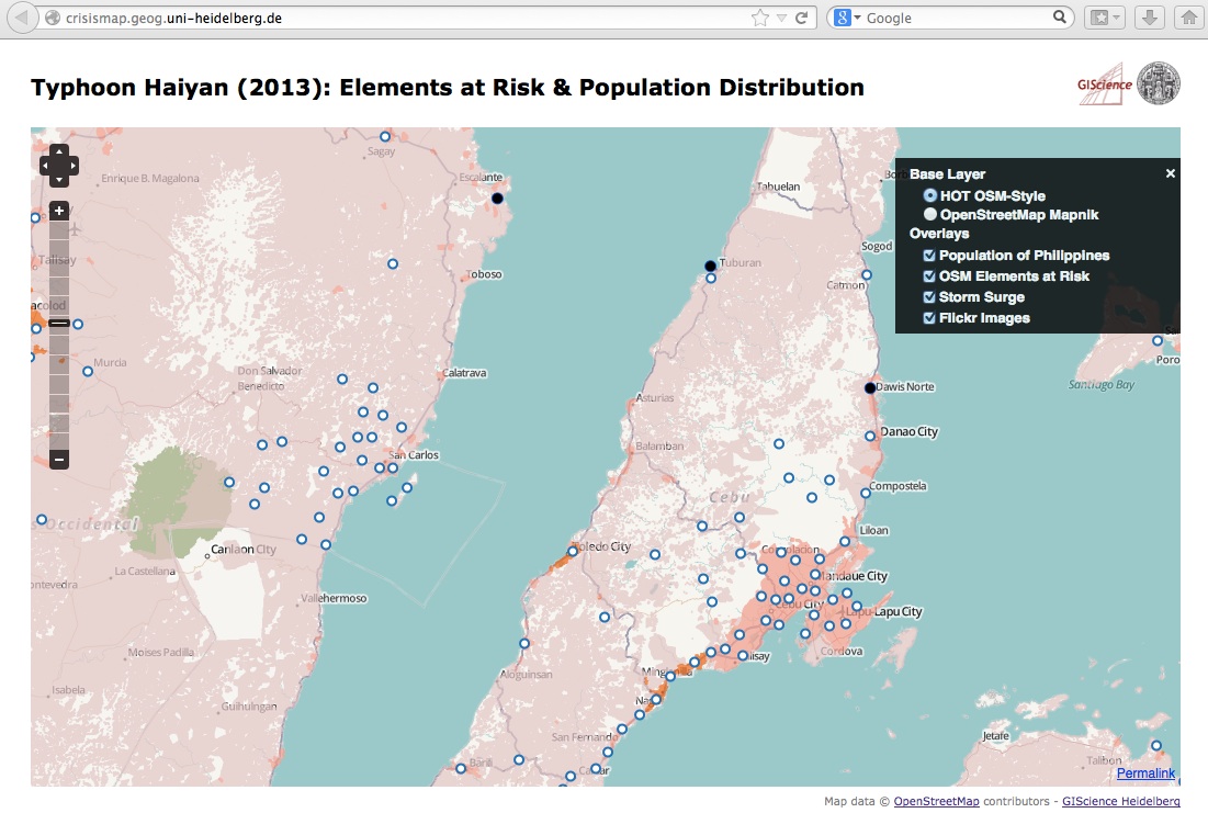
In order to support the disaster management activities after the typhoon Yolanda/Haiyan a new WebSite http://crisismap.geog.uni-heidelberg.de/ has been set up by GIScience Heidelberg that visualizes the new map layers described earlier:
the “Elements at Risk” and “Population Distribution” for the Philipines.
Further it adds a currently less populated Flickr layer and a storm surge layer on top of the H.O.T. base map. Thanks to Pascal, Joao, Bernd, Günther, Andreas & Maxim!
http://crisismap.geog.uni-heidelberg.de
UPDATE: Due to a request by the crisis mappers also a simple table with the “Elements at Risk“ has been made available as csv-file:
http://openmapsurfer.uni-hd.de/downloads/phl_osm_gadm_elr.csv
It is being updated every hour.