

On Saturday, 9th of November, a hands-on laser scanning workshop took place within the framework of the Conference ‘Digital Geoarchaeology – New Technologies for Interdisciplinary Human-Environmental Research‘ (held at the Heidelberg Academy of Sciences and Humanities). The conference organizers Dr. Christoph Siart1) and Dipl.-Geogr. Markus Forbriger2) introduced a group of interested conference participants to terrestrial laser scanning (TLS). Equipment was provided by the chair of GIScience, University of Heidelberg, and Martin Hämmerle3) of the LiDAR Research Group supported the workshop participants.
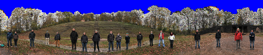
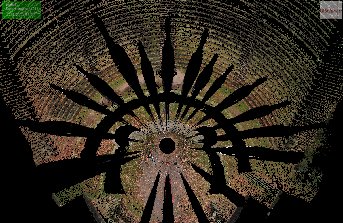
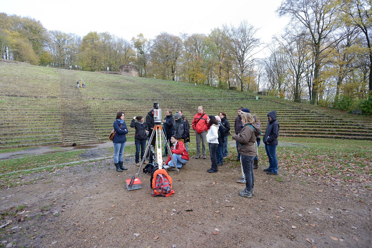
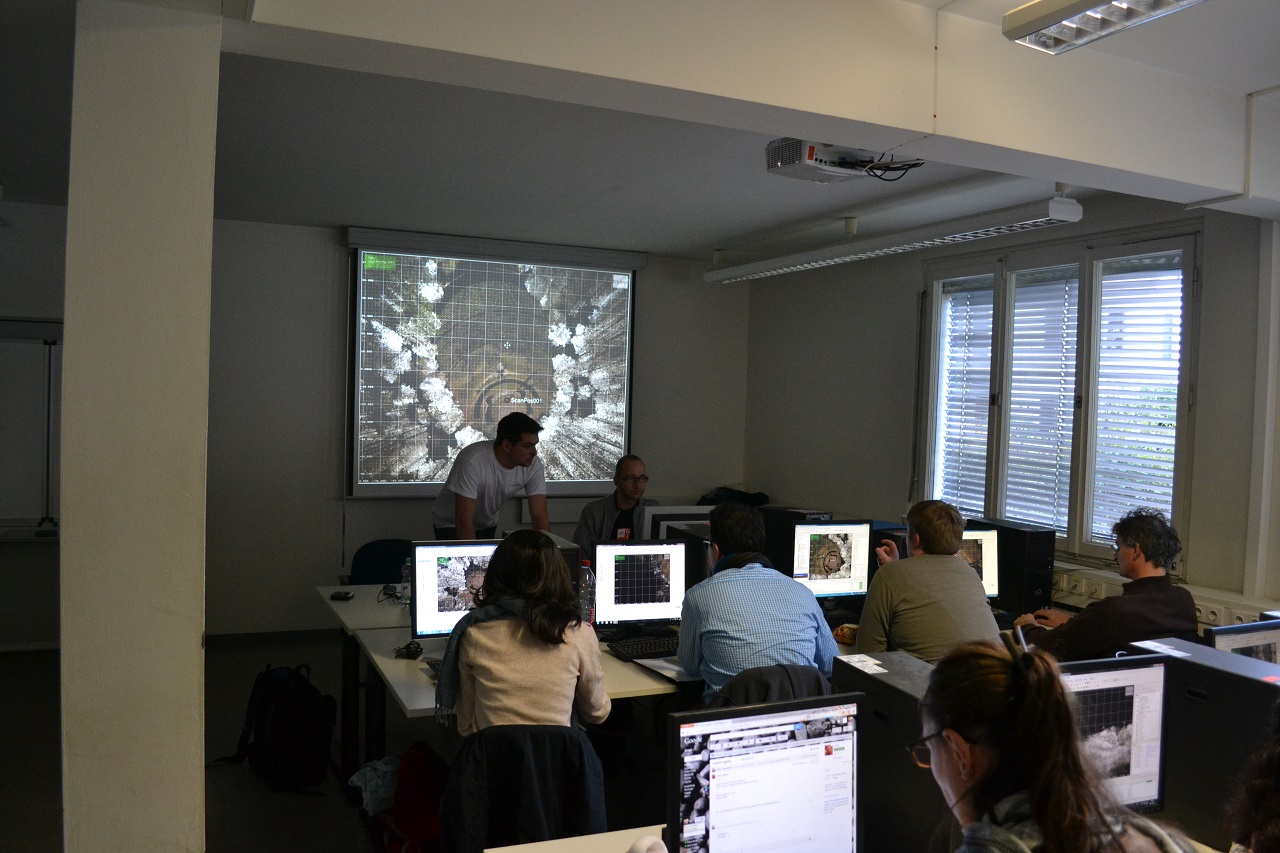
The 16 participants’ professional background reflected the interdisciplinary approach of the conference, and the workshop was a come-together of researchers in archaeology, remote sensing, robotics, photogrammetry, geography, GIScience, and representatives of governmental heritage management institutions. The group first was introduced to practical issues of TLS in the field at the Thingstätte Heidelberg, where TLS point clouds of the amphitheatre and its surroundings were produced. The second part of the workshop, which took place in facilities of the Institute of Geography, focussed on processing the captured data with different software packages and included visualisation of captured data, co-registration of multiple scan positions, selecting and filtering point clouds, generating digital terrain models (DTMs) and object profiles, etc.
The workshop aimed at presenting the huge potential of 3D geodata for archaeological research, and this aim was successfully reached not least by the intense discussion and the lively interaction of all workshop participants.
1) formerly Institute of Geography, University of Heidelberg; now GeoNet.MRN (metropolitan region Rhine-Neckar)
2) formerly Institute of Geography, University of Heidelberg; now Institute of Geography, University of Cologne
3) University of Heidelberg, Institute of Geography, Chair of GIScience, LiDAR Research Group