Tag: publication
-

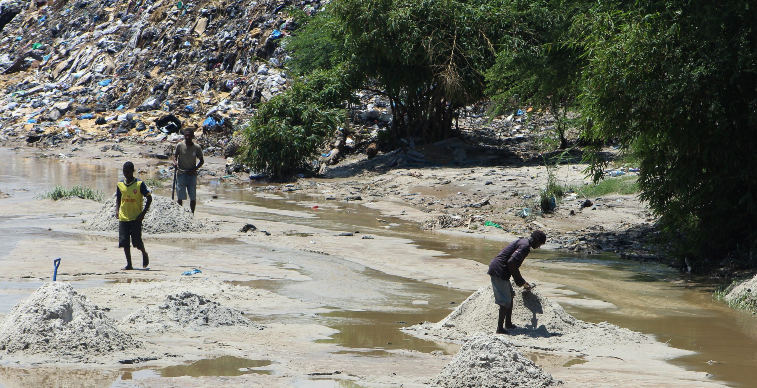
New Paper: “UAV-Assisted Municipal Solid Waste Monitoring for Informed Disposal Decisions”
Solid waste pollution is the cause of many environmental and health risks, especially in areas where waste is generated in large quantities but cannot be properly disposed of. Knowledge of the size and location of dump sites is required to keep waste management efficient and low-cost. When the extent of these dump sites needs to…
-

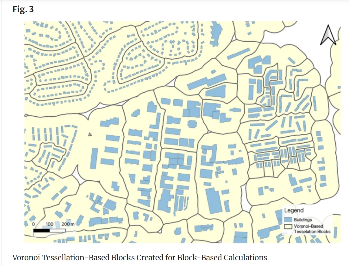
New Paper: “Enriching building function classification using Large Language Model embeddings of OpenStreetMap Tags”
Rapid global urbanization is placing immense pressure on planners to make informed decisions that promote sustainable growth. A crucial aspect of this challenge is understanding how urban buildings are used. Traditionally, classifying the function of buildings—such as residential or commercial—relies on costly and subjective on-site surveys. However, advances in AI are poised to transform this…
-

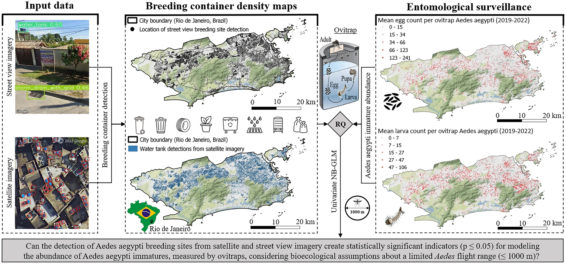
New Paper in Nature ‘Scientific Reports’: „High-resolution Mapping of Urban Aedes Aegypti Immature Abundance Through Breeding Site Detection Based on Satellite and Street View Imagery“
Knoblauch, S; Su Yin, M.; Chatrinan, Krittin; Rocha, Antonio A. de A.; Haddawy, P.; Biljecki, F.; Lautenbach, S.; Resch, B.; Arifi, D.; Jänisch, T.; Morales, I.; and Zipf, A published the paper ‘High-resolution mapping of urban Aedes aegypti immature abundance through breeding site detection based on satellite and street view imagery’ in Nature Scientific Reports.…
-
New Publication in “Nature Communication” on the unequal distribution of building data in OSM
Benjamin Herfort and his colleagues Sven Lautenbach, João Porto de Albuquerque, Jennings Anderson and Alexander Zipf published an article in the renowned journal Nature Communications (Impact Factor 2023: 17.7). In their article, they address the uneven distribution of OpenStreetMap data worldwide, which can have an impact on research results and humanitarian operations. They provide solutions…
-
Improving OpenStreetMap missing building detection using few-shot transfer learning in sub- Saharan Africa
OpenStreetMap (OSM) has been intensively used to support humanitarian aid activities, especially in the Global South. Its data availability in the Global South has been greatly improved via recent humanitarian mapping campaigns. However, large rural areas are still incompletely mapped. The timely provision of map data is often essential for the work of humanitarian actors…
-
New Paper: Correspondence-driven plane-based M3C2 for lower uncertainty in 3D topographic change quantification
Check out our new paper presenting a novel approach (correspondence-driven plane-based M3C2) to lower the uncertainty in 3D topographic change quantification (get free access here until 2 February 2022) Zahs, V., Winiwarter, L., Anders, K., Williams, J.G., Rutzinger, M. & Höfle, B. (2022): Correspondence-driven plane-based M3C2 for lower uncertainty in 3D topographic change quantification. ISPRS…
-
Mapping physical access to health care for older adults in sub-Saharan Africa and implications for the COVID-19 response: a cross-sectional analysis
New paper published on healthcare access in Sub-Saharan Africa It is almost a year since SARS-CoV-2 first emerged in China. The virus spread all over the world. Countries south of the Sahara did not receive much attention. Although outbreaks here have a strong risk potential due to existing crises. In our new published paper we…
-
Classification of 3D ALS Point Clouds using End-To-End Deep Learning
In a new publication, we show how deep neural networks can be used in an end-to-end manner for the classification of 3D point clouds from airborne laser scan data. The research, based on the award-winning diploma thesis of Lukas Winiwarter at TU Wien, has now been published in “PFG – Photogrammetrie, Fernerkundung, Geoinformation“, the Journal…
-
Green spaces in cities promote well-being and mental health — ‘Nature’ Neuroscience study published with participation of GIScience researchers at Heidelberg University
INTERDISCIPLINARY NATURE STUDY SHOWS THAT INNER TOWN GREEN DIRECTLY INFLUENCES ON CITY RESIDENTS Inner city green areas such as lawns, flowerbeds, trees or parks can directly improve the well-being of city dwellers. These are the findings of a recent study conducted by scientists from GIScience Research Group at Heidelberg University and the Heidelberg Institute for…
-
Estimating tree height from TanDEM-X data at the northwestern Canadian treeline
A new paper on tree height estimation from TanDEM-X data has just been published in Remote Sensing of Environment. The article finds that tree height can be predicted using TanDEM-X metrics (backscatter, bistatic coherence, and interferometric height) in the sparse forest patches of the Arctic treeline zone at the transition from forest to tundra. Taking…
-
Constraints in multi-objective optimization of land use allocation – Repair or penalize?
Land is a spare resource so it makes sense to think about how to use it most efficiently. This leads to the problem of land use allocation under consideration of trade-offs. Multi-objective optimization algorithms are a tool quantify the trade-offs by estimating the Pareto-optimal land use allocations. Often, constraints in the solution space have to…


