

Tag: openrouteservice
-
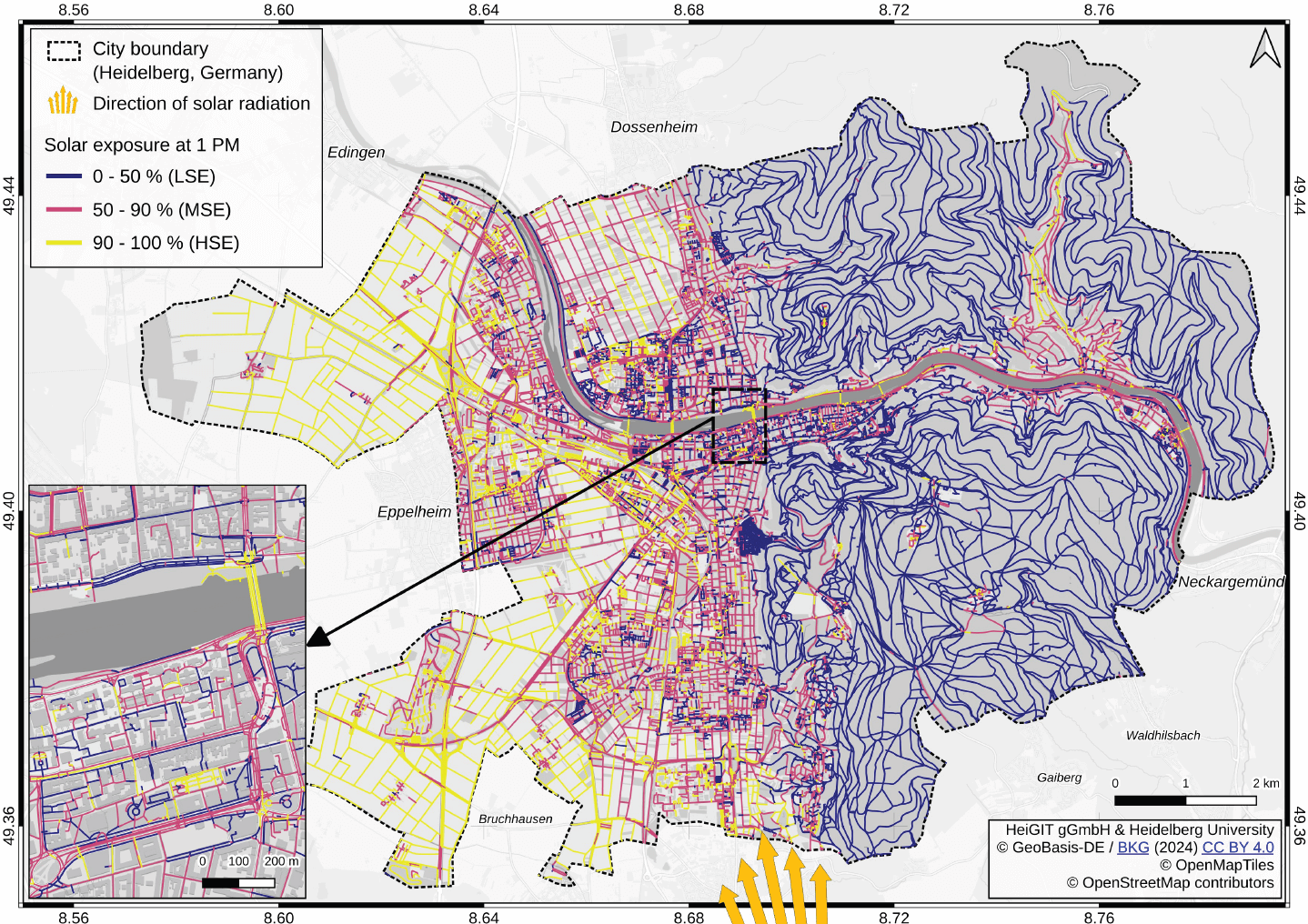
New paper “Mitigating heat stress by reducing solar exposure in pedestrian routing”
Using Heidelberg as a case study, researchers modeled time-dependent solar exposure for the entire pedestrian network by combining high-resolution DEM/DSM building and vegetation data with OpenStreetMap road data. Adapting to heat stress in cities is a major challenge under global warming, as both climate change and the urban heat island effect increase health risks worldwide.…
-
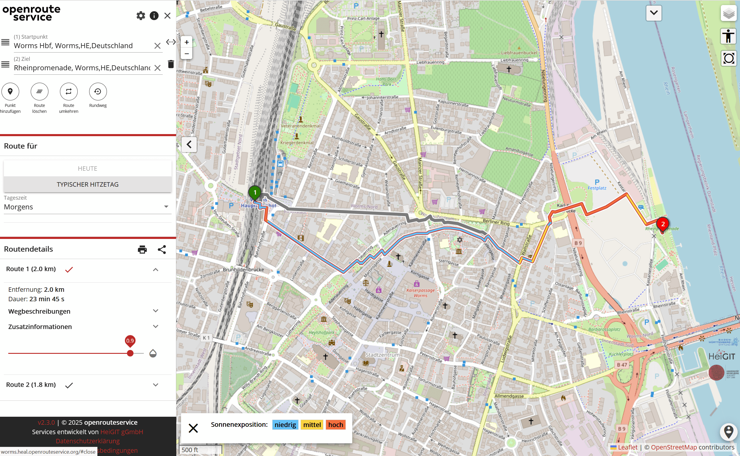
A Routing App to Avoid the Heat: HEAL App now available also for Worms
As summer temperatures soar, being outdoors poses rising health risks, especially in urban areas and for vulnerable groups like the elderly, children, and citizen with pre-existing conditions. The HEAL project launched a routing app to help citizens avoid heat stress, supporting climate adaptation and public health during hot weather periods. Initially developed for Heidelberg, the…
-
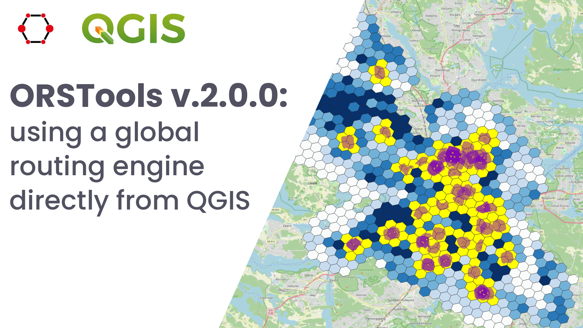
Release of QGIS plugin ORSTools v.2.0.0 & QGIS User Conference
What is ORSTools? With ORSTools, most of the functionalities of openrouteservice are directly accessible in QGIS. The plugin offers a toolset, including routing, isochrone generation and matrix calculations. These functions can be used interactively in the map canvas or applied to point files within the processing framework. Output files come with rich attribute data such…
-
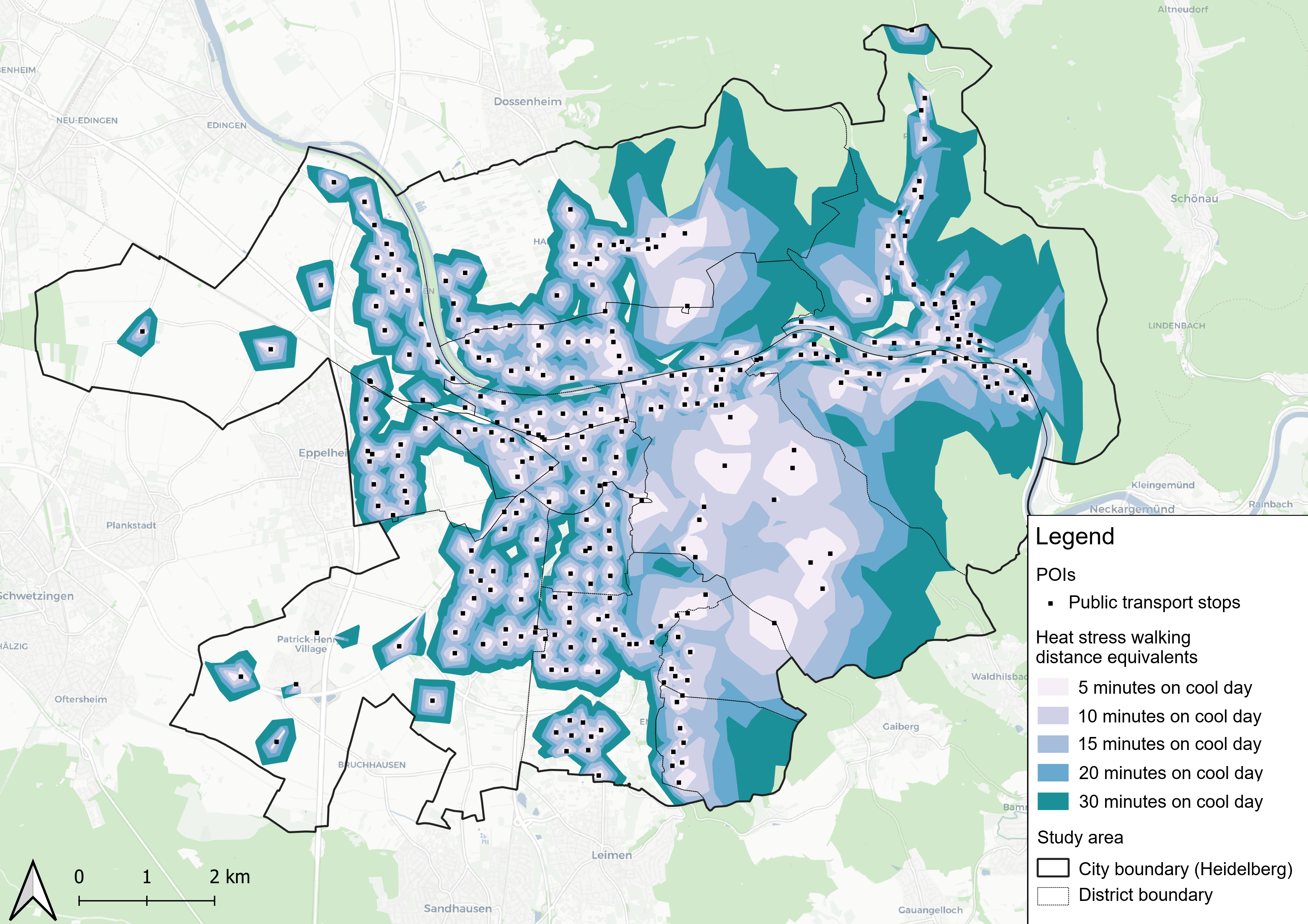
New Paper “Accessibility for pedestrians under heat stress – the example of Heidelberg, Germany”
This study introduces the isocalor approach to assess how solar exposure and heat stress impact pedestrian access to essential services in Heidelberg, using OpenStreetMap data and a customized openrouteservice routing engine. As climate change intensifies, cities are increasingly exposed to extreme heat events, with urban populations—especially vulnerable groups like older adults, children, and those with…
-
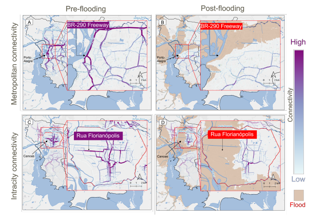
New paper “Changes in Road Centrality and Hospital Access Redundancy: Impacts of the 2024 Flood in the Metropolitan Core of Porto Alegre”
This study examines the resilience of urban infrastructure, with a focus on road network connectivity and redundancy in the face of extreme weather events. Using OpenStreetMap (OSM) data and the openrouteservice (ORS) routing engine, the research assesses centrality metrics and redundancy to evaluate how floods impact mobility and access to critical services, such as healthcare.…
-
HeiGIT at QGIS User Conference
HeiGIT will present two sessions on openrouteservice. ORSTools – using a global routing engine directly from QGIS Monday, June 2 2025, 16:30–17:00 (Europe/Stockholm), Statisten Getting from A to B fast and efficiently is central to mobility analysis and requires both road network data and a route calculation algorithm capable of using it. This session introduces…
-
New Paper “Lessons in Traffic: Nairobi’s School Term Congestion and Equity Challenges”
This study, published at African Transport Studies, investigates the impact of school sessions on traffic congestion in Nairobi, highlighting how children’s mobility needs are often overlooked in transport planning. The paper explores how poor integration of school-related travel into urban transport planning contributes to traffic congestion in Nairobi. While the conventional response to congestion has…
-
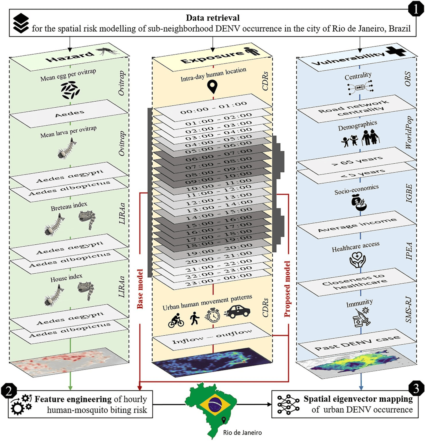
New Paper in Scientific Reports “Modeling Intraday Aedes-human exposure dynamics enhances dengue risk prediction”
Scientific Reports publishes a paper by Steffen Knoblauch et al. that underscores the critical importance of integrating vector ecology and human behavior into advanced disease modeling frameworks. The increasing availability of human movement data presents significant potential for tackling global public health challenges, especially in the context of infectious diseases. This is particularly important for…
-

Call for participation: “Walking the X-min City: Methods and implementations to assess walkability and pedestrian accessibility” Workshop at the AGILE Conference
Join our collaborative workshop at the AGILE Conference in Dresden on June 10, where researchers, practitioners, and policymakers come together to explore methods in walkability and pedestrian accessibility assessment. Workshop scope The assessment of walkability and pedestrian accessibility through GIS methods has gained momentum, offering urban planners and policymakers new ways to assess and implement…
-

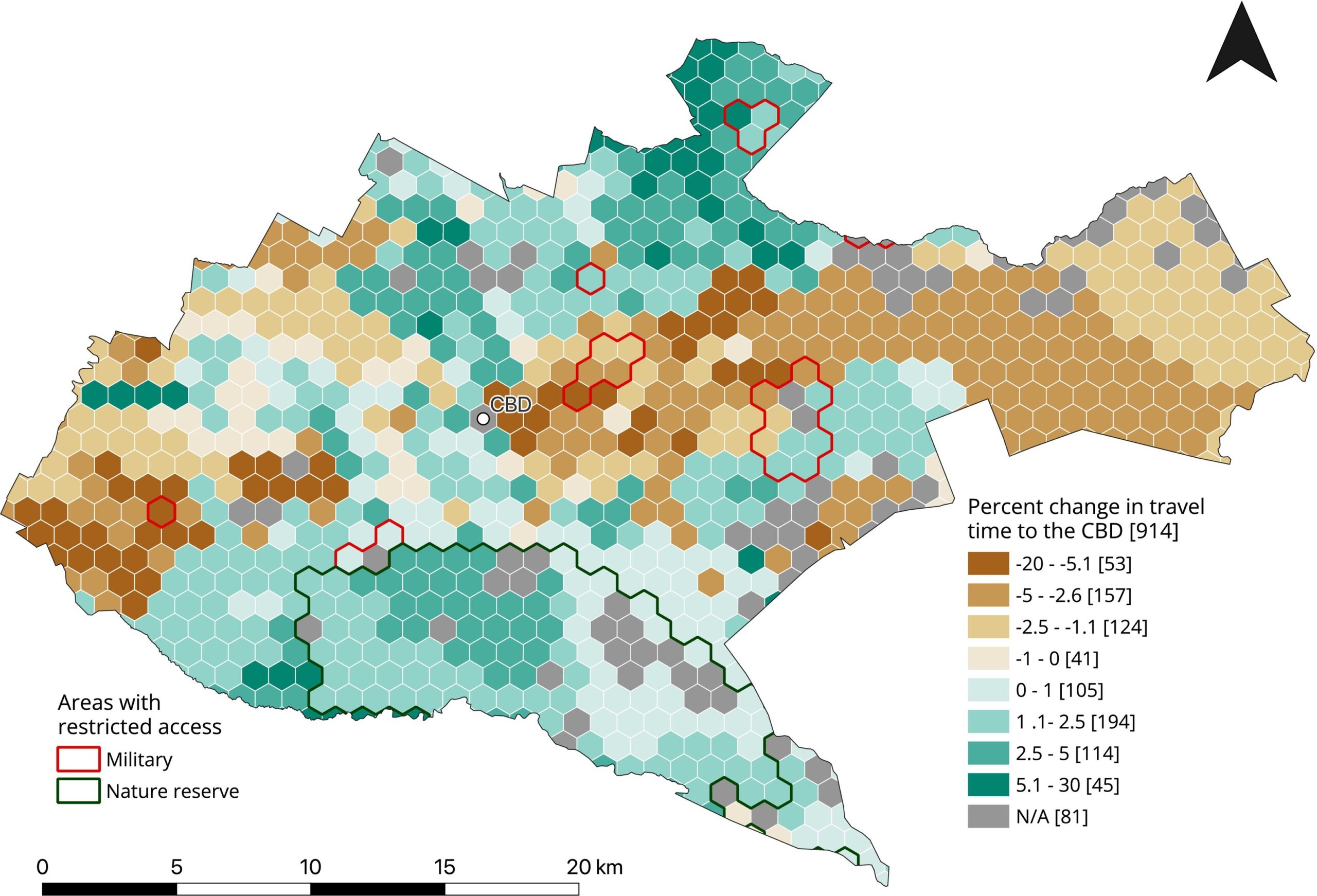
New Paper “Crime-associated inequality in geographical access to education: Insights from the municipality of Rio de Janeiro”
To what extent does crime potentially inhibit geographical access to schools, measured by cumulative average travel time? Education is recognized globally as a fundamental human right and essential for promoting equality,eradicating poverty, reducing crime, and supporting sustainable development. Despite global progress, full educational access remains a challenge, particularly in highly criminal areas. The paper uses…
-
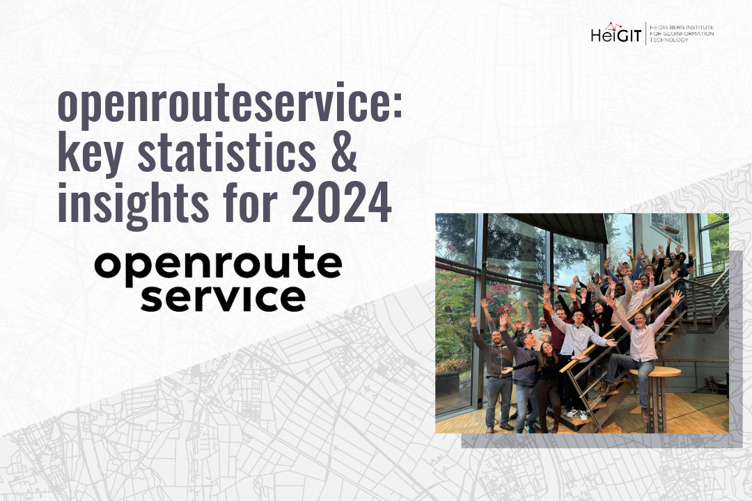
openrouteservice: key statistics and insights for 2024
HeiGIT has released the 2024 key statistics and numbers of openrouteservice. It demonstrates a significant increase in new users compared to the previous year. Specifically, there has been an increase of approximately 39% in new users since 2023, with a particularly notable rise in collaborative users. The number has increased by around 270%, compared to…
-

Silver Ways: Enhancing Walkability for Older Adults in 15-Minute Cities
The 15-minute city concept is gaining traction in urban planning, aiming to ensure that essential services are within a short walk or bike ride. As the older population grows, walking remains a key factor in their well-being, yet their mobility is highly dependent on the built environment. A new research project, Silver Ways, is tackling…