Tag: machine learning
-
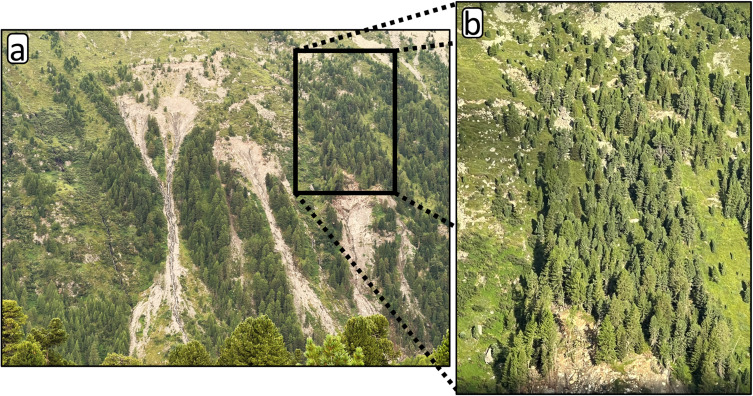
New Paper: Method for monitoring landslides in forested area
Tabernig, R., Albert, W., Weiser, H., Fritzmann, P., Anders, K., Rutzinger, M. & Höfle, B. (2025): Temporal aggregation of point clouds improves permanent laser scanning of landslides in forested areas. Science of Remote Sensing. Vol. 12, pp. 100254. DOI: https://doi.org/10.1016/j.srs.2025.100254 In our brand-new study ‘Temporal aggregation of point clouds improves permanent laser scanning of landslides…
-
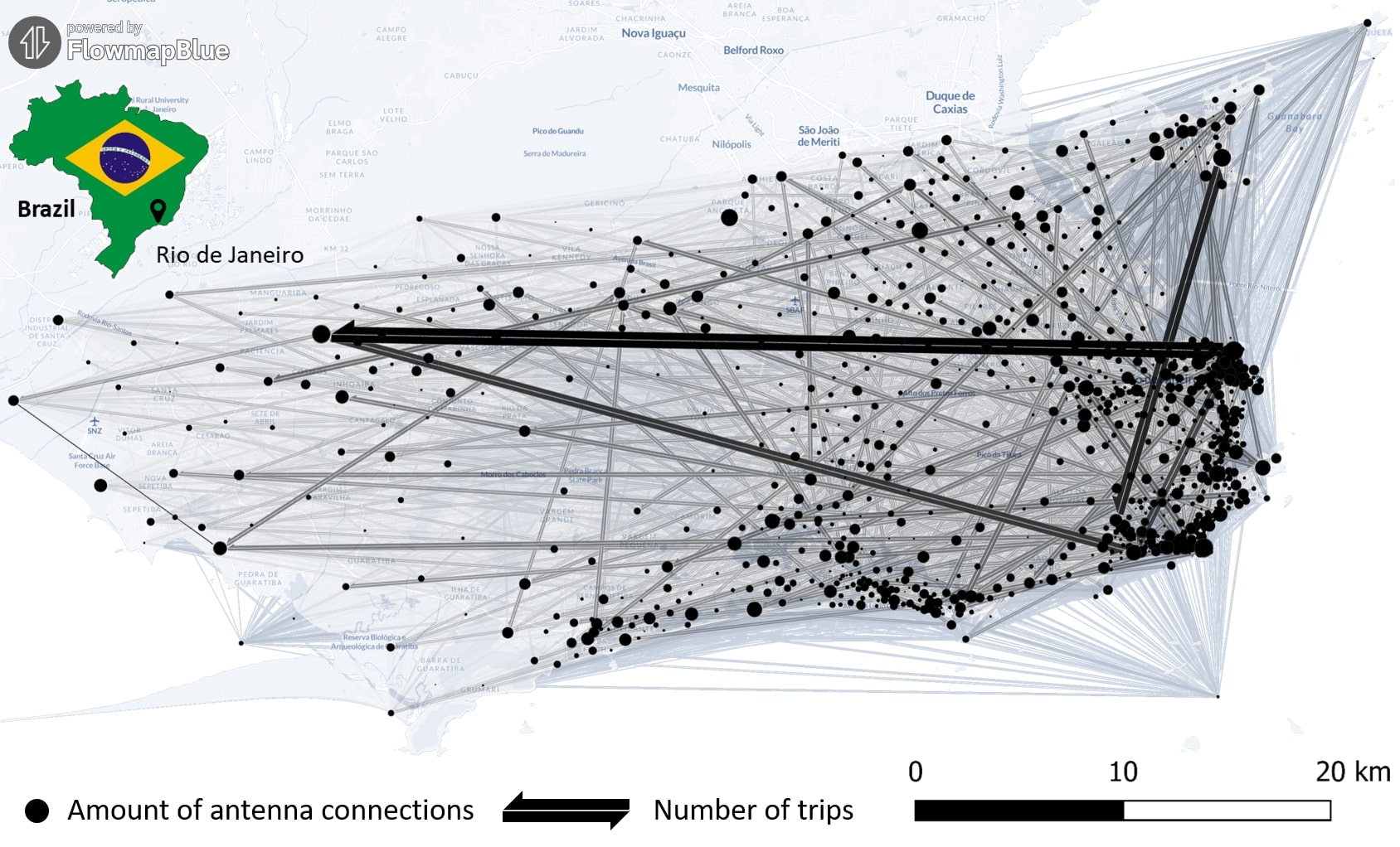
New Paper “Long-term validation of inner-urban mobility metrics derived from Twitter/X”
Data on mobility behavior can yield valuable insights that are beneficial for various applications such as public policy, emergency response, and urban planning. As the availability of freely-accessible mobility data is limited, the attention to X (formerly known as Twitter) as a data source has increased. Users of the platform can tag their online posts…
-

New Paper: “UAV-Assisted Municipal Solid Waste Monitoring for Informed Disposal Decisions”
Solid waste pollution is the cause of many environmental and health risks, especially in areas where waste is generated in large quantities but cannot be properly disposed of. Knowledge of the size and location of dump sites is required to keep waste management efficient and low-cost. When the extent of these dump sites needs to…
-
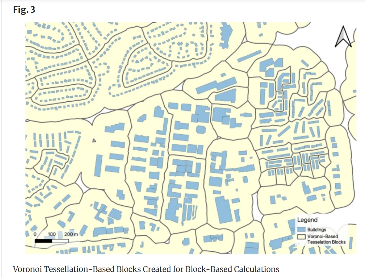
New Paper: “Enriching building function classification using Large Language Model embeddings of OpenStreetMap Tags”
Rapid global urbanization is placing immense pressure on planners to make informed decisions that promote sustainable growth. A crucial aspect of this challenge is understanding how urban buildings are used. Traditionally, classifying the function of buildings—such as residential or commercial—relies on costly and subjective on-site surveys. However, advances in AI are poised to transform this…
-
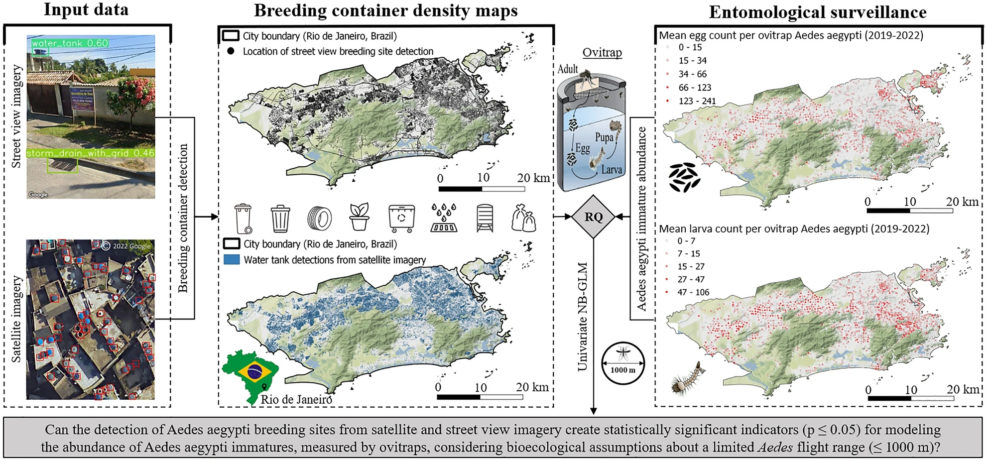
New Paper in Nature ‘Scientific Reports’: „High-resolution Mapping of Urban Aedes Aegypti Immature Abundance Through Breeding Site Detection Based on Satellite and Street View Imagery“
Knoblauch, S; Su Yin, M.; Chatrinan, Krittin; Rocha, Antonio A. de A.; Haddawy, P.; Biljecki, F.; Lautenbach, S.; Resch, B.; Arifi, D.; Jänisch, T.; Morales, I.; and Zipf, A published the paper ‘High-resolution mapping of urban Aedes aegypti immature abundance through breeding site detection based on satellite and street view imagery’ in Nature Scientific Reports.…
-
Deep learning with simulated laser scanning data for 3D point cloud classification
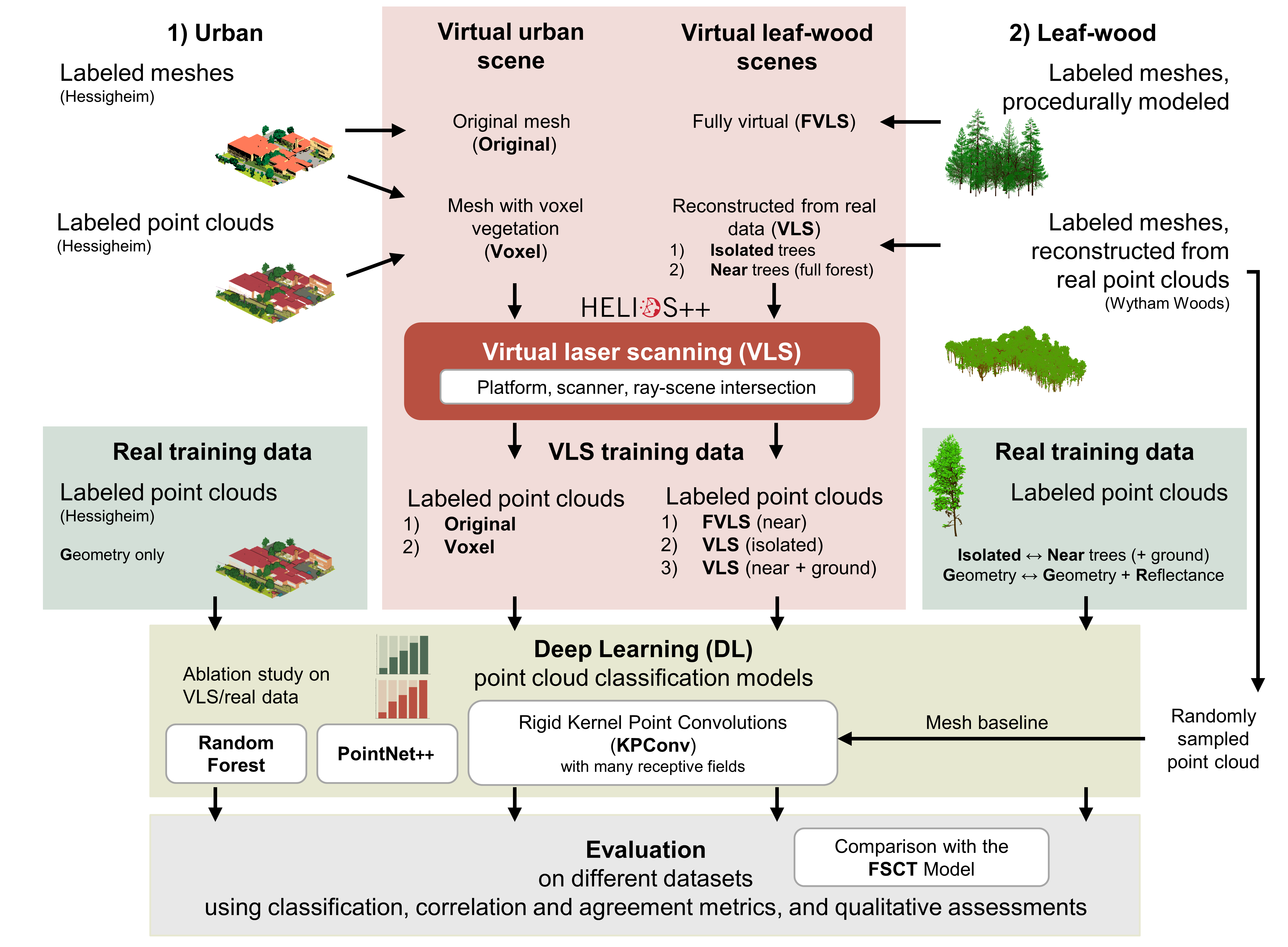
Esmorís, A.M., Weiser, H., Winiwarter, L., Cabaleiro, J.C. & Höfle, B. (2024): Deep learning with simulated laser scanning data for 3D point cloud classification. ISPRS Journal of Photogrammetry and Remote Sensing. Vol. 215, pp. 192-213. DOI: 10.1016/j.isprsjprs.2024.06.018 3D point clouds acquired by laser scanning are invaluable for the analysis of geographic phenomena. To extract information…
-

Call for Papers: Special Issue on Urban AI in Environment and Planning B
Together with collaborators from Urban Analytics Lab Singapore and CICI Lab, we are organising a special issue in Environment and Planning B: Urban Analytics and City Science, on the topic of Urban AI for a Sustainable Built Environment. Here is the summary of the call for papers: “Recently, Urban AI has become an emerging field…
-

VirtuaLearn3D: New Preprint
We have published a preprint of our recent work in the VirtuaLearn3D project! Deep learning with simulated laser scanning data for 3D point cloud classification Esmorís, A.M., Weiser, H., Winiwarter, L., Cabaleiro, J.C. & Höfle, B. (2024) Laser scanning is an active remote sensing technique to acquire state-of-the-art spatial measurements in the form of 3D…


