

Tag: geoEpi
-
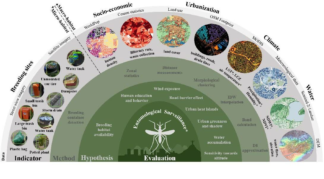
New Paper in Lancet Planetary Health “Urban Aedes aegypti suitability indicators”
To improve vector control strategies, Dr. Steffen Knoblauch (PostDoc at GIScience and HeiGIT) has developed detailed maps showing where Aedes aegyti is most likely to thrive. Using a holistic approach, his work leverages geospatial big data – including openly available satellite and street view imagery as well as climate data – to identify common breeding…
-
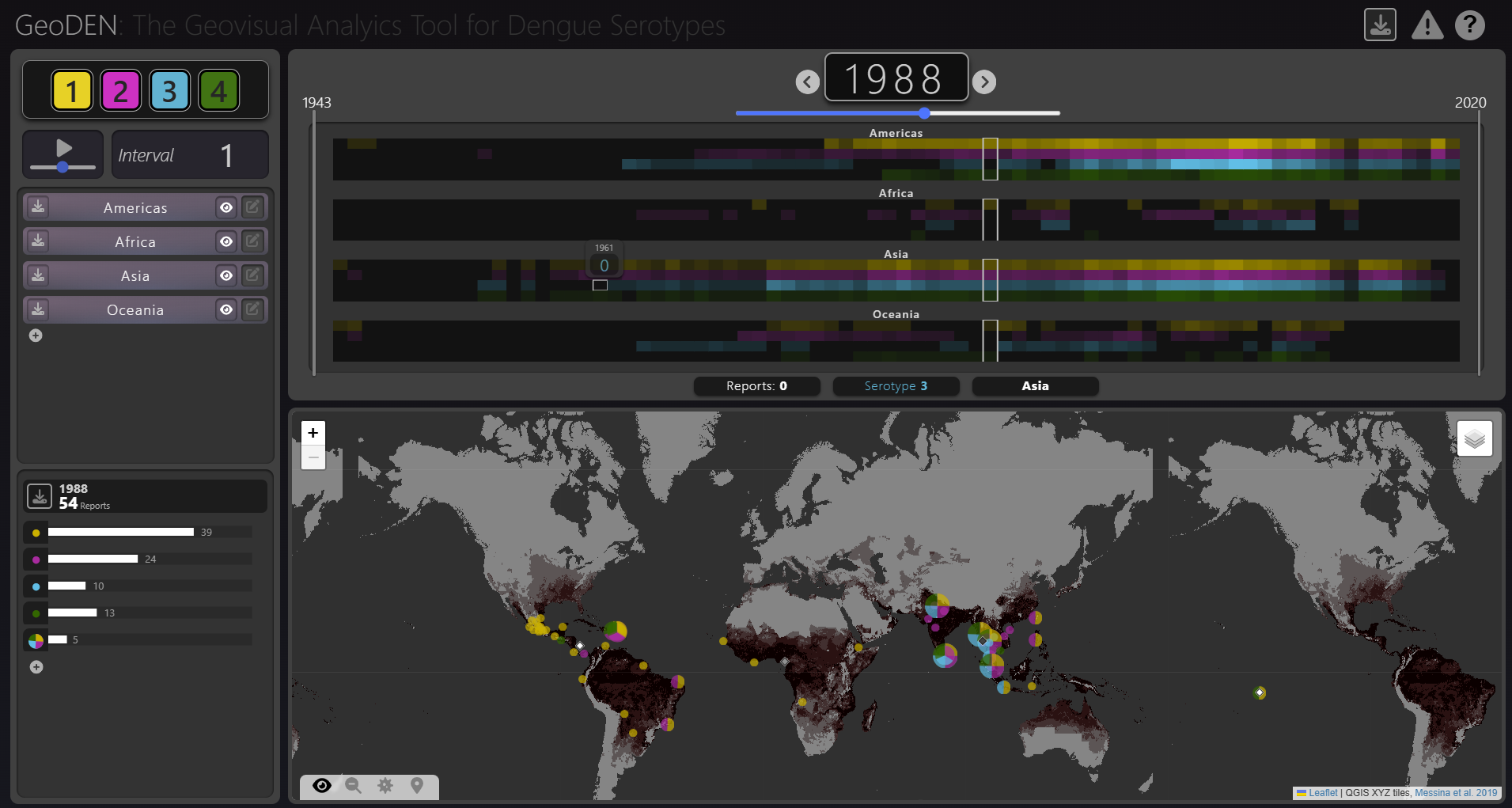
New Paper “GeoDEN: A Visual Exploration Tool for Analyzing the Geographic Spread of Dengue Serotypes”
With the increasing availability of global disease datasets, Visual Analytics (VA) has emerged as a valuable tool in spatial epidemiology, particularly for studying serotype interactions in diseases like dengue. Dengue, caused by four serotypes (DENV1-DENV4), poses a significant global health threat exacerbated by urbanization and climate change. Traditional approaches rely on static mapping or animation…
-
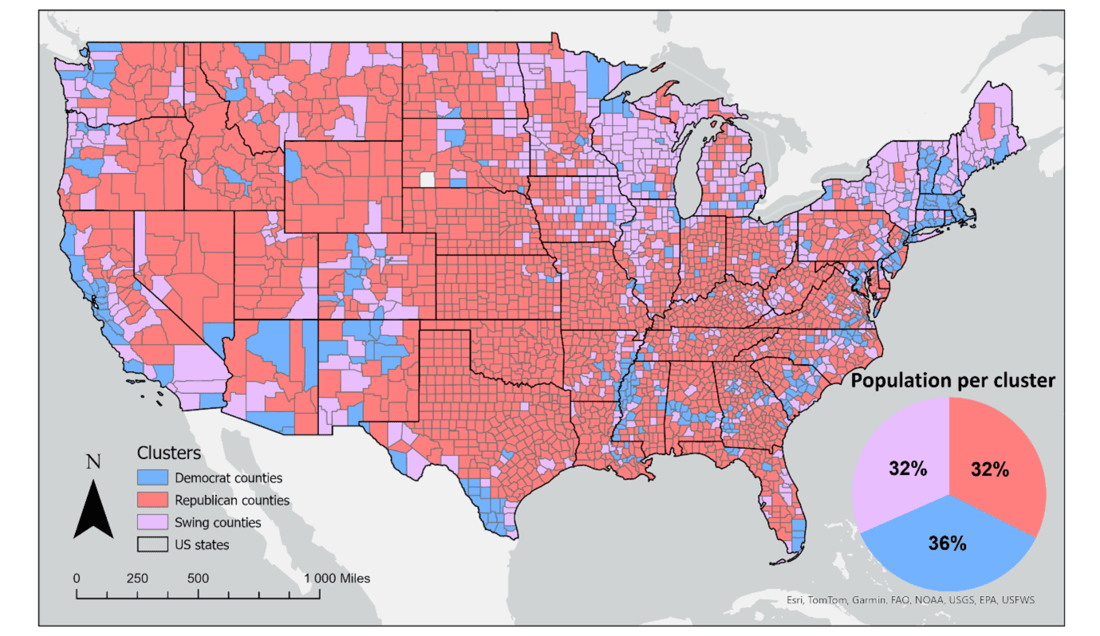
New Paper “Geosocial Media’s Early Warning Capabilities Across US County-Level Political Clusters: Observational Study”
The novel coronavirus disease (COVID-19) generated significant health concerns worldwide, leading policymakers and health care experts to implement nonpharmaceutical public health interventions to mitigate the spread of the virus. While these interventions played a crucial role in controlling transmission, they also resulted in substantial economic and societal costs, necessitating strategic deployment, particularly during periods of…
-
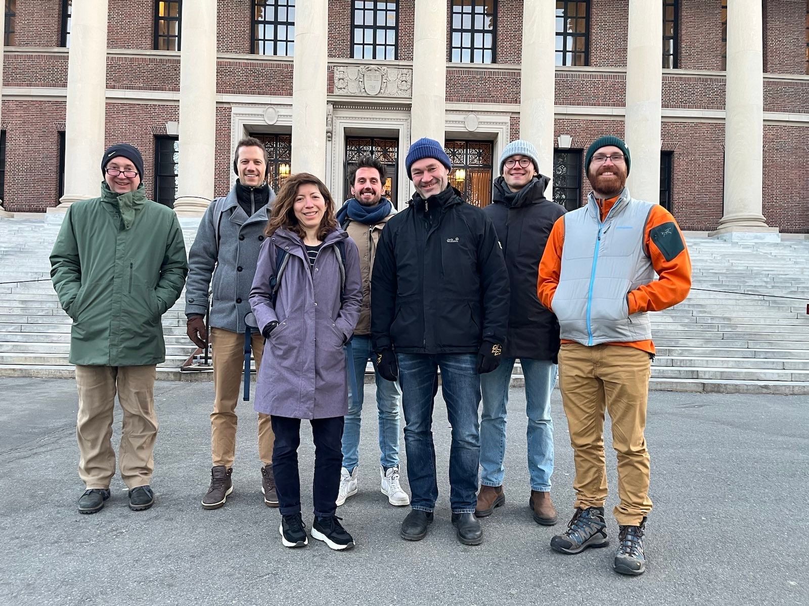
GeoEpi at CGA 2023: From Geospatial Research to Health Solutions
Featured photo: The geoEpi team attending CGA 2023. Back row from left: PD Dr. med. Thomas Jaenisch, Assoz. Prof. Dr. Bernd Resch, Dorian Arifi and Steffen Knoblauch. Front row from left: Dr. rer. nat. Ivonne Morales Benavides, Apl. Prof. Dr. Sven Lautenbach, and Dr. Yannik Roell. Ever since Dr. John Snow’s 1854 tracing of a…