

Tag: GeoAI
-
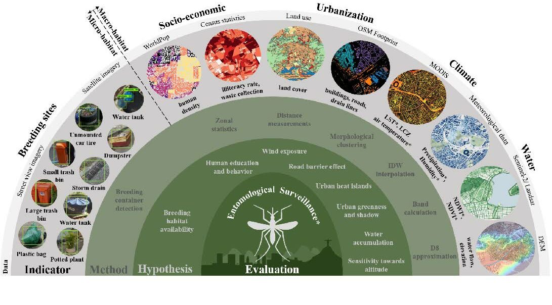
New Paper in Lancet Planetary Health “Urban Aedes aegypti suitability indicators”
To improve vector control strategies, Dr. Steffen Knoblauch (PostDoc at GIScience and HeiGIT) has developed detailed maps showing where Aedes aegyti is most likely to thrive. Using a holistic approach, his work leverages geospatial big data – including openly available satellite and street view imagery as well as climate data – to identify common breeding…
-
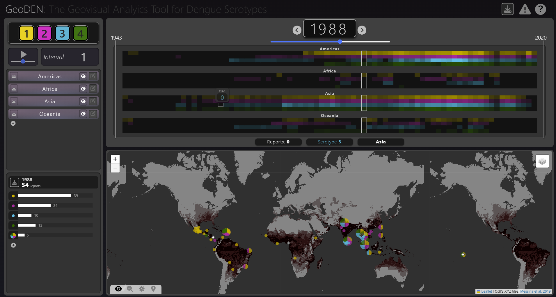
New Paper “GeoDEN: A Visual Exploration Tool for Analyzing the Geographic Spread of Dengue Serotypes”
With the increasing availability of global disease datasets, Visual Analytics (VA) has emerged as a valuable tool in spatial epidemiology, particularly for studying serotype interactions in diseases like dengue. Dengue, caused by four serotypes (DENV1-DENV4), poses a significant global health threat exacerbated by urbanization and climate change. Traditional approaches rely on static mapping or animation…
-

New Paper “An explainable GeoAI approach for the multimodal analysis of urban human dynamics: a case study for the COVID-19 pandemic in Rio de Janeiro”
The COVID-19 pandemic highlighted the importance of understanding human behavior in cities to develop effective public health interventions. Crowd-sourced geospatial data available online can therefore serve as a valuable resource for analyzing such dynamics with Geospatial Artificial Intelligence (GeoAI). However, previous research often struggles with the complexity and heterogeneity of such data, and faces challenges…
-
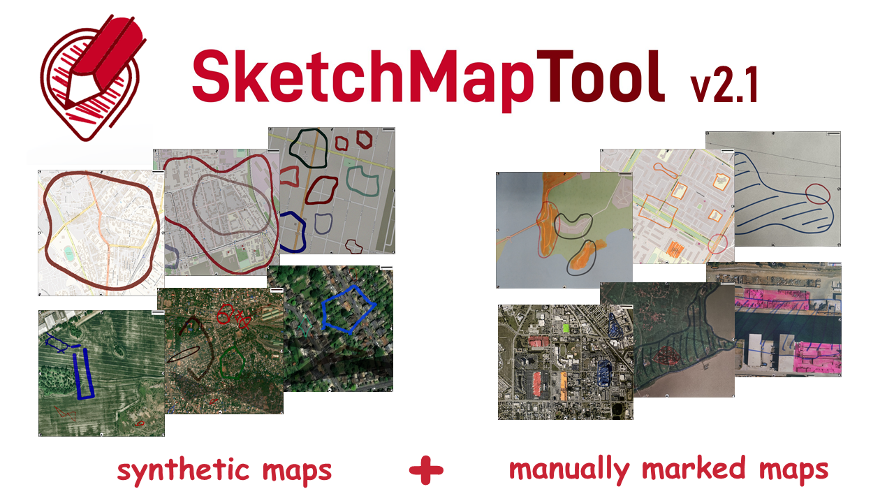
Digitizing Maps with SketchMapTool v2.1: Enhanced Sketch Detection and Global Impact
The newly released Sketch Map Tool v2.1 features a higher accuracy in digitizing hand-sketched markings on Sketch Maps, thanks to a larger training dataset and an updated machine learning model for sketch detection. New user metrics show that thousands of Sketch Maps are created every month all over the world. The Sketch Map Tool The…
-

New Paper “Crime-associated inequality in geographical access to education: Insights from the municipality of Rio de Janeiro”
To what extent does crime potentially inhibit geographical access to schools, measured by cumulative average travel time? Education is recognized globally as a fundamental human right and essential for promoting equality,eradicating poverty, reducing crime, and supporting sustainable development. Despite global progress, full educational access remains a challenge, particularly in highly criminal areas. The paper uses…
-
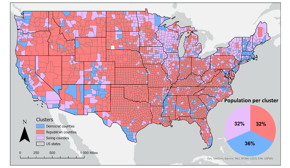
New Paper “Geosocial Media’s Early Warning Capabilities Across US County-Level Political Clusters: Observational Study”
The novel coronavirus disease (COVID-19) generated significant health concerns worldwide, leading policymakers and health care experts to implement nonpharmaceutical public health interventions to mitigate the spread of the virus. While these interventions played a crucial role in controlling transmission, they also resulted in substantial economic and societal costs, necessitating strategic deployment, particularly during periods of…
-
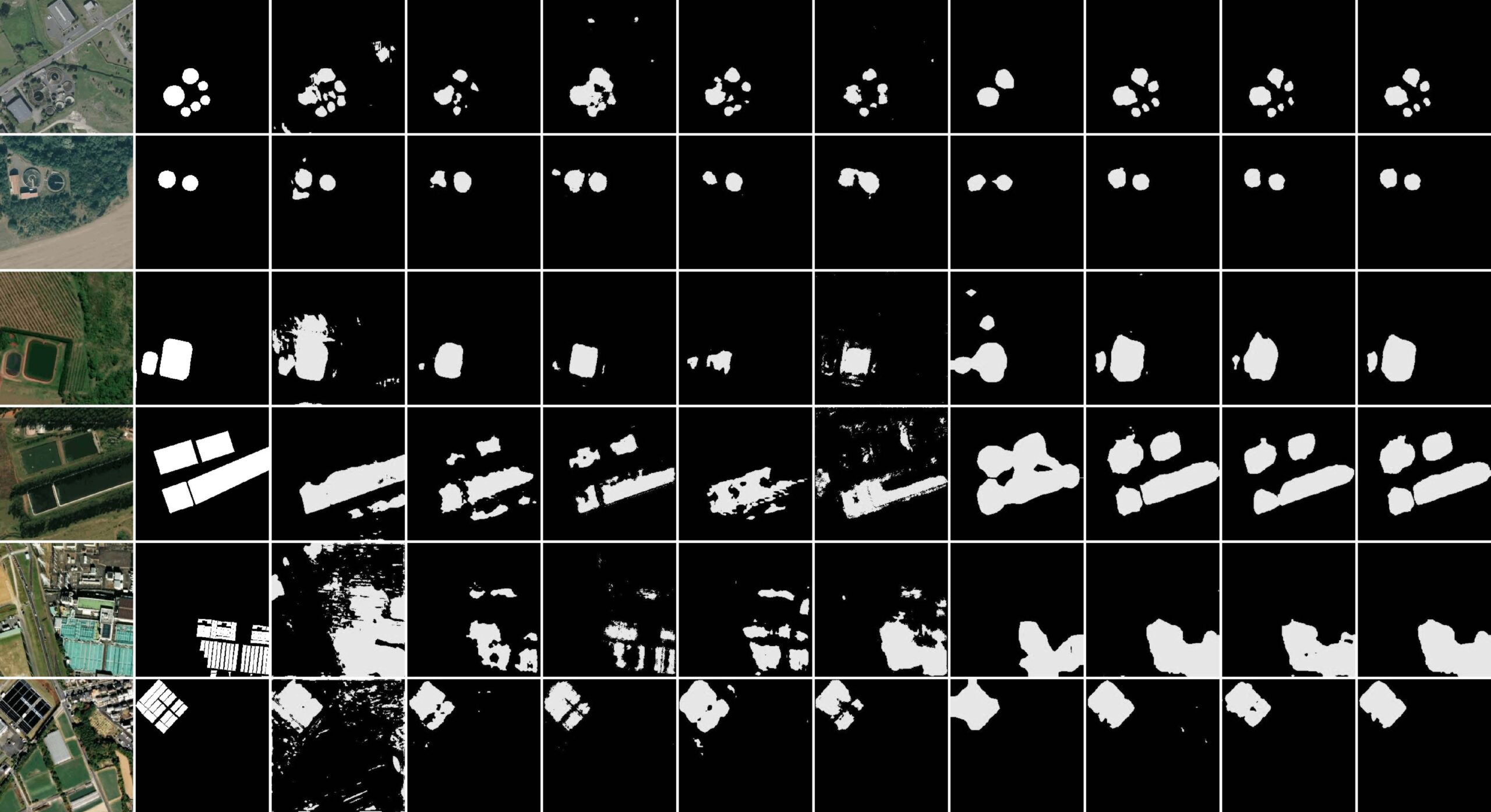
New paper “STVAE: Skip connection driven two-stream property Fusion Variational AutoEncoder for cross-region wastewater treatment plant semantic segmentation”
Wastewater treatment plants (WWTPs) play a crucial role in maintaining ecological balance and public health and are essential for advancing social sustainable development goals. However, the diverse architectural styles, scales, and environmental contexts of WWTPs—shaped by climate, topography, and regional economic conditions—pose significant challenges for generalizing segmentation algorithms. To address this, integrating knowledge from different…
-
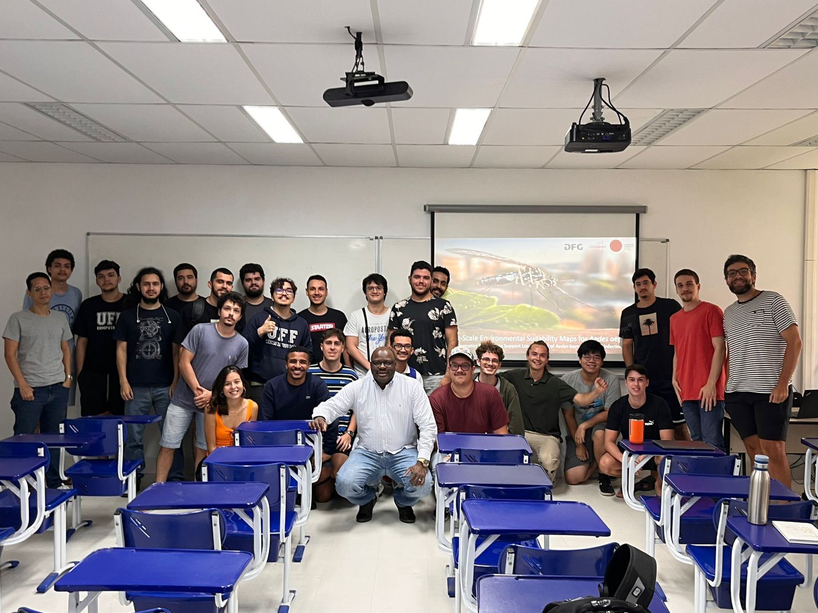
Research Visit to Rio de Janeiro
Building on ongoing efforts to enhance urban health management and mosquito-borne disease monitoring in the municipality of Rio de Janeiro, PhD candidate Steffen Knoblauch returned to the city for a second visit deepen collaborations and explore further applications of his research findings. He delivered lectures at several research institutions such as Universidade Federal do Rio…
-
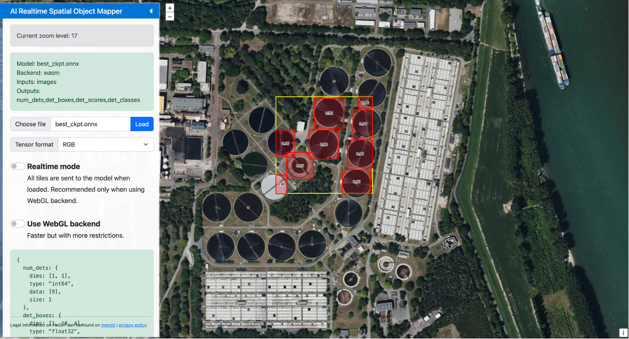
GeoAI4Water III Thailand
In times of natural disasters and other emergencies, access to reliable data on critical infrastructure can mean the difference between a swift recovery and prolonged crisis. Building on the success of previous initiatives, the GeoAI4Water III project is taking a step forward by developing a comprehensive dataset of Wastewater Treatment Plants (WTPs) across Thailand. This…
-
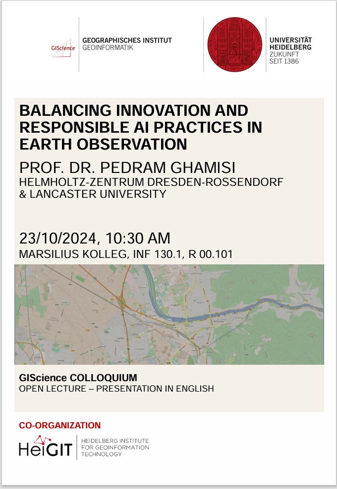
GIScience Colloquium by Pedram Ghamisi on responsible AI on 23 October 2024
We are very pleased to soon host guest speaker Prof. Dr. Pedram Ghamisi, head of the machine learning group (FWGE-L) at Helmholtz-Zentrum Dresden-Rossendorf, Germany (HZDR) & visiting full professor at Lancaster University, UK. Prof. Dr. Pedram Ghamisi will give a lecture on ´Balancing Innovation and Responsible AI Practices in Earth Observation: A Few Examples´. The…
-
New Paper: GeoAI for Science and the Science of GeoAI
GeoAI integrates AI, geospatial big data, and high-performance computing for solving data- and computation-intensive geospatial problems. This field has gained continuous momentum, driven by strong demands in geography and the rapid advancement of AI. Wenwen Li´s paper “GeoAI for Science and the Science of GeoAI”, published in the latest edition of the Journal of Spatial…
-

Advancing Vector Control Through GeoAI: Insights from Steffen Knoblauch’s talk at The Program of Scientific Computing (PROCC) at FIOCRUZ
On May 15th, the Program of Scientific Computing (PROCC) at Fiocruz hosted Steffen Knoblauch, a GIScience Ph.D. candidate, for his presentation titled “GeoAI 4 Dengue: Harnessing Geospatial Big Data to Guide Vector Control.” This event, organized in partnership with The Global Health Network Latin America and the Caribbean (TGHN LAC), provided a platform for academic…