

Tag: Extract4D
-
New Paper: Method for monitoring landslides in forested area
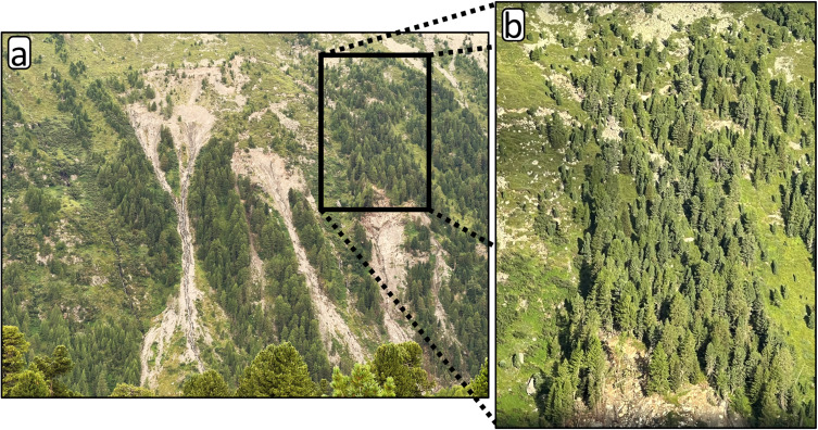
Tabernig, R., Albert, W., Weiser, H., Fritzmann, P., Anders, K., Rutzinger, M. & Höfle, B. (2025): Temporal aggregation of point clouds improves permanent laser scanning of landslides in forested areas. Science of Remote Sensing. Vol. 12, pp. 100254. DOI: https://doi.org/10.1016/j.srs.2025.100254 In our brand-new study ‘Temporal aggregation of point clouds improves permanent laser scanning of landslides…
-
Kick-off: Extract4D Project
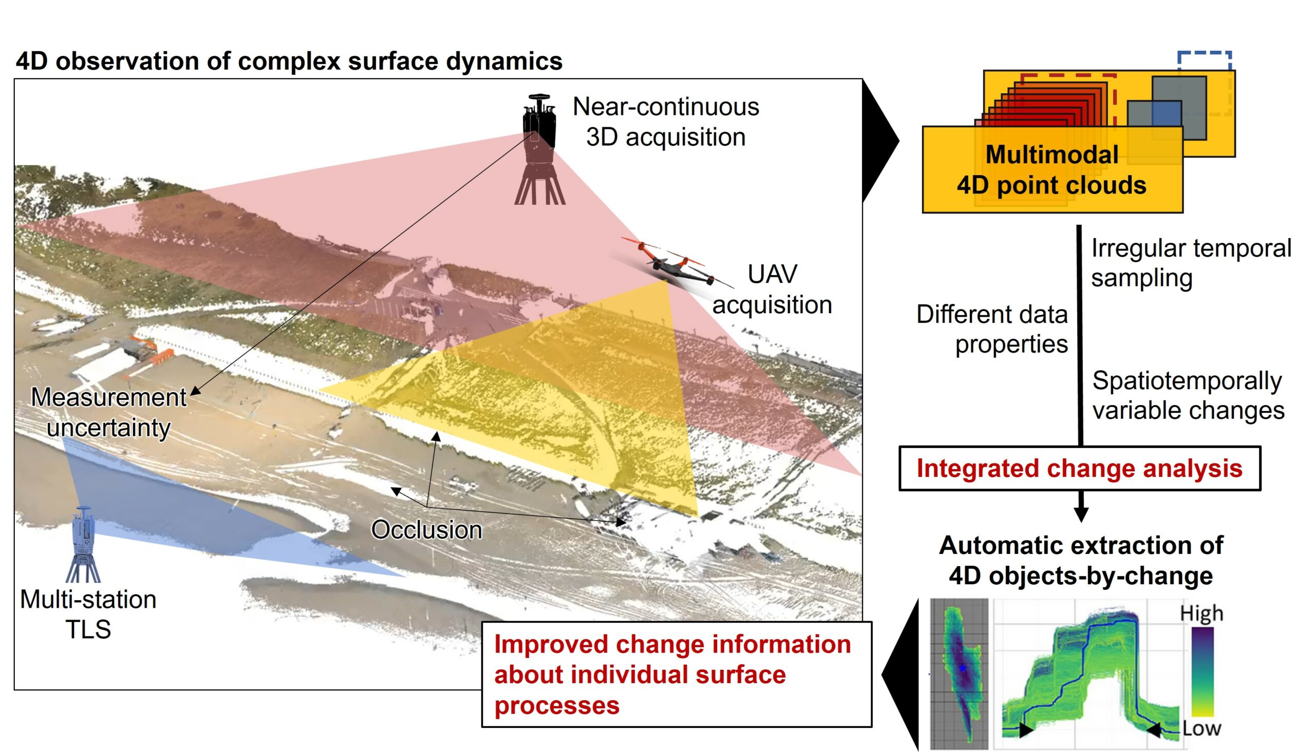
Last week, we, 3DGeo Heidelberg (Prof. Dr. Bernhard Höfle), had a kick-off meeting for our new joint research project Extract4D, led by Prof. Dr. Katharina Anders (TU Munich, Remote Sensing Applications). Here is a sneak peek at this exciting research project. Background The Earth’s surface is constantly being shaped by wind, water and gravity. Observing…