

Category: Allgemein
-
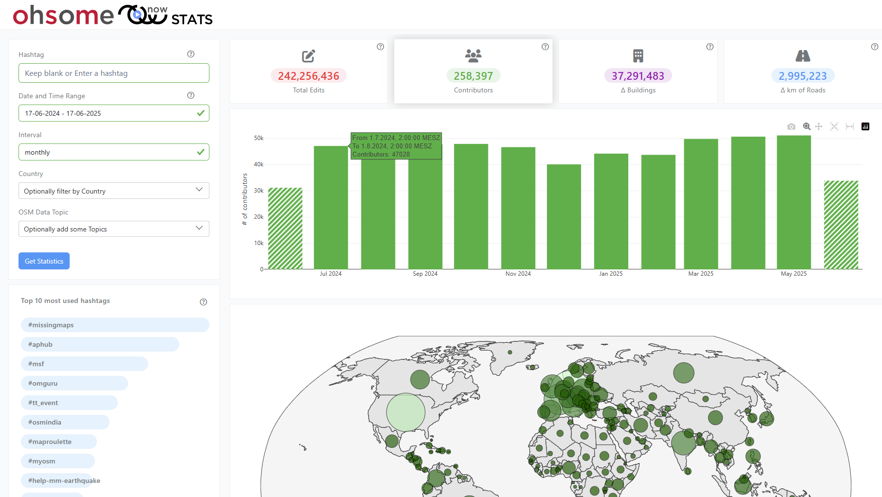
New insights into global mapping with the updated ohsomeNow Stats
The enhanced ohsomeNow Stats dashboard now provides near real-time access to all OpenStreetMap contributions since 2005, enabling more flexible and detailed analysis of global mapping activities. ohsomeNow stats provides a comprehensive overview of mapping activities in near real time. The dashboard was developed as part of our long-term cooperation with the Humanitarian OpenStreetMap Team (HOT),…
-

HGG lecture: Glaciers – from process understanding to early warning systems to symbols of the climate crisis
The third HGG lecture is about the function of glaciers as early warning systems for climate change and how this has changed over the years.
-
Empowering cities to act: The Climate Action Navigator highlights where climate action is most needed
What does a climate-neutral, livable city look like – and what concrete actions can help us get there? The new Climate Action Navigator (CAN) from HeiGIT (Heidelberg Institute for Geoinformation Technology) offers data-driven answers. This interactive online tool supports cities, NGOs, and community initiatives in identifying and addressing key areas for climate action – scientifically…
-
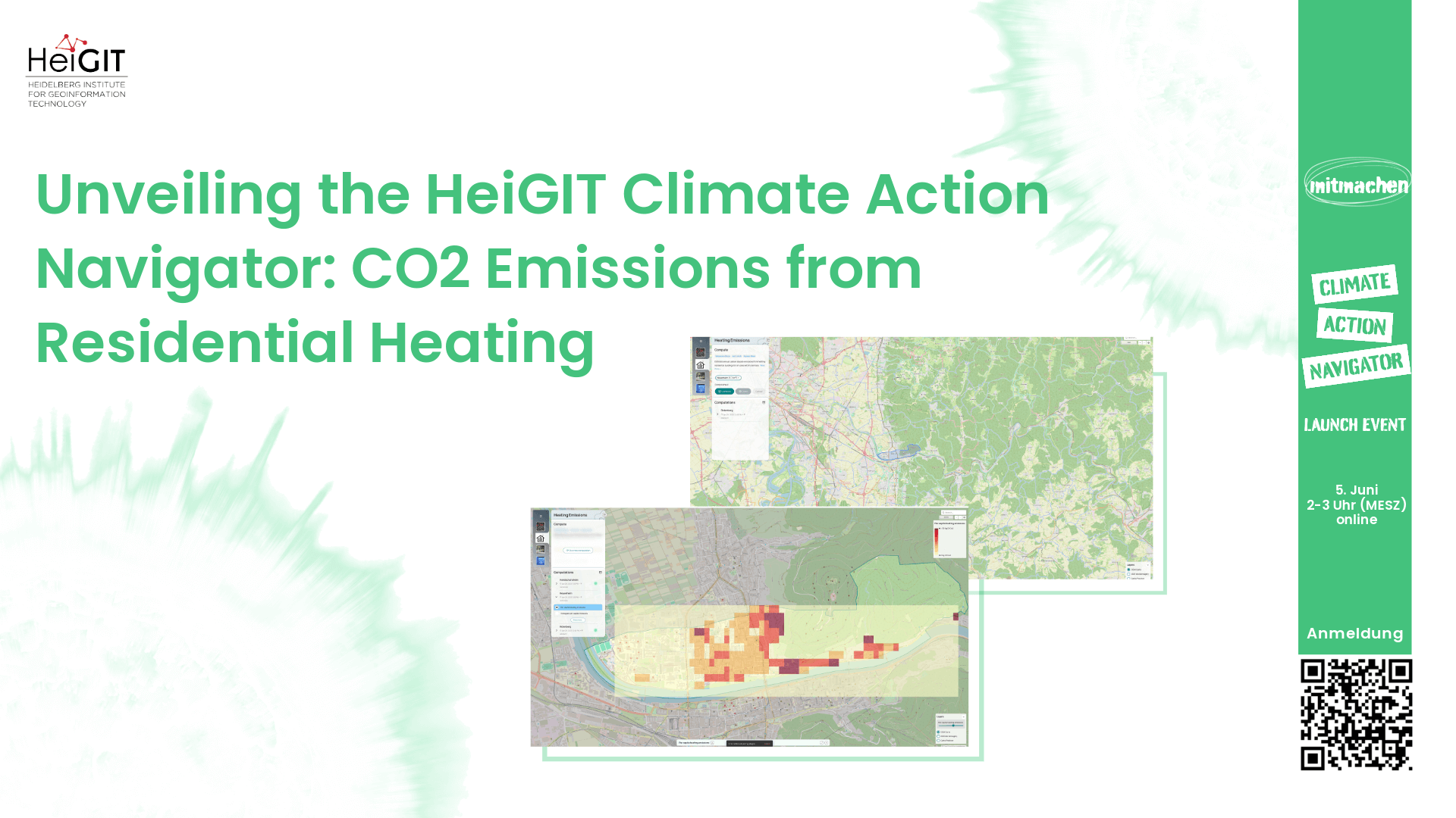
Unveiling the HeiGIT Climate Action Navigator Part 3 – CO2 emissions from residential heating
In just 8 days, on May 15th, we will officially launch the Climate Action Navigator (CAN), HeiGIT’s interactive dashboard offering high-resolution data and analysis on key climate indicators, from the quality and availability of mobility infrastructure to carbon dioxide emissions from heating of residential buildings. In this third part of our blog post series, we…
-
Marie Curie Postdoctoral Fellowships at HeiGIT & GIScience related to Climate Action and Humanitarian Aid
We are pleased to announce that HeiGIT and GIScience research Group at Heidelberg University are open to hosting postdoctoral researchers through the Marie Skłodowska-Curie Postdoctoral Fellowships (MSCA-PF) 2025. MSCA Fellowships offer a unique chance to pursue an independent research project in an international setting while benefiting from advanced training and interdisciplinary exchange. We invite researchers…
-
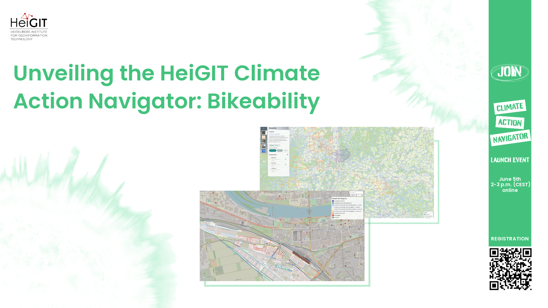
Unveiling the HeiGIT Climate Action Navigator Part 2 – Bikeability (hiBike)
In just 15 days, on May 15th, we will officially launch the Climate Action Navigator (CAN): HeiGIT’s new dashboard offering high-resolution, open data-based insights into key climate action indicators. From assessing CO2 emissions from residential heating to urban active mobility infrastructure, CAN helps identify where targeted action is most urgently needed. In this second post…
-
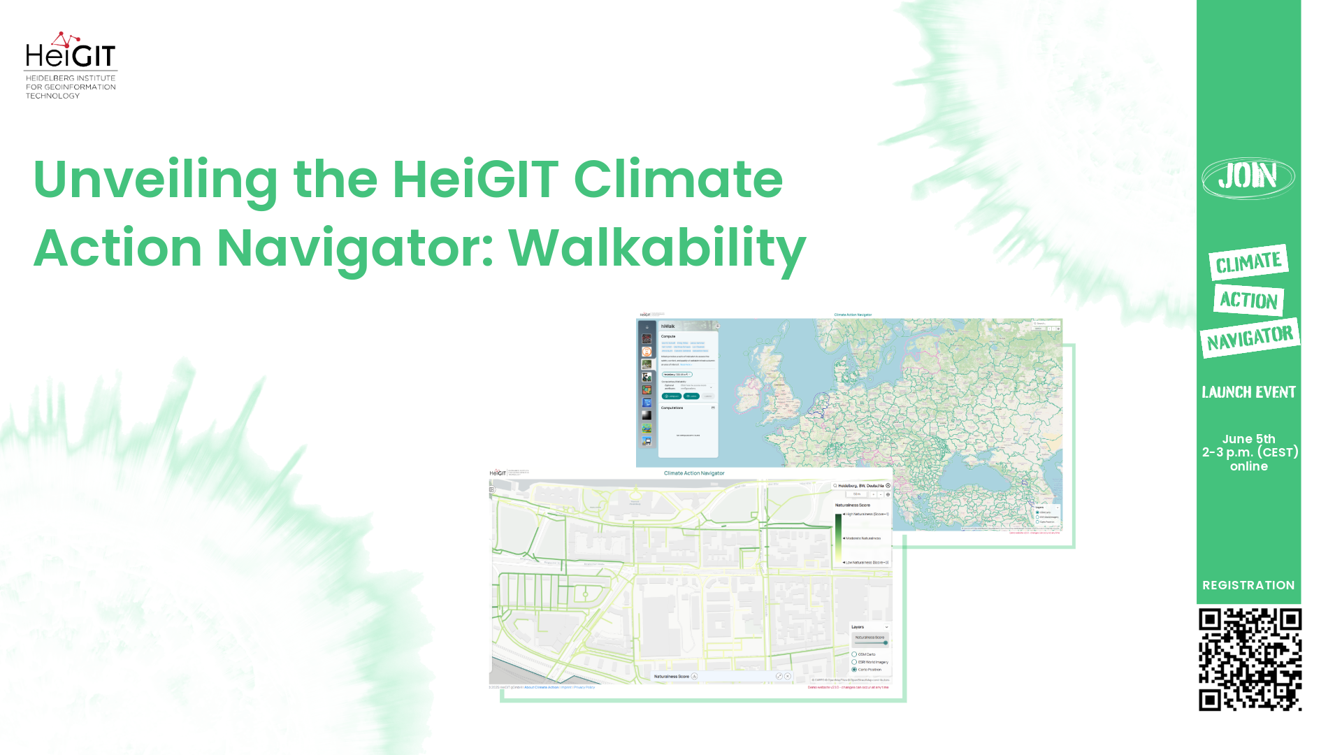
Unveiling the HeiGIT Climate Action Navigator Part 1 – Walkability
In just 22 days, on May 15th, we will officially launch the Climate Action Navigator (CAN): HeiGIT’s new dashboard offering high-resolution, open data-based insights into key climate action indicators. From assessing CO2 emissions from residential heating to urban active mobility infrastructure, CAN helps to identify where targeted action is most urgently needed. In this first…
-
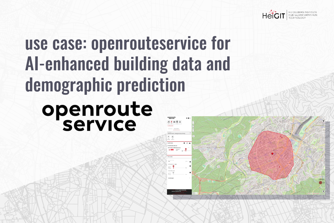
use case: openrouteservice for AI-Enhanced Building Data and Demographic Prediction
This research shows how spatial indicators from openrouteservice (ORS) can support building-level demographic predictions using machine learning. The study combines ORS APIs, building attributes, and POI data to estimate population and age characteristics in German cities, offering insights into the relationship between urban accessibility and demographic patterns. In today’s data-driven world, understanding cities at a…
-
First release of ohsome-planet: OSM history data in GeoParquet format
We’re excited to share the release of the ohsome-planet – a new software library on GitHub, marking a significant step toward the development of ohsome 2.0. This tool is designed to facilitate the transformation of raw OpenStreetMap (OSM) history data into the GeoParquet format, making it more accessible and efficient for spatial data analysis. What…
-
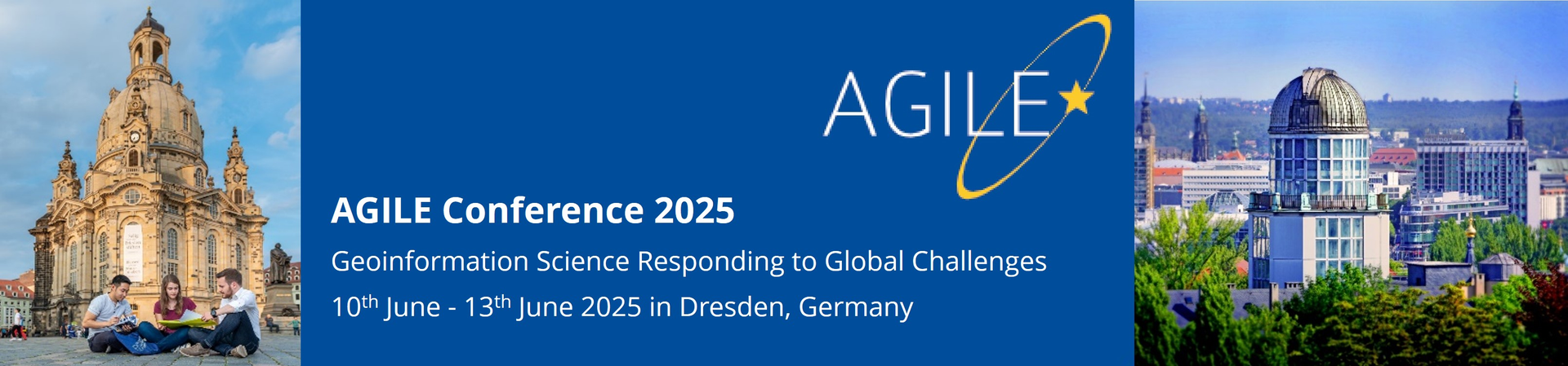
Call for participation: “Walking the X-min City: Methods and implementations to assess walkability and pedestrian accessibility” Workshop at the AGILE Conference
Join our collaborative workshop at the AGILE Conference in Dresden on June 10, where researchers, practitioners, and policymakers come together to explore methods in walkability and pedestrian accessibility assessment. Workshop scope The assessment of walkability and pedestrian accessibility through GIS methods has gained momentum, offering urban planners and policymakers new ways to assess and implement…
-

New Paper “An explainable GeoAI approach for the multimodal analysis of urban human dynamics: a case study for the COVID-19 pandemic in Rio de Janeiro”
The COVID-19 pandemic highlighted the importance of understanding human behavior in cities to develop effective public health interventions. Crowd-sourced geospatial data available online can therefore serve as a valuable resource for analyzing such dynamics with Geospatial Artificial Intelligence (GeoAI). However, previous research often struggles with the complexity and heterogeneity of such data, and faces challenges…
-
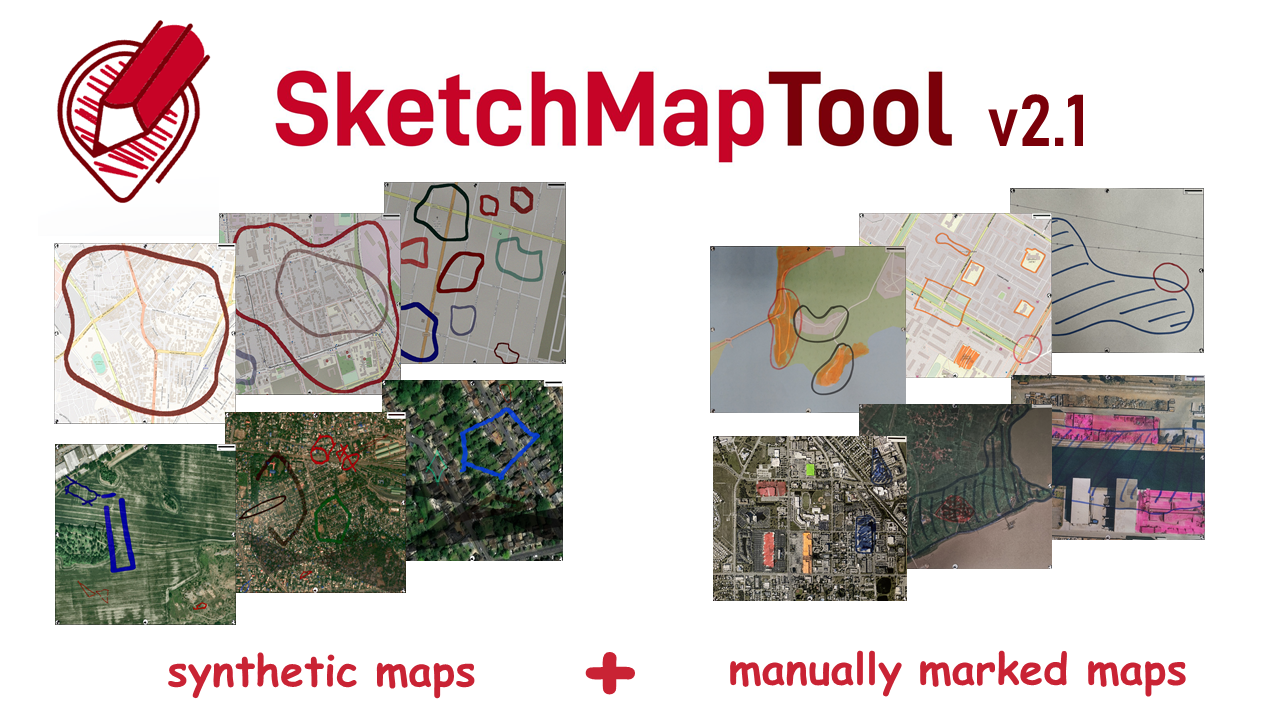
Digitizing Maps with SketchMapTool v2.1: Enhanced Sketch Detection and Global Impact
The newly released Sketch Map Tool v2.1 features a higher accuracy in digitizing hand-sketched markings on Sketch Maps, thanks to a larger training dataset and an updated machine learning model for sketch detection. New user metrics show that thousands of Sketch Maps are created every month all over the world. The Sketch Map Tool The…