

Author: Lisa Shkredova
-
New paper “Leveraging geospatial data to evaluate women’s employment opportunities in the renewable energy sector”
The renewable energy (RE) sector is a cornerstone of global climate action, yet its workforce remains marked by gender inequality. Women are significantly underrepresented, often relegated to lower-paid, non-technical roles. Traditional analyses of this disparity frequently ignore the spatial dimensions that influence women’s employment opportunities—factors like public transportation access, safety, and neighborhood walkability. Addressing these…
-
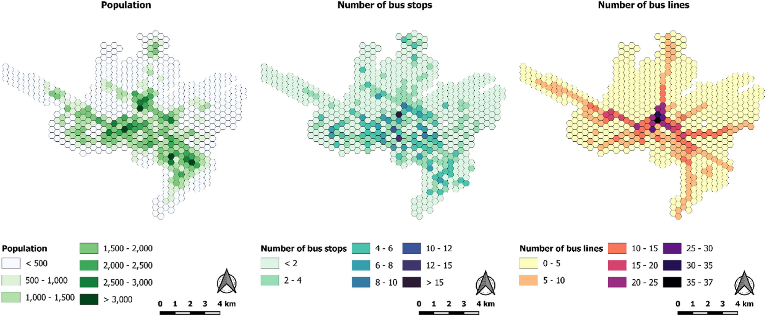
New Paper “Evaluation of accessibility disparities in urban areas during disruptive events based on transit real data”
Studies have long assessed people’s accessibility to amenities through public transportation, typically using General Transit Feed Specification (GTFS) data. GTFS reflects planned transportation schedules, detailing the intended services and routes of transit systems. However, this approach raises an important question: are we missing critical insights by not incorporating real-time information? A recent study led by…
-

Announcing openrouteservice version 9.0.0: codename “Europa”
We are proud to announce the release of openrouteservice version 9.0.0, codename “Europa”. In this release, there are a number of new features that make running your own instance a whole lot easier, and some changes that improve the general routing results. For our API users, this release will not mean much, as just a…
-
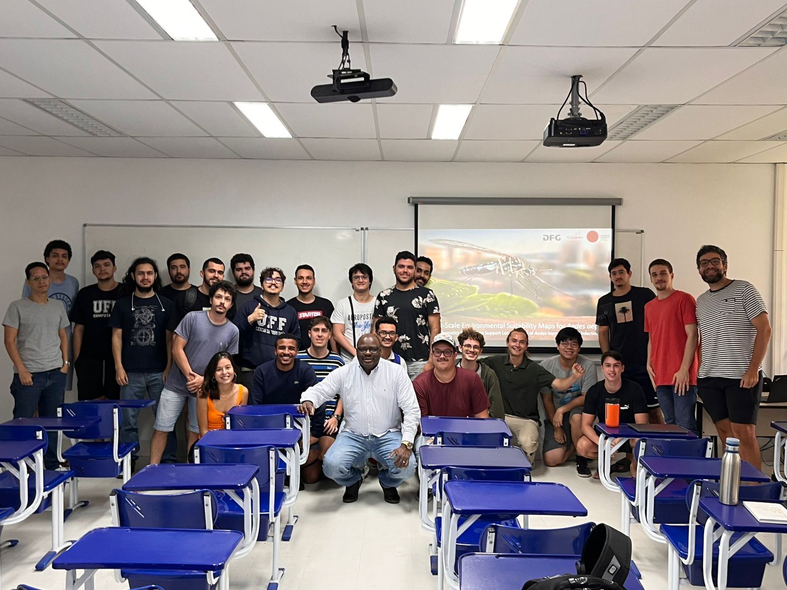
Research Visit to Rio de Janeiro
Building on ongoing efforts to enhance urban health management and mosquito-borne disease monitoring in the municipality of Rio de Janeiro, PhD candidate Steffen Knoblauch returned to the city for a second visit deepen collaborations and explore further applications of his research findings. He delivered lectures at several research institutions such as Universidade Federal do Rio…
-
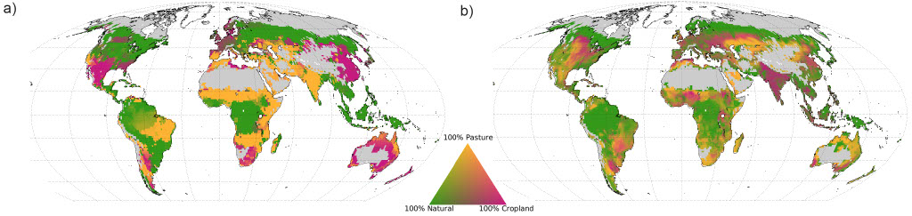
Reorganising land use: balancing food, water, and carbon storage
How can humanity meet the growing demand for food while addressing climate change and preserving vital water resources? A recent lecture by Sven Lautenbach, based on a paper addressing global land management, revisited this critical question. The findings reveal that a radical spatial reorganisation of land use could double food production, conserve water, and significantly…
-
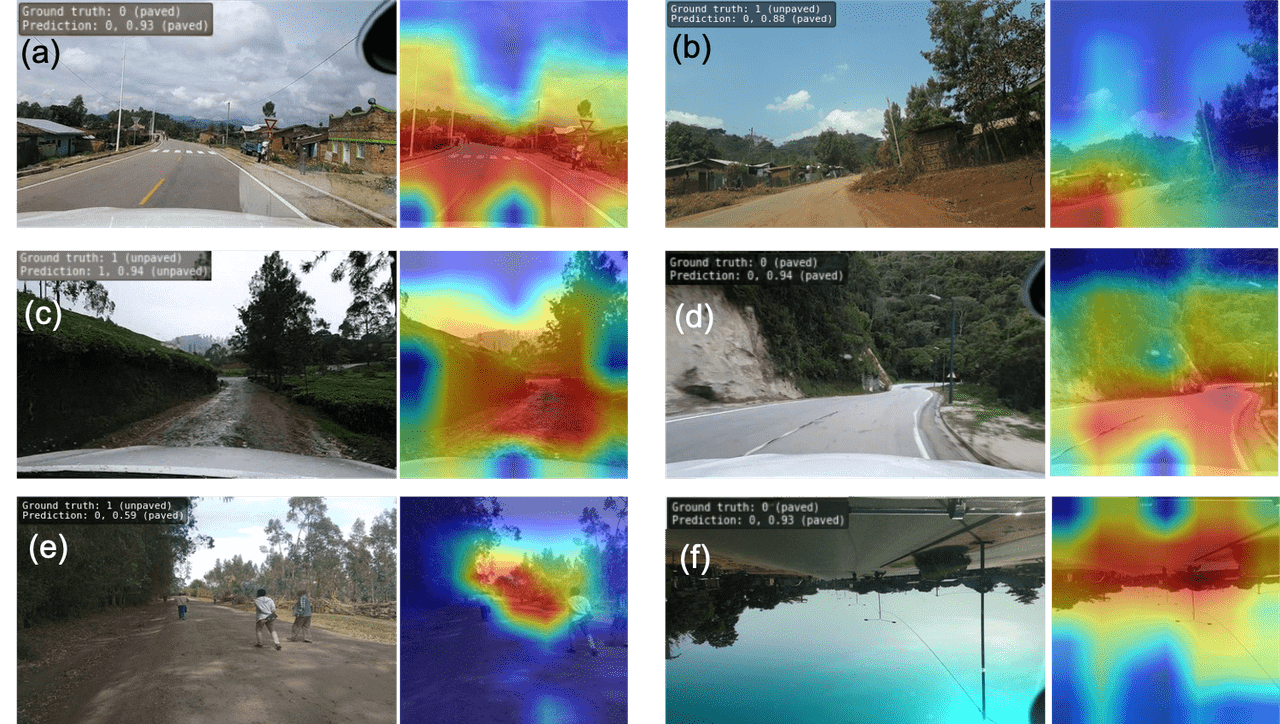
Accurate road surface data for transportation, safety, and economic development
Researchers at HeiGIT (Heidelberg Institute for Geoinformation Technology) have publicly released a first of its kind planet-scale dataset on road surface type (paved or unpaved) using state-of-the-art GeoAI methods based on street-view imagery from Mapillary, in order to support humanitarian response, urban planning and progress towards the Sustainable Development Goals. Road surface information plays an essential…
-
Strengthening humanitarian efforts with the German Red Cross
A few days ago, we had the pleasure of welcoming our longtime partners from the German Red Cross (GRC) to HeiGIT. Together, we not only mapped out our future priorities but also took a moment to look back on the journey we’ve shared since our partnership began in 2017. The strategic partnership was established to develop GIS…
-

HGG (Heidelberger Geographische Gesellschaft) Lecture Series in Winter Semester 2024
Latin America: Energy Powering the Future. For years, opinions and reports on Latin America have varied greatly between stagnation, political risks and hope, for example with regard to the supply of energy sources, food and raw materials. “Who still cares about Latin America?” asked Paul Ingendaay on April 24, 2024 in the Frankfurter Allgemeine. The…
-
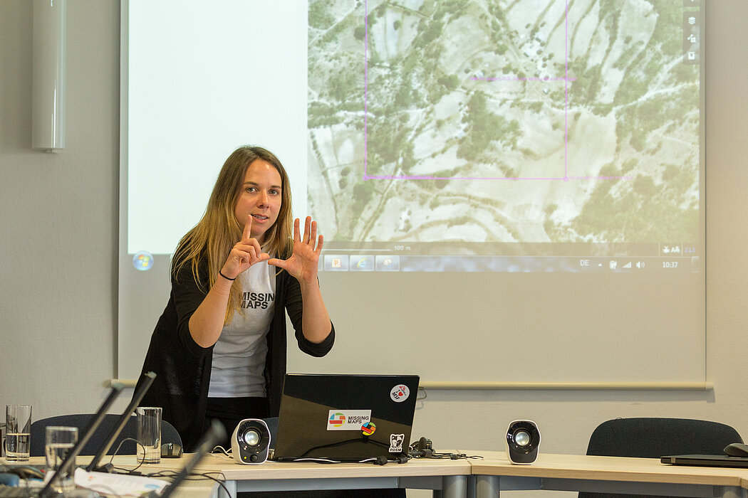
Sketch Map Tool Updates and Video Introduction
We are happy to share new developments on our ongoing work with the Sketch Map Tool! To help you better understand the tool, its key functionalities, and potential applications, we have included an introductory video. We require your explicit consent to use your Sketch Maps for training purposes. Sharing your data is entirely optional, and…
-
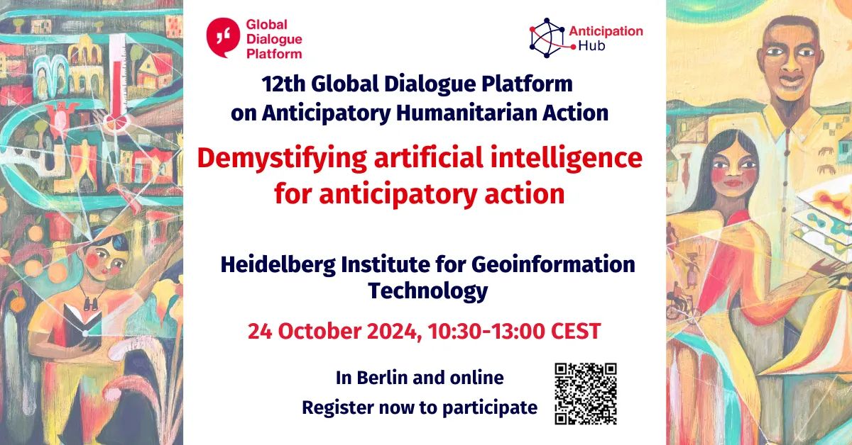
Meet HeiGIT and Discover Our AI and Anticipatory Action Related Projects at the Global Dialogue Platform in Berlin
Join us at this year’s Global Dialogue Platform on Anticipatory Humanitarian Action, themed “Mainstreaming Anticipatory Action: Collaboration in Complex Contexts.” This topic has been a focal point for HeiGIT over the past few years, and its prominence as the core theme of this year’s event underscores its relevance in today’s humanitarian landscape. How can we best…
-
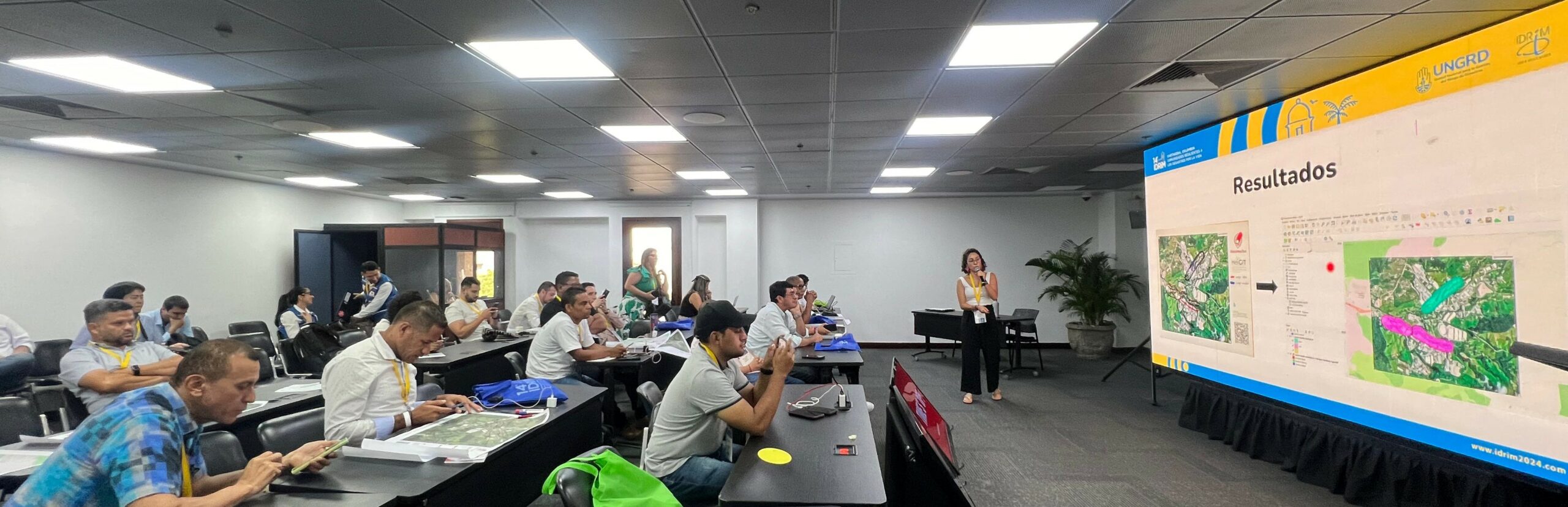
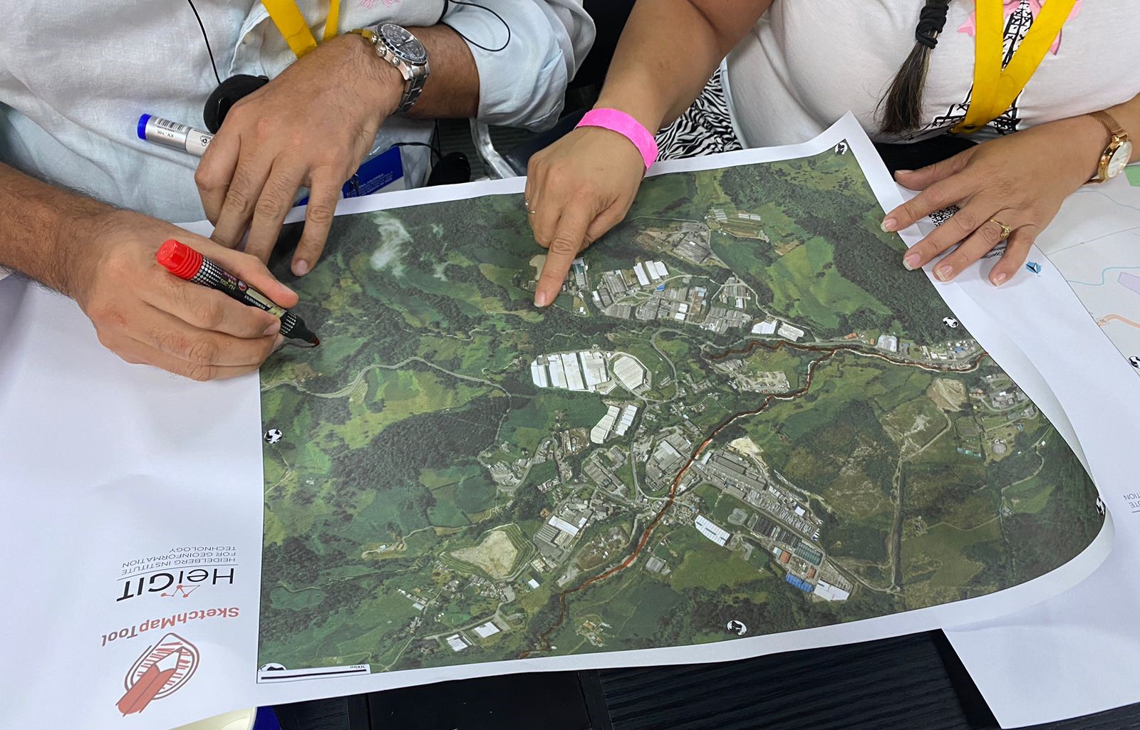
Digitalizing Paper-based Participatory Risk Mapping with the Sketch Map Tool – IDRiM 2024. Cartagena, Colombia
HeiGIT, the Colombian Red Cross (CRC), Colombia’s National University in Manizales (UNAL) and UBDC successfully ran the international workshop “Digitalizing Paper-based Participatory Risk Mapping with the Sketch Map Tool” at the IDRiM 2024 in Cartagena, Colombia on 29th of September 2024. This was the first time the conference was held in South America, with over…
-
Senior Spatial Data Scientist for Climate Action (m/f/d, up to 100%)
You are a highly motivated person who loves spatial data science? You want to use your expertise for the benefit of society and the environment – in particular stimulating Climate Action? You want to improve the availability and quality of geographic information for Climate Action and develop geoinformatics methods used for related open, non-profit applications?…