The openrouteservice (ORS) continuously evolves, bringing a suite of new features: the export and snap endpoints. These new features will change the way users interact with and process routing data, making it easier to handle complex use cases or pre-process points for routing queries.
Export Feature
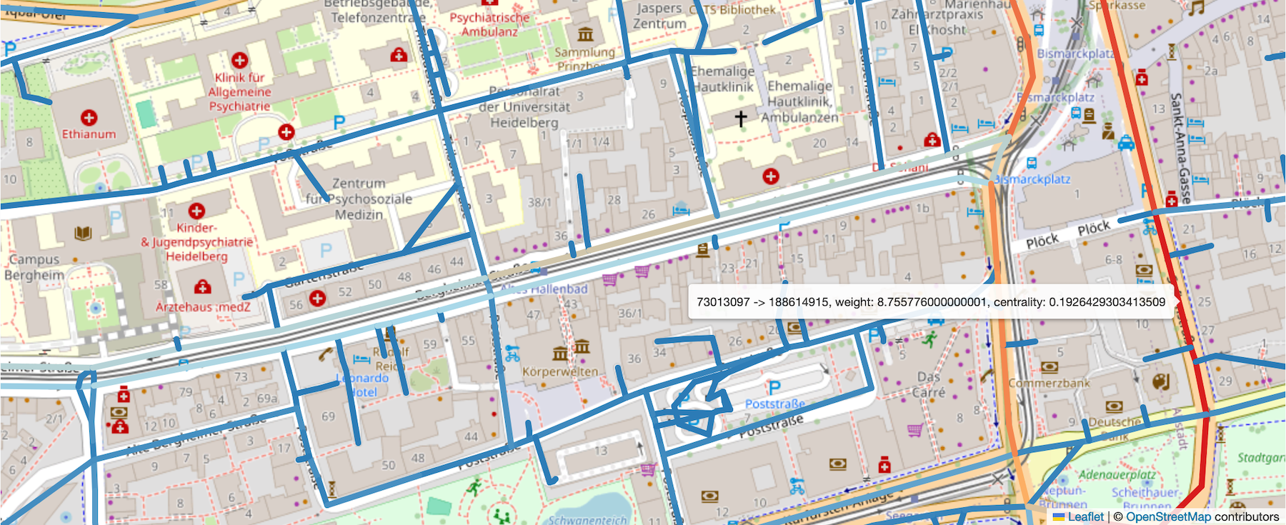
While openrouteservice does not directly provide tools for network analysis, it now offers the export endpoint, which allows users to access the underlying graph structure used by the routing engine. This exported data can be used to perform custom network analyses externally, such as calculating betweenness centrality, which measures the importance of certain routes in a network. This enables the simulation of network disruptions (e.g., a bridge collapse) and the effects that these disruptions might have on the road network.
Key Points:
- The export endpoint enables you to retrieve a graph representation of the road network.
Its nodes correspond roughly to crossings, starts or ends of roads, its edges roughly to roads. The edge weight describes a travel time in seconds. - The geometries of the edges included in the export do not correspond to the geometries of the roads they represent
- For details on the export format, check out the API documentation.
- An example of an analysis and a disruption simulation using this feature is available on the openrouteservice website.
- The feature is already integrated in the openrouteservice QGIS Plugin and R package, making it easy to incorporate into your workflows.
Snap endpoint feature
The snapping endpoint can be used to return the closest point on the street network for a specific means of transportation within a defined radius for many points at once. This is the first internal step in a directions, isochrones or matrix request before further processing happens.
The endpoint can be used e.g. before batch requesting routes, isochrones or matrices with the QGIS plugin to ensures that point coordinates are valid and the batch request won’t fail.
For user interfaces, this endpoint can be used to snap to the road network in realtime when hovering over a road to preview where a point of a generated route or isochrone will end up.
Key Points:
- The Snap endpoint is integrated into the QGIS plugin, R package and JavaScript package.
- For more information about this feature, please refer to the API playground or backend documentation.
Current Limitations: Certain restrictions will apply, for further information please refer to API Restrictions. Additionally, usage quotas can be found here.
To keep up with future developments and releases related to mobility, humanitarian aid, climate action and data analytics, follow the social media channels and stay up to date on our blog.


