

The full article was originally published on geoawesome.
The management of Municipal Solid Waste (MSW) represents a significant challenge, particularly in regions lacking adequate waste management infrastructure. In Africa, several regions are identified as critical hotspots for waste mismanagement. In 2012, only 55% of MSW was collected across Africa, with a mere 4% being recycled, despite the fact that 70-80% of MSW is actually recycable. This leads to issues such as environmental pollution, health risks, and increased flooding due to waste accumulation in illegal dumpsites, especially along riverbanks.
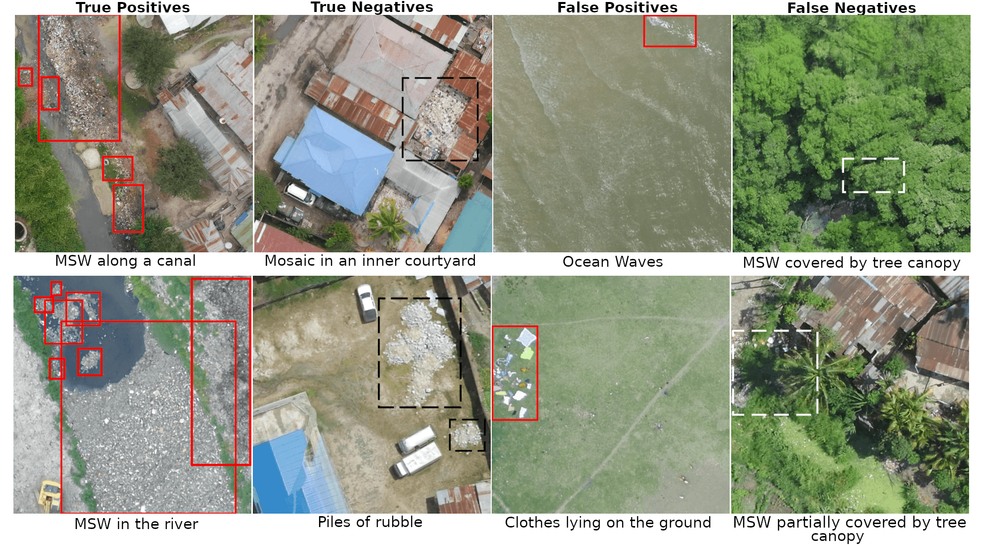
In response to this challenges, a team of geoinformatics researchers from the University of Heidelberg and HeiGIT, in collaboration with OpenData Development Tanzania, has proposed a novel workflow that utilises Unmanned Aerial Vehicles (UAVs) to monitor Municipal Solid Waste (MSW) (cf. UAV-Assisted Municipal Solid Waste Monitoring for Informed Disposal Decisions | Proceedings of the 2024 International Conference on Information Technology for Social Good ). The utilization of UAVs provides high-resolution aerial imagery, which surpasses the resolution of openly accessible satellite data. This enables the identificaton of both large and small waste piles with greater precision.
A case study was conducted in Dar es Salaam, Tanzania, focusing on the Msimbazi River area, one of the most polluted riverbeds in eastern Africa. The region’s inadequate waste management infrastructure resulted in environmental pollution and increased flooding risks due to clogged drainage systems. The research team developed an object detection algorithm on UAV imagery for MSW detection, achieving a high level of accuracy.
The workflow shows promising results for MSW detection; however, several challenges such as indisting waste pile boundaries remain. With future enhancements such as applying image classification or segmentation techniques to small UAV imagery tiles, a higher detection accuracy can be achieved.
These maps can guide municipal decision-making, helping to prioritize waste collection efforts and identify optimal locations for establishing new official dumpsites that adhere to environmental regulations, ultimately reducing risks related to flooding and disease outbreaks.