

Within the AHK-4D project, we continually monitor topographic change at the alpine rock glacier Äußeres Hochebenkar in Austria. Based on multitemporal and multi-source 3D point clouds at up to two-week acquisition intervals, we are developing methods to quantify the magnitudes and frequencies of individual processes of topographic change over varying timescales.
This year, we have also acquired a UAV-borne photogrammetry dataset for the fist time, alongside with the extension of the existing TLS and UAV-borne laser scanning time series. As in the past years, we conducted a joint field campaign together with colleagues from the University of Innsbruck.
An interactive visualization of the brand new photogrammetric point cloud is available here:
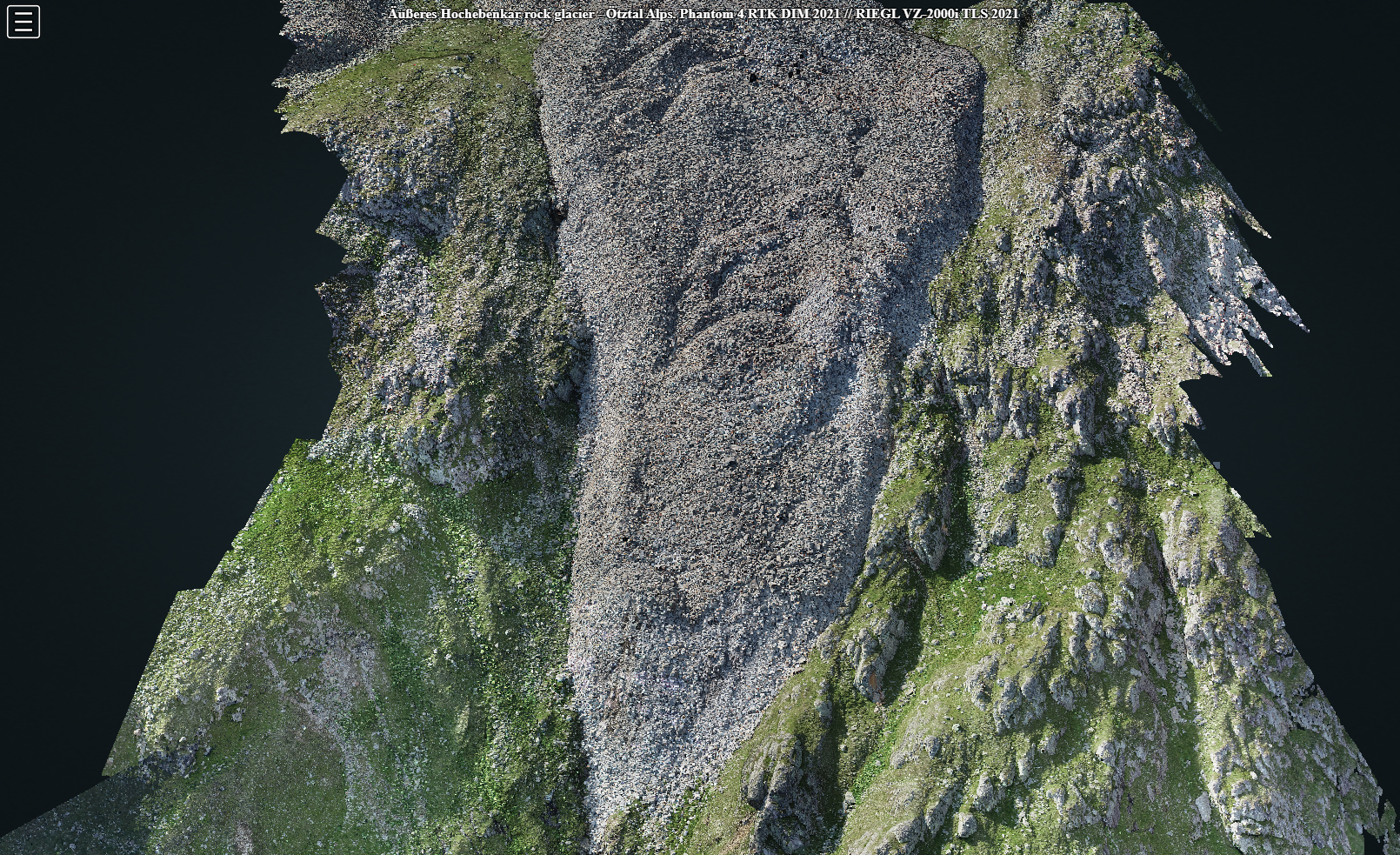
A first check of the new dataset shows huge surface change on a ridge structure above the rock glacier front (see below) – valuable input for further development of our methods on 3D/4D change analysis – check them out, they might be interesting for you research as well!

Ulrich, V., Williams, J.G., Zahs, V., Anders, K., Hecht, S., Höfle, B. (2021): Measurement of rock glacier surface change over different timescales using terrestrial laser scanning point clouds. Earth Surface Dynamics. Vol. 9, pp. 19-28.
Williams, J.G., Anders, K., Winiwarter, L., Zahs, V., Höfle, B. (2021): Multi-directional change detection between point clouds. ISPRS Journal of Photogrammetry and Remote Sensing. Vol. 172, pp. 95-113.
Winiwarter, L., Anders, K., Höfle, B. (2021): M3C2-EP: Pushing the limits of 3D topographic point cloud change detection by error propagation. ISPRS Journal of Photogrammetry and Remote Sensing, 178, pp. 240–258.
Zahs, V., Hämmerle, M., Anders, K., Hecht, S., Rutzinger, M., Sailer, R., Williams, J.G., Höfle, B. (2019): Multi-temporal 3D point cloud-based quantification and analysis of geomorphological activity at an alpine rock glacier using airborne and terrestrial LiDAR. Permafrost and Periglacial Processes. Vol. 30 (3), pp. 222-238.
The acquisition of UAV-borne laser scanning data was supported by the 4EU+ collaboration project Towards sustainable development of natural environments based on continuous remote sensing monitoring.