

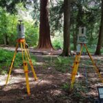
Last Fieldwork Friday, a group of students gathered in Arboretum I to capture Heidelberg’s sequoia trees in the frame of a 3D Sensor Practical. In small groups, the students learned surveying strategies via terrestrial laser scanning (TLS) and Global Navigation Satellite System (GNSS) measurements. It was one of the first joint field campaigns of our two TLS instruments, capturing billions of 3D points.
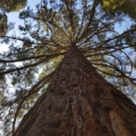
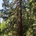
The sequoias in Heidelberg were planted in 1876 and are said to be among the largest in Germany. But how tall are they now actually? The students will use the acquired point clouds to derive the latest measures of the largest sequoia – stay tuned!
Overall, the captured data provides a detailed and highly accurate 3D model of the trees which archives the current status of the Arboretum I for future generations and potential analysis of the changing vegetation structure.
We thank the City of Heidelberg for allowing this field campaign on site!