

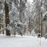
A joint field campaign was conducted this week in the snow-covered black forest (Hundseck, 48.643°N, 8.228°E) by the research groups Hydrology and Climatology (Prof. Menzel) and 3DGeo (Prof. Höfle). Regular in-situ surveys are conducted at the site to investigate snow as crucial component of the hydrologic cycle, forest management, and evapotranspiration.
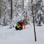
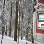
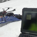
Surveys comprise measurement of snow depths and snow water equivalents, which complement time-lapse photography and soil moisture logging. In the most recent campaign, the 3DGeo group joined for the acquisition of 3D point clouds by UAV-borne and terrestrial laser scanning. Acquired data are used to evaluate a non-destructive and high-resolution method to measure accumulated snow using an automated time-lapse camera. Automated time-lapse imagery can add substantial value to highly accurate ecological monitoring by providing frequent and high-resolution data.
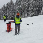
The field work is part of the PhD research of Guyen Battuvshin. The observation site is operated by the group of Prof. Menzel since 2014. Find more info about their work in snow process monitoring in this article:
, . Snow process monitoring in montane forests with time‐lapse photography. Hydrological Processes. 2017; 31: 2872– 2886. https://doi.org/10.1002/hyp.11229