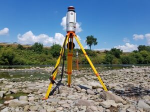
As part of the practical field training “Physiogeographische Geodatenerfassung” this week, a group of students acquired the gravel bar and terrace at an oxbow of the old Neckar river near Ilvesheim (49°28’36” N 8°34’34” E) with geophysical and 3D surveying techniques.
In small groups, the students learned a different surveying strategy and processing the acquired data each day: Terrestrial laser scanning, GNSS surveying, photogrammetric acquisition, and electrical resistivity tomography. The aim is to obtain a comprehensive picture of the surface topography and subsurface situation for explaining the characteristics of this fluvial form.


The 3D data acquisition is a repetition of a field course several years ago – now we can find out what changed in the area of the gravel bar and how much volume was transported by the river and in the course of flooding in recent years, by comparing the 3D models of multiple years. A previous study comparing the surface from 2011 to 2012 already showed that truckloads of volume in gravel had been moved at this seemingly calm and idyllic site.
No group photo in these times, so maybe have a look at this video of the previous field course at the gravel bar: https://www.youtube.com/watch?v=tt4rmc8ks4o
We thank the local community and the nature conservation association for allowing this field campaign on site!


