Link-VGI Workshop Programme @ AGILE2016 Helsinki

Link-VGI: LINKing and analyzing Volunteered Geographic Information (VGI) across different platforms

Link-VGI is a single-day pre-conference workshop at the AGILE 2016 Conference in Helsinki, Finland on June 14th 2016. The workshop will be held in Helsinki University Main building, Fabianinkatu 33, Helsinki.

Link-VGI: Workshop Programme

09:00 – 09:15 Welcome Welcome, goals for the day, logistics, etc
Dr. Peter Mooney (Maynooth University, IE)
09:15 – 9:45 LINK-VGI research at the 3 organizing institutions – short presentations
  • Dr. Hartwig Hochmair/Levente Juhász (University of Florida)
  • Dr. Alexander Zipf/Dr. Adam Roussell (University of Heidelberg)
  • Dr. Peter Mooney (Maynooth University, IE)
09:45 – 10:30 Paper session 1: 2 presentations (45 minutes) [Chair: Hartwig Hochmair] “Applications of Across-platform VGI”

  • A conceptual model for quality assessment of VGI for the purpose of flood management
    Lívia Castro Degrossi (University of Heidelberg), João Porto de Albuquerque, Hongchao Fan, Alexander Zipf
    Download full paper (pdf format)
  • A 3D georeferencer and viewer to relate landscape pictures with VGI
    Timothée Produit, Jens Ingensand (G2C Institute, Department EC+G)
    Download full paper (pdf format)
10:30 – 11:00 Tea and Coffee Break (30 minutes) – With the other AGILE 2016 Workshops
11:00 – 12:30 Paper session 2: 4 presentations (90 minutes) [Chair: Alexander Zipf] “Across ‒ platform VGI Semantic and Ontologies”

  • Linking VGI for place-based map generalization
    Azam Bahrehdar, Ross S. Purves (University of Zürich)
    Download full paper (pdf format)
  • Semantic Interoperability of Volunteered Geographic Information based on Contextual Knowledge
    G. Bordogna*, M. Boschetti, P.A. Brivio (CNR-IREA), L. Frigerio, T. Kliment, S. Sterlacchini (CNR-IDPA)
    Download full paper (pdf format)
  • Visual Analysis of Thematic, Social and Geospatial Patterns of Microblogging Content Using D3.
    Thomas Gründemann, Dirk Burghardt (Technische Universität Dresden)
    Download full paper (pdf format)
  • Towards Linked Data and ontology development for the semantic enrichment of volunteered geo-information
    Rob Lemmens (University of Twente), Gilles Falquet, Claudine Métral (University of Geneva) Download full paper (pdf format)
12:30 – 14:00 Lunch Lunch with other AGILE workshops (90 minutes)
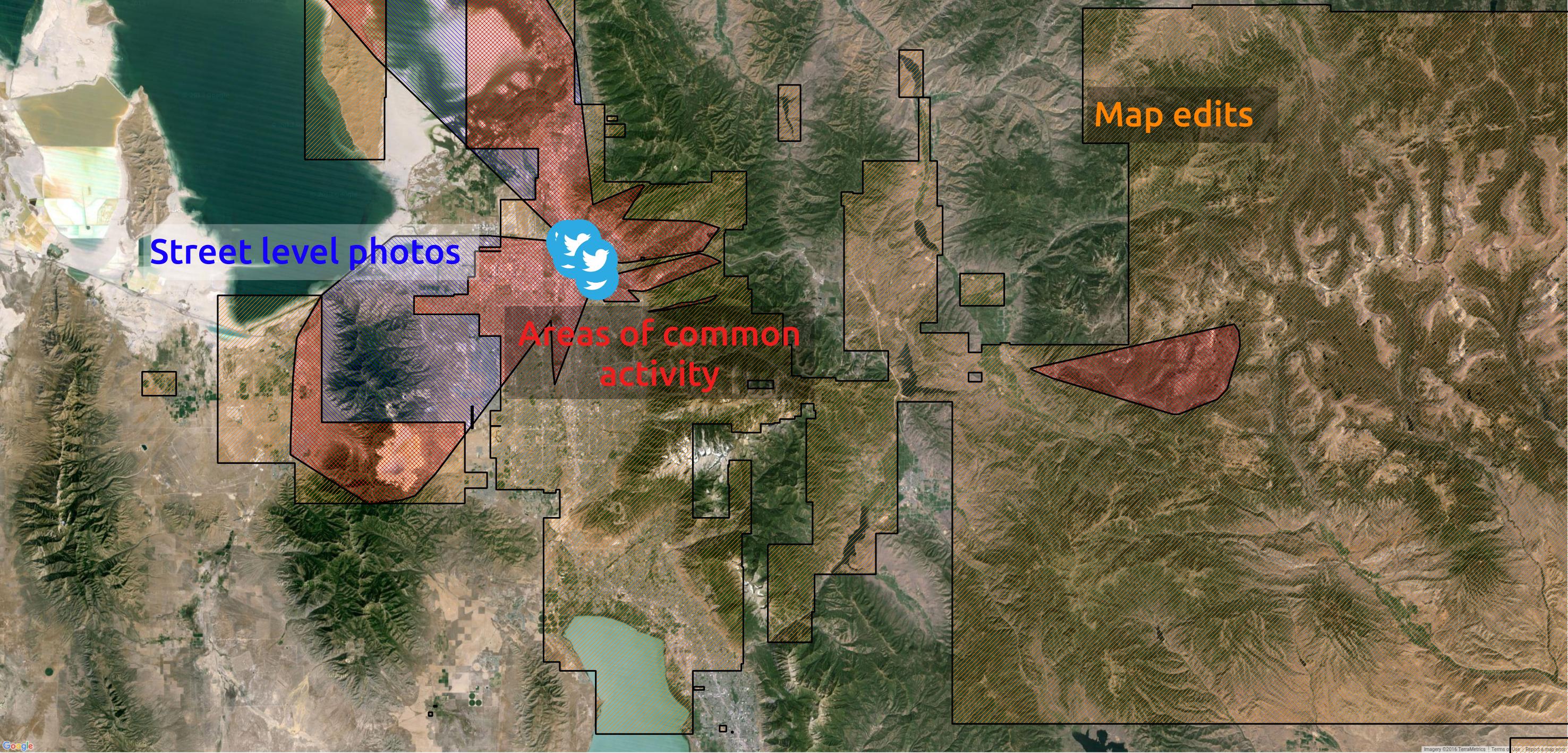
14:00 – 15:30 Hands-on session part 1 (90 minutes) [Presenters and Facilitators: Levente Juhász, Jamal Jokar Arsanjani, Adam Rousell]
“VGI data linkage: Accessing, linking, and analyzing data from multiple platforms”
15:30 – 16:00 Tea and Coffee Break (30 minutes) – With the other AGILE 2016 Workshops
16:00 – 17:00 Hands-on session part 2 (60 minutes) [Presenters and Facilitators: Levente Juhász, Jamal Jokar Arsanjani, Adam Rousell] “VGI data linkage: Accessing, linking, and analyzing data from multiple platforms”
17:00 – 17:45 Open floor discussion (45 minutes) “Identifying research issues, core questions and plans for future collaborations and publications” [Moderator: Peter Mooney] – all participants of the workshop are invited to participate.
17:45 – 18:00 (15 minutes – Closing) [Rapporteur: Peter Mooney]
Final remarks, overall impressions, summary, and goodbye.

Hands-on Session: VGI data linkage:

Accessing, linking, and analyzing data from multiple platforms

The hands-on session will be presented and facilitated by Levente Juhász, Jamal Jokar Arsanjani and Adam Rousell

The first section intends to provide a brief overview of the basics of interacting with APIs that provide access to geospatial data. Several examples will be given to illustrate client authentication, making data requests, exporting data to standardized geospatial formats and importing data in a statistical modeling environment (R). This section will use the public APIs of OpenStreetMap (OverpassAPI), Twitter, Instagram, Mapillary, Flickr and Wheelmap.

The second section is a detailed Case study around the topic of accessibility. It intends to provide a more detailed assessment of the accessibility of popular locations based on data from Flickr, Wheelmap, Instagram, Mapillary and Foursquare. The exercise will use VGI photos and POI information as a proxy to popular locations.

All materials which participants will require will be made available on GitHub (link to appear in the next few days)

Workshop participants can take part using their own laptop. Please ensure that your laptop can connect to the AGILE conference WiFi and that you have appropriate permissions to install software on your laptop. Unfortunately we are not in a position to offer access to laptops or desktop computers for these sessions.

Further information http://www.geog.uni-heidelberg.de/gis/link_vgi.html


Posted

in

by

Tags: