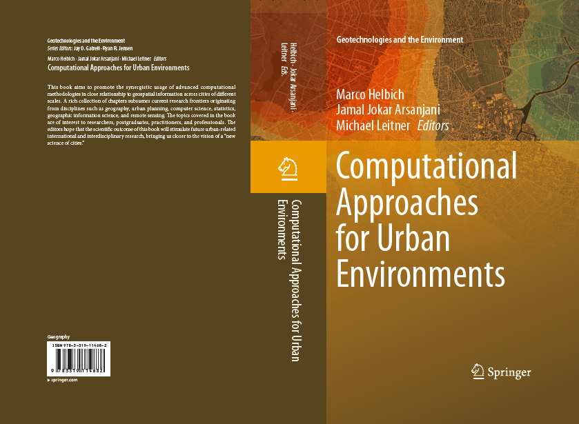
We are pleased to announce that a book edited by Dr. Marco Helbich, Dr. Jamal Jokar Arsanjani, Dr. Micheal Leitner titled “Computational Approaches for Urban Environments” is about to be released shortly. The edited book will be published by Springer in its “Geotechnologies and the Environment” series, edited by Jay D. Gatrell and Ryan R. Jensen. For more detailed information about this series, we refer to the Springer webpage, accessible via the following link http://www.springer.com/series/8088.
This book aims to promote the synergistic usage of advanced computational methodologies in close relationship to geospatial information across cities of different scales. A rich collection of chapters subsumes current research frontiers originating from disciplines such as geography, urban planning, computer science, statistics, geographic information science, and remote sensing. The topics covered in the book are of interest to researchers, postgraduates, practitioners, and professionals. The editors hope that the scientific outcome of this book will stimulate future urban-related international and interdisciplinary research, bringing us closer to the vision of a “new science of cities.”
Here is the content of the book.
————————————-
Preface
Mei-Po Kwan
Department of Geography and Geographic Information Science, University of Illinois at Urbana-Champaign, USA
Computational Approaches for Urban Environments: An Editorial
Marco Helbich1, Jamal Jokar2, Michael Leitner3
1 Department of Human Geography and Spatial Planning, Utrecht University, Netherlands
2 Institute of Geography, University of Heidelberg, Germany
3 Department of Geography and Anthropology, Louisiana State University, USA
Section 1: Spatial Planning and Decision-Making
1. From Fractal Urban Pattern Analysis to Fractal Urban Planning Concepts
Pierre Frankhauser1
1 Université de Franche-Comté, France
2. Knowledge discovery in Spatial Planning Data – A Concept for Cluster Understanding
Martin Behnisch1, Alfred Ultsch2
1 Leibniz Institute of Ecological Urban and Regional Development, Germany
2 Databionic, Philipps-University Marburg, Germany
3. Clustering Contextual Neural Gas: A New Approach for Spatial Planning and Analysis Tasks
Julian Hagenauer1
1 Institute of Geography, University of Heidelberg, Germany
Section 2: Housing and Real Estate
4. Hedonic House Price Modeling based on Multilevel Structured Additive Regression
Alexander Razen1, Wolfgang Brunauer2, Nadja Klein3, Stefan Lang1, Nikolaus Umlauf1
1 Department of Statistics, University of Innsbruck, Austria
2 UniCredit Bank Austria AG, Austria
3 Chairs of Statistics and Econometrics, University of Göttingen, Germany
5. Simple Agents, Complex Emergent City: Agent-Based Modeling of Intraurban Migration
Shipeng Sun1, Steven M. Manson2
1 Institute on the Environment, University of Minnesota, USA
2 Department of Geography, University of Minnesota, USA
6. Quantifying Urban Diversity: Multiple Spatial Measures of Social and Economic Characteristics
Timothy Rosner1, Kevin M. Curtin1
1 Department of Geography and GeoInformation Science, George Mason University, USA
Section 3: Urban Transportation and Mobility
7. Everyday Cycling in Urban Environments: Understanding Behaviours and Constraints in Space-Time
Godwin Yeboah1, Seraphim Alvanides2, Emine Mine Thompson2
1 The Centre for Transport Research, University of Aberdeen, UK
2 Engineering and Environment, Northumbria University, UK
8. Performance Improvements for Large-Scale Traffic Simulation in MATSim
Rashid A. Waraich1, David Charypar1, Michael Balmer2, Kay W. Axhausen1
1 Institute for Transport Planning and Systems, ETH Zurich, Switzerland
2 Senozon AG, Zurich, Switzerland
Section 4: Remote Sensing
9. Recent Advances on 2D and 3D Change Detection in Urban Environments from Remote Sensing Data
Konstantinos Karantzalos1
1 Remote Sensing Laboratory, National Technical University of Athens, Greece
10. Fusion of airborne hyperspectral and LiDAR remote sensing data to study the thermal characteristics of urban environments
Christian Berger1, Frank Riedel1, Johannes Rosentreter1, Enrico Stein2, Sören Hese1, Christiane Schmullius1
1 Department of Earth Observation, University of Jena, Germany
2 Earth Observation Center, German Aerospace Center (DLR), Germany
11. Modeling Urban Land Use Change: Integrating Remote Sensing with Socioeconomic Data
Junmei Tang1
1 Geography and Environmental Systems, University of Maryland, USA
Section 5: Urban Sensing, Social Networks and Social Media
12. Linked Activity Spaces: Embedding Social Networks in Urban Space
Yaoli Wang1,2, Chaogui Kang3,4, Luís M. A. Bettencourt2, Yu Liu3,Clio Andris2,5
1 Deptartment of Geography, University of Georgia, USA
2 Santa Fe Institute, USA
3 Institute of Remote Sensing and Geographical Information Systems, Peking University, Beijing, China
4 Senseable City Lab, Massachusetts Institute of Technology, USA
5 Department of Geography, Pennsylvania State University, USA
13. Using Non-authoritative Sources During Emergencies in Urban Areas
Emily Schnebele1, Christopher Oxendine2, Guido Cervone3, Celso Ferreira4, Nigel Waters5
1 Department of Geography and Geoinformation Science, George Mason University, USA
2 Department of Geography & Environmental Engineering, United States Military Academy, USA
3 Department of Geography, Pennsylvania State University and Research Application Laboratory, National Center for Atmospheric Research, USA
4 Department of Civil & Environmental and Infrastructure Engineering, George Mason University, USA
5 Center for Excellence in GIS, George Mason University, USA
14. Towards a comparative science of cities: using mobile traffic records in New York, London and Hong Kong
Sebastian Grauwin1, Stanislav Sobolevsky1, Simon Moritz2, István Gódor3, Carlo Ratti1
1 Senseable City Lab, Massachusetts Institute of Technology, USA
2 Ericsson Research, Sweden
3 Ericsson Research, Hungary
Epilogue
Paul Longley1
1 Department of Geography, University College London, London, UK


