

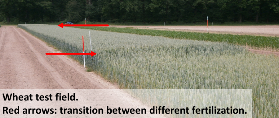
On 19th of June, a multitemporal data set of agricultural plants was completed by researchers of the Chair of GIScience‘s LiDAR Research Group in the course of the projects Hyland and ESOB. A field of several grain varieties and fertilization quantities in maximum growth stage was captured in 3D using a terrestrial laser scanner (TLS). In combination with the bare soil model which was captured earlier this year, geometric parameters such as stand height, growth density and biomass can now be derived and used for improving plant growth models. Additionally, indices such as the leaf area index (LAI) will be calculated using the TLS point cloud.
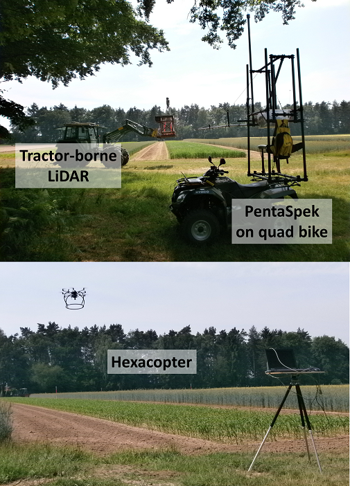
The test site in Braunschweig (Brunswick, Germany) was prepared by the Julius-Kühn-Institute for Crop and Soil Science, which captured complementary data using its hyperspectral sensor ‘PentaSpek’ and also provides reference data for validating the TLS-derived products. Furthermore, a researcher of the Thünen-Institute of Agricultural Technology captured the field with high-resolution images, shot with an airborne camera mounted on a hexacopter equipped with circuit boards and embedded software developed at the Thünen-Institute.
The products derived from geometric information will be analysed in terms of their potential for improving plant growth models used e.g. in precision agriculture and plant breeding. A second leap in modelling quality is expected from the fusion of multi-sensor data. Further investigation will focus on the usability of low-cost sensors providing 3D data in comparable quality.