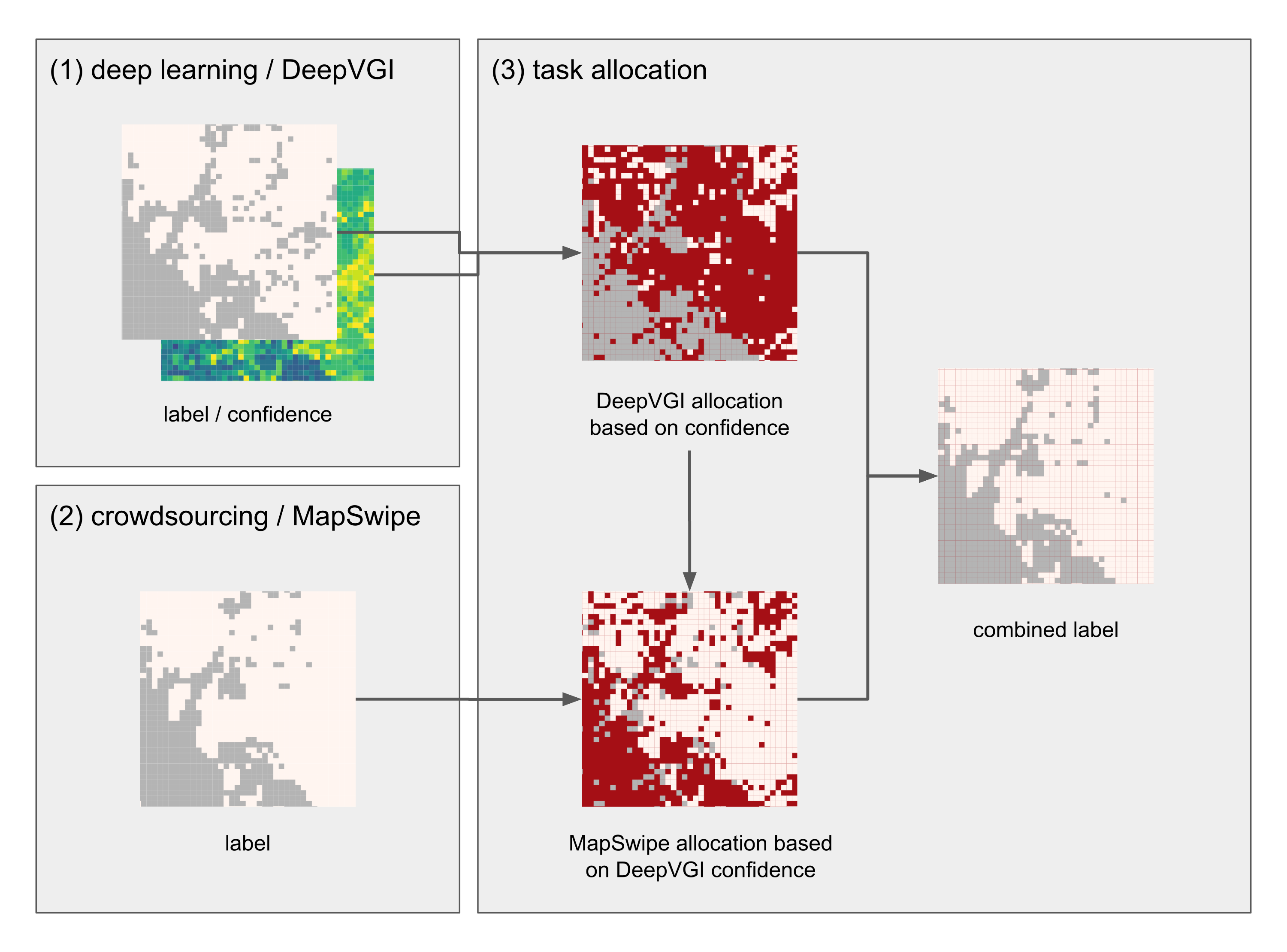
Today we celebrate the International Day for #DisasterRiskReduction. HeiGIT offers a growing set of tools and services that support humanitarian aid during and before disasters. Examples include work in the context of the Missing Maps initiative, like conceptualising and extending microtasking apps like MapSwipe, as well as services for analysing MapSwipe data and making it usable through a workflow integration in the HOT tasking manager. The data is also used in deep learning applications for generating settlement layers or feedback for microtasked mapping. Improving and analysing the data quality of OpenStreetmap as a major data set for humanitarian aid is supported through the ohsome framework (OpenStreetMap History Analytics platform), including an API for related analysis, the ohsome dashboard,or map interfaces like the ohsomeHEX OSM History Explorer, that includes some selected map layers relevant for HOTOSM, such as WASH related OSM tags.
Of course the OpenRouteService for disaster management combined with realtimeOSM offers fast routing solutions within disasters, or also isochrones for accessibility analysis, but recently the ORS API includes new options related to advanced fleed management for rich logistics support in disasters.
And last but not least we support capacity building with many workshops, conferences and mapathons or research projects and related activities. Further information can be found in our publications in Journals and conferences.
We are looking forward to cooperate with relevant stakeholders to further advance GI tools and open geoinformation for disaster risk reduction. Let’s get in contact and innovate new tools and put them into practice!
Open Source at: https://github.com/GIScience